Showing posts with label LAC. Show all posts

Friday, September 1, 2023

The Holy Waterfalls and the Great Guru

My article The Holy Waterfalls and the Great Guru appeared in Rediff.com

Here is the link...

It is on the exact spot where the Guru is said to have created 108 waterfalls, that the Yangtse clash took place between the Indian Army and the Chinese PLA on the night of December 9, 2022.
As it had done in Ladakh in May 2020, the PLA tried to change the unmarked LAC in the Yangtse sector in Arunachal Pradesh.
It was the most serious border incident since the Galwan Valley clash in June 2020, notes Claude Arpi.


The Chumig Gyatse Holy Waterfalls are truly special and worth a visit, if you have the occasion (or the good karma) and this for several reasons.
First, this very sacred place in Arunachal Pradesh has been blessed by Guru Padmasambhava (also known as Guru Rinpoche by the Tibetans), the great yogi and tantric master who lived in the 8th century AD.
Padmasambhava (‘Born from a Lotus’) was a tantric Vajra practitioner from Oddiyana (or Swat, in today’s Pakistan) who played a crucial role in the establishment of Buddhism in Tibet.
After King Trisong Detsen invited Shantarakshita, the Nalanda Abbot to Tibet to teach Buddhism, the latter faced a lot of difficulties from the old shamanic faith. The King had to send him back to Nepal to fetch Padmasambhava in order to tame the local spirits and covert the Tibetans with his magical and ritual powers.
Padmasambhava practiced various forms of tantric Buddhist yoga and thanks to his great occult siddhis, the Samye Monastery, the first Buddhist monastery in Tibet, could be constructed.
The Great Guru extensively visited the border areas and his legacy can still be found not only in Nepal and Bhutan (for example Taktsang monastery in Paro), but on the Indian side too (Rewalsar in Himachal Pradesh or Gurudongmar in Sikkim, etc.).

The 2022 Yangtse Clash

It is on the exact spot where the Guru is said to have created 108 waterfalls, that the Yangtse clash took place between the Indian Army and the Chinese People's Liberation Army (PLA) in the night of December 9, 2022.
As it had done in Ladakh in May 2020, the PLA tried to change the unmarked Line of Actual Control (LAC) in the Yangtse sector, northeast of Tawang in Arunachal Pradesh.
According to the Indian media, violent clashes took place between the two armies which confronted each other with nail-studded clubs and other melee weapons on a ridgeline above the waterfalls. It was the most serious border incident along the boundary since the Galwan Valley clash in June 2020.
After receiving timely reinforcements, the Indian troops were able to send back the Chinese PLA to their side of the LAC, though six Indian soldiers who with severe injuries had to be flown to Guwahati for medical treatment. As usual, the casualties on the Chinese side were not disclosed.
Interestingly, Yangtse was one of three main ‘disputed’ areas in 1960 when the Indian and Chinese officials held several months of talks to try to sort out the boundary issue (the other places were Khenzimane/Sumdorong chu sector in the west and Longju sector in today’s Upper Subansiri district).

A Tourist Spot
The good news is that the area has recently been opened to Indian tourists.
To reach the place is a pilgrimage in itself; it takes some 4 hours drive from Tawang. One first moves in the direction of Bumla, the pass where senior Indian and Chinese officers regularly meet to sort out their differences of ‘perceptions’, it is known as Border Meeting Point or BPM.
Just 6 km before Bumla, one takes an eastward turn towards Nagu-la Lake: “One of the most picturesque places to visit in Tawang. …with some alluring reflections of the mountain waters in its serene waters, Nagula Lake is a captivating tourist attraction in Tawang,” says a tourist site.
The scenery around the lake and the pass (at an altitude of 4,200 meters) leaves you spellbound. Of course, one encounters a heavy military presence, due to the proximity of the border and the constant Chinese belligerence.
Then after one more hour drive on the high plateau one reaches a grazing ground for a large number of healthy yaks and often wild horses; the only vegetation is rhododendrons.
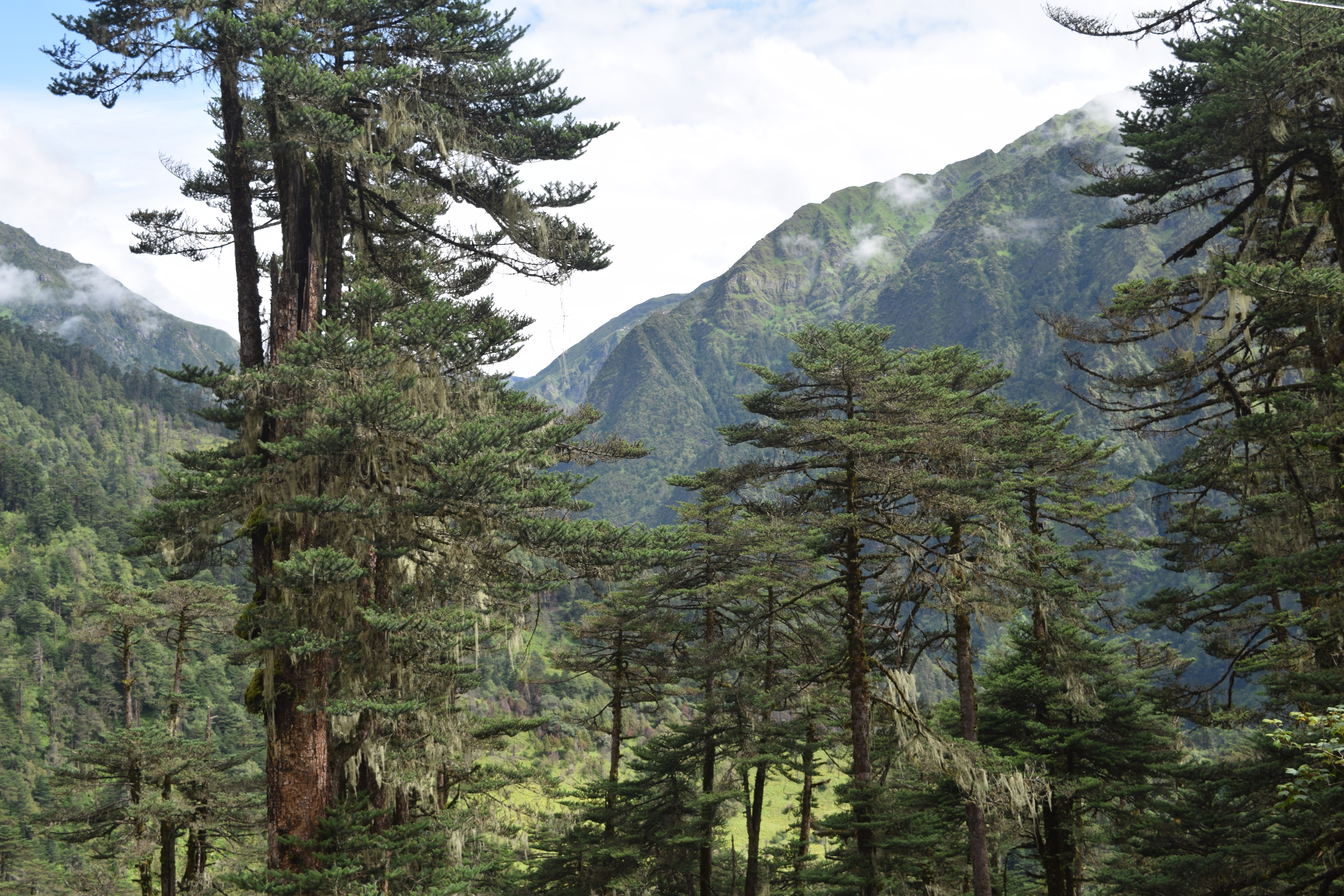
Later, moving down, one returns to a thickly forested area with extremely old and tall pine trees. The sight of the sharp gorges further down is rather scary. It takes one more hour of driving in this stunning paradise-like landscape before reaching the Tsona chu (river) gushing down from Tibet a few kilometers upstream.
Everywhere on the road, one crosses groups of local ladies working for the Border Road Organisation (BRO) to improve the road. In this very difficult terrain, the BRO’s work is really commendable.
After a few hundred meters walk, the great falls dropping from the cliffs like fairy hair suddenly appear; a signboard says “Enjoy the Magical, Mystical & Magnificent falls.”
Though the fighting took place on the ridge above the falls, it is in this idyllic surrounding that the clash took place in December 2022. 


Chumig Gyatse
It is truly is a magical place; as in most of the places associated with Guru Padmasambhava, one can feel the presence of the great master around.
A small Chumig Gyatse monastery, below the falls, was inaugurated by the young Chief Minister of Arunachal Pradesh, Pema Khandu on July 20, 2020 (note that it was a month before the Galwan incident in Ladakh). Khandu had then to walk for an hour or so before reaching the holy place.
Below the falls, a board said: “The temple is a symbol of spirituality. The magnificent falls adds to the beauty of the temple and makes it one of the most picturesque and mystic sights on earth.”
The same board describes various beliefs about the origin of Holy Waterfalls (also known as HWF by the Indian Army). According to the most popular religious belief: “during 8th century an epidemic struck the villages of this area and all villagers came to Guru Padmasambhava in the hope for relief. Guru Padmasambhava mediated and did penance in the area; in order to make the villagers free from the epidemic, [he] took out his rosary beads garland & threw the 108 beads on the mountain. Wherever the beads fell, a stream of water originated and thus Holy waterfalls came into existence. It is believed that the water here has magical medicinal values.”
It is said that Guru Rinpoche spent five days near the falls before moving to another retreat.
The board near the small gompa which houses a statue of Guru Rinpoche (and where a resident Lama reads the scriptures) informs us: “The Holy water is believed to have medicinal and healing properties and anyone consuming it with faith & devotion gets healed from all his ailments. Also childless couples if consumes holy water with credence, then blessings of Guru Padmasambhava are showered upon them and they are blessed with children. …Chumig Gyatse is a sight to behold.”

Chumig Gyatse and the LAC
The Chumig Gyatse falls lie some 250 meters from the LAC; it is today the main landmark in the Yangtse sector where the two prominent ridges, namely the Bumla ridge to its southwest and the Tulung-la ridgeline to its northeast, meet. The McMahon line at Yangtse is said to be coterminous with the two ridgelines.
It is only after the Chinese tried to occupy the Wangdung pasture in the Sumdorung chu area in 1986 that Indian troops moved troops to the ridge above the falls and occupied the area.

Open for Tourism
It is a great move from the Government of Arunachal Pradesh and the Ministry of Defence to have decided to allow tourists to visit the sacred place. Isn’t it the best proof that the area belongs to India despite the repeated Chinese claims?
Last year only, 6,000 Indian pilgrims/visitors had the darshan of the falls. Probably a similar number will visit this year.
A Tibetan friend told me that by throwing his mala, Guru Rinpoche certainly knew that one day the area would be disputed; he marked the place with the beads of his mala.
A news item reported by Radio Free Asia (RFA) came back to mind: a three-storyed high statue of Guru Padmasambhava was destroyed at the Chanang Monastery in Drago county of the Kardze Tibetan Autonomous Prefecture in Tibet. According to sources living in exile and satellite imagery, it was razed in late January 2022.
Satellite imagery of the Chanang Monastery taken October 3, 2019, shows the statue of the Guru on the site, but on another shot taken February 25, 2022, one can see the destruction of the statue indicated by the circular mounts on the ground: “Though there has been no explanation of the reasons for its destruction, it falls in line with the Chinese government’s policy of demolishing Tibetan religious sites in the region,” a Tibetan told RFA.
It is really a grace that the falls are on the Indian side of the LAC; had they been 500 meters north, Guru Padmasambhava would never have been even mentioned, let alone worshipped.
Further, many believe that the Tantric Master still offers protection to the Indian soldiers, who guard this remote scenic spot.

The Gompa

The Holy Waterfalls and Tibet in the background

The Gompa

Guru Padmasambhava looking after the place

Yaks on the route

En route

The Ridge marking the LAC

Tsona chu flowing from Tibet


Monday, February 20, 2023

LAC vs IB: Why India's assessment of the length of border along China is misleading

My article LAC vs IB: Why India's assessment of the length of border along China is misleading appeared in FirstPost.

 Here is the link...

The length given by India's Ministry of Home Affairs (3,488 km) is unfortunately wrong

What is the length of India’s border with China?
You may think that it is easy to answer this question, but unfortunately, it is not.
The Ministry of Home Affairs states: “India has 15,106.7 Km of land border and a coastline of 7,516.6 Km including island territories.” It then gives the length of India’s land borders with neighbouring countries; Bangladesh has the longest border (4,096 km), then China (3,488 km) and Pakistan (3,323 km).

India’s International Border (IB) with China is 4,056 km.
Let me explain why.
The length given by the MHA (3,488 km) is the length of the Line of Actual Control (LAC), not the IB.
The concept of LAC was introduced by the Chinese Premier Zhou Enlai, during a press conference in Delhi in April 1960 (he had earlier vaguely mentioned it at the end of 1959 in a letter to Prime Minister Jawaharlal Nehru).
Zhou proposed six points to solve the border issue; the first two points were:

  •     There exist disputes with regard to the boundary between the two sides.
  •     There exists between the two countries a line of actual control (LAC) up to which each side exercises administrative jurisdiction.

The fact that the Indian government then rejected the Premier’s proposal is irrelevant to the present argument.
Zhou had come to Delhi to set up talks with India on the boundary dispute. Subsequently, the officials of India and China met for several months during which Delhi made its position clear: “The India-China boundary starts from the tri-junction of the boundaries of India, China and Afghanistan and runs eastward through the Kilik Pass, Mintaka Pass, Kharchanai Pass, Parpik Pass, and the Khunjerab Pass. These passes lie on the watershed between the Hunza river flowing into the Indus system in India and the Qara Chukar river flowing into the Yarkand system in Sinkiang. From the Khunjerab Pass the boundary lies along a spur down to the north-western bend of the Shaksgam or Muztagh river which it crosses at that point and ascends the crest line of the Aghil mountains. It then runs along the crest of the Aghil watershed through the Aghil Pass the Marpo Pass and the Shaksgam Pass to the Karakoram Pass.” The coordinates for each of these places were given.
Historically, there is no doubt that Gilgit-Baltistan (GB) was part of the Maharaja of Jammu and Kashmir’s territory and that the IB presently starts at the trijunction with Afghanistan while the LAC begins at the Karakoram Pass.

Rajnath Singh’s declaration
On 28 October, 2022, Defence Minister Rajnath Singh, while addressing a function in Srinagar to mark 75th year of induction of the Indian Army in Kashmir, reiterated that GB was part of India, though presently under occupation. “India’s development march towards the North will be complete after reaching GB,” he stated.
The minister also referred to the 1994 Resolution passed in the Indian Parliament to recover the territories under illegal occupation of the ‘neighbouring country’. “We have only started our northward journey. Our journey will be complete when we fully implement the unanimous resolution passed by the Parliament on February 22, 1994, and we reach our remaining areas like GB,” said Singh.

A little bit of history
In 1935, the viceroy prevailed upon Maharaja Hari Singh of Kashmir, ‘in the interests of the security of the British empire’ to lease the Gilgit Agency as well as the hill-states Hunza, Nagar, Yasin and Ishkoman for 60 years to the British. Thereafter, Gilgit was administered by the Political Department, with a Political Officer reporting to the viceroy.
The British Paramountcy lapsed on 1 August, 1947, and Gilgit reverted to the Maharaja’s control. Lt Col Roger Bacon, the British Political Agent, handed his charge to Brig Ghansara Singh, the new governor appointed by the Maharaja. A British officer, Maj Brown remained in-charge of the Gilgit Scouts.
On 26 October 1947, after the brutal tribal invasion of Jammu and Kashmir organised by Pakistan, Maharaja Hari Singh signed an Instrument of Accession and joined the Union of India. However, Maj Brown refused to acknowledge the orders of the Maharaja, under the pretext that some leaders of the Frontier Districts Province (in GB) wanted to join Pakistan. He took it upon himself to hand over the entire area to Pakistan on 1 November, 1947.
An interesting announcement was published in the 1948 London Gazette which mentioned that the King “has been graciously pleased… to give orders for… appointments to the Most Exalted Order of the British Empire…” The list included “Brown, Major (acting) William Alexander, Special List (ex-Indian Army).”
Why awarding Brown? Simply because Brown had just ‘offered’ to Pakistan this strategically important area for London.

A British Article
In 2017, an IANS article, When the British poured scorn over Gilgit, explained the background of the 1947 rebellion in Gilgit: “A carefully chosen force capable of rapid movement in the mountainous territory controlled by British officers, the Gilgit Scouts, provided the muscle to the administration.”
The article continued: “The bloodless coup d’etat was planned by Brown to the last detail under the code name ‘Datta Khel’, which was also joined by a rebellious section of the J&K 6th Infantry under Mirza Hassan Khan.”
In his memoirs, Gilgit Rebellion: The Major who Mutinied over the Partition of India, Brown described his encounter with Pakistan prime minister Liaquat Ali Khan in November 1947: “Colonel Bacon, Colonel Iskander Mirza, and I were called into the ante-room. The Pakistan Premier was seated at a desk, poring over a large-scale map of Kashmir and Central Asia. …Mr Liaquat Ali Khan started by congratulating me and thanking me for all I had done in preserving peace in the Gilgit Agency.”
Liaquat then said: “Brown, give me your ideas [for Gilgit] from a military point of view.” The major explained in detail his plans to defend the area by reorganising the Scouts. “Right” said the Premier: “That disposes of the military angle.”
Though there is no doubt about the illegality of the mutiny, one paramount question remains: was the British Headquarters informed?
At the time, the entire Pakistani Army hierarchy was British. So, the answer can only be that Maj Brown’s British bosses were aware of his ‘gift’ to Pakistan. The fact that he was nominated to the OBE is further proof. The King usually does not appoint ‘deserters’ or ‘rebels’ to the august Order.

The length of the IB
Even today, this has serious implications for India, though it does not change the length of the IB (4,056 km), beginning at the trijunction with Afghanistan in the West and ending at the trijunction with Burma (Myanmar) in the east. The report of the officials cited above gives the Indian position in the East: “The boundary crosses the Yonggyap Pass and the Kangri Karpo Pass in this sector. It then crosses the Lohit river a few miles south of Rima and joins the tri-junction of the India, Burma and China boundaries near the Diphu Pass.”

The UN Resolutions
The UN resolutions of 17 January, 1948, and 13 August, 1948, and 5 January, 1949, (UNCIP Resolutions) made it clear that “Pakistan cannot claim to exercise sovereignty in respect of J&K.” In 1963, a secret note from the MEA clarified further that according to the term of the UN Resolutions, “Pakistan cannot purport to exercise even ‘actual control’ over the defence of these areas.”
Practically, it also means that the agreement signed on 2 March, 1963, between Pakistan and China about the Shaksgam Valley of the Gilgit Agency being transferred to China is legally invalid.
Another logical conclusion is that inhabitants of the area if they want to move to India, should be entitled to Indian citizenship.

A British Resolution

Amazingly, in 2017, the British Parliament passed a resolution confirming GB was part of Jammu and Kashmir.
The motion was tabled on 23 March, 2017, by Bob Blackman of the Conservative Party. It reads: “GB is a legal and constitutional part of the state of Jammu and Kashmir, India, which is illegally occupied by Pakistan since 1947, and where people are denied their fundamental rights including the right of freedom of expression.”
Two years later, the new maps released by the Government of India showing the Leh district of Ladakh including the districts of Gilgit, Gilgit Wazarat, Chilhas and Tribal Territory of 1947, made this clear.
Interestingly, the Indian media reported last month: “Amidst news of flour and food crisis across Pakistan, the Pakistan Occupied Kashmir (PoK), GB is again making headlines as residents are furious over the discriminative policies of the Pakistan government that has exploited the region for several decades and are now demanding a reunion with India in Ladakh”, noted India Today, adding: “Several videos on the internet show the extent of the discontent among residents.”
Let us hope that the correct length of India’s border with China will soon be obvious to all.

Friday, December 23, 2022

Why clear demarcation of LAC is a prerequisite to ensure India and China border peace

A Very Sacred Place: Arunachal Pradesh CM inaugurating a small gompa in the area
My article Why clear demarcation of LAC is a prerequisite to ensure India and China border peace appeared in Firstpost

Here is the link

Unless maps of the different perceptions are exchanged and a Line of Actual Control is agreed upon by both parties, clashes will continue, with the risk of degenerating into a larger armed conflict

It is important to understand how the northern border of India has been delineated. From the end of the 19th century, the main factor for fixing a boundary in the Himalaya, in particular with Tibet, India’s northern neighbour, has been the watershed principle.
During the Simla Conference in 1913-14, Sir Henry McMahon, India’s foreign Secretary and Lonchen Shatra, the Tibetan Prime Minister representing the 13th Dalai Lama, agreed to define the border between their nations; they signed, with seals, a map, today known as the ‘McMahon Line’, though ideally it should be the ‘McMahon-Shatra Line’.
It should be noted that Ivan Chen, the Chinese Plenipotentiary, who was present during the Conference, did not object to the presence of Lonchen Shatra on the same footing as him and India’s Foreign Secretary, and this for months.
Till 1954, when India unnecessarily agreed to the ‘Five Principles of Peaceful Co-Existence’ (Panchsheel), the Line was a peaceful frontier with Tibet; but the ink had not dried on the agreement that it became a ‘disputed’ border with China, with serious consequences for India, which continue to be seen today.
Apart from the watershed, other principles can be used to define a frontier, i.e. rivers running in the area, land tax patterns or grazing rights of the local population; this has been done in some cases.
It is a fact that during the previous centuries, no dispute had taken place with Tibet in the remote Himalayan areas; with the arrival of the People’s Liberation Army (PLA) on the border at the end of the 1950s, all this changed.

A very old dispute indeed (Chinese map of 1960)
An old dispute
While the first clash with the PLA took place in the Central Sector (Barahoti) in 1954, by mid-1959, soon after the Dalai Lama crossed to India, the Chinese started intruding in the Eastern Sector. Three places soon became ‘disputed’ (today one can count seven); these were Khenzimane, Yangtse and Longju.
It is Maj Bob Khathing, who after touring the area, demarcated the border in the Yangtse sector at the end of 1951. It was later confirmed by a detailed survey in 1954, as well as during tours of Indian officials in the following years; in Yangtse, the border was along the Kanglung Himalayan ridge.
In some cases, the border had to be slightly adjusted with the McMahon Line which, at time was imprecise due to the fast pace McMahon’s surveyors had to work before the Simla Conference and the inadequate equipment available at that time.

No fixed LAC
While China still today claims the entire Arunachal as theirs, the Line of Actual Control (LAC) remains officially undefined.
Maps of the Chinese and Indian perceptions of the LAC were exchanged in 2000 for the Central Sector (Barahoti); maps of the Northern Sector (Ladakh) came on the table for 20 minutes during a joint meeting in 2002, but were later withdrawn as China did not agree to Delhi including Gilgit-Baltistan in India’s territory.
In the case of the Eastern Sector (particularly of Tawang), maps have never been exchanged or even seen. This compounds the present confusion (often to the advantage of Beijing) and reinforces Chinese perceptions.
Sixty-two years later, the 1960 ‘disputed’ places remain ‘hotspots’ and it was expected that a flare-up could take place on any one of this places (one could also add Asaphila in the Upper Subansiri district as a possible point for a future clash).
The last flare-up took place on 9 December in Yangtse.
Indian troops were ready to retaliate
An unofficial report explains that the area under attack has “a commanding view of the ridges and tracks across the LAC deep into Tsona County in Tibet. The PLA were roughly 300 troops.”
It is far more than for their ‘routine’ intrusions.
They used melee weapons with a clear intention to harm the Indian troops holding the area: “Closely placed echelons on the lower ridges and the river valley were quickly able to reinforce the 50 troops firmly facing the PLA onslaught and reinforcements poured in from multiple directions immediately after being radioed.”
The report continues: “What started with abuses and stone pelting gradually progressed to fisticuffs and then fierce hand to hand combat where the PLA troops were overpowered and in some cases their weapons were used against them. This free for all went on until the PLA found itself losing ground with many of their troops overpowered and battered.”
The Chinese troops then started falling back on their side of the LAC.
Interestingly, they left behind some sleeping bags and other equipment which indicates that they had come to stay.

Medieval Weapons
Like in Galwan on 15 June, 2020 (it was Xi Jinping’s birthday), the PLA used melee weapons and shields. This time, the Indian soldiers were ready with the same equipment.
The reason why guns were not used is the “Agreement on the Maintenance of Peace and Tranquility along the LAC” signed by China and India in September 1993, agreeing to maintain the status quo on their mutual border pending a final solution, as well as the 1996 Agreement on Confidence-Building Measures in the Military Field” on the LAC, which mentioned: “No armed forces deployed by either side in the border areas along the line of actual control as part of their respective military strength shall be used to attack the other side, or engage in military activities that threaten the other side or undermine peace, tranquility and stability in the India-China border areas.”
Can this be considered a positive aspect during in these tense moments?

The gompa at Chumig Gyatse close to the LAC in the same sector

Development of Chumi Yangtse area
Though the Opposition would like to blame the Government for the incident, tremendous efforts have been made by Delhi in the recent years to develop the border areas in this sector and elsewhere.
It is enough to mention the opening of a new gompa (monastery); dedicated to Guru Padmasambhava, who meditated there in the 8th century, it is located a few hundred meters south of the LAC.
The Chief Minister of Arunachal Pradesh, Mr Pema Khandu himself walked to this exceptionally sacred place, blessed by 108 waterfalls, to inaugurate the gompa in July 2020.
It has to be noticed that the Chinese did not object to the construction of the gompa and its opening to Indian tourists in July 2020.

Xiaokang village north of the LAC (@NatureDesai)
Xiaokang Village as base?
A rather disturbing news that is China may have used one of the Xiaogang border villages (Beijing has built more than 600 of them, officially, ‘moderately well-off’ villages for the welfare of the local populations) as a base for their operation.
Does it mean that this string of villages on the border can just be used as garrisons for the PLA to launch attack on India?
This issue has to be followed closely by the Indian government (Army and Security agencies).

Xi Jinping abroad
President Xi Jinping was out of China (in Saudi Arabia) when the incident took place. Was he informed about the massive attack on the Indian position? Like when more than one thousand PLA troops intruded in Chumar (Ladakh) in September 2014, while Xi was visiting India?
Informed or not, such an operation needs a high level of clearance, at least from the Central Military Commission in Beijing.

End of the COVID lockdown
The Tibet Region, including the Tibetan Military District, which is responsible for the border, has been under severe (not to say brutal) COVID restrictions since the month of August; it is clear the PLA could not move earlier.
The lockdown had just been lifted when the incident in Yangtse took place and with the winter coming, rendering the logistics more complicated, Beijing had not much choice of options to show India that it has not forgotten the old disputes.
A longer stand-off would have undoubtedly been difficult for the PLA. At the same time, the CMC was probably not expecting such a stiff Indian resistance; it was therefore better for the PLA to withdraw as if nothing ‘big’ had happened.

China will not drop the ‘disputed’ area

In a press statement, Senior Colonel Long Shaohua, the spokesperson for the Western Theater Command in Chengdu claimed that it was the Indian troops who illegally crossed the LAC; he said: “The Chinese troops made a professional, normative and resolute response, bringing the on-site situation under control. Up to now, the Chinese and Indian troops have disengaged,” said the Chinese military officer.
Interestingly, he did not mention that a number of Chinese soldiers were severely injured.
The above means that the intrusions will continue, whether in Yangtse, Sumdorong chu or Asaphila (or in the Fish Tails area in Eastern Arunachal).

The status quo
India’s Defence Minister made a statement in the Parliament; he said: “On 9 December 2022, PLA (People’s Liberation Army of China) troops tried to transgress the LAC in Yangtse area of Tawang Sector and unilaterally change the status quo. The Chinese attempt was contested by our troops in a firm and resolute manner.”
Status Quo is the need of the hour, until a LAC (if not a IB) is agreed upon, the status quo should be respected by both parties.

Need to demarcate the LAC
One way forward could be to hold Ladakh-type talks for the Eastern Sector.
After 16 rounds of talks in Moldo/Chushul, some progress has been made to delineate a LAC, though in two areas (Demchok and Depsang), China has refused to vacate the areas occupied in May 2020.
Unless maps of the different perceptions are exchanged and a LAC is agreed upon by both parties, clashes will continue, with the risk of degenerating into a larger armed conflict.

Friday, November 13, 2020

India’s big blunders and China changing the posts

My article India’s big blunders and China changing the posts appeared in The Daily Guardian

Here is the link...

The border dispute with China since May 2020 seems to be a repeat of the episode which took place in the 1950s. The then Indian leadership made a mistake by keeping it away from the public and the media. What remains to be seen now is whether Delhi has learnt its lesson and will do better this time.

One of the greatest tragedies of post-Independence India is having let China occupy the Aksai Chin plateau and with barely any protest. The nation still suffers the consequences of this blunder today in Ladakh.

The fact that China occupied this part of north Ladakh and built a road on Indian territory was known to the Indian leadership as early as 1952, when the first surveys were conducted by the People’s Liberation Army (PLA). The Chinese started to build the road sometime in 1954, but the issue only came up for discussion between Jawaharlal Nehru and Zhou Enlai, the Chinese Premier, in September 1959, more than two years after the road was inaugurated.

A year earlier, on 18 October 1958, Foreign Secretary Subimal Dutt had sent a feeble protest to Beijing: “It had come to the Government of India’s [GoI] notice that a road had been constructed by the PRC [People’s Republic of China] across the eastern part of the Ladakh region of the J&K State, which is part of India.” The note continued: “It is a matter of surprise and regret that the Chinese Govt should have constructed a road through indisputably Indian territory without first obtaining the permission of the GoI and without even informing the Government of India.” The note sounded more as an encouragement to go ahead than anything else.

In September 1959, the Prime Minister, who knew that the Chinese had built the road, explained India’s rationale to his Chinese counterpart: “We did not release to the public the information which we had about the various border intrusions into our territory by Chinese personnel since 1954, the construction of a road across Indian territory in Ladakh, and the arrest of our personnel in the Aksai Chin area in 1958 and their detention. We did not give publicity to this in the hope that peaceful solutions of the disputes could be found by agreement by the two countries without public excitement on both sides.”

 Delhi did not want ‘to make things worse’, probably fearing a violent reaction from Beijing, but what can be worse than the 1,00,000 troops facing each other now, in the harsh winter of Ladakh. One can’t rewrite history but we can learn from it: Had the Indian public and media known about the road in 1953-54, India might not have been facing China in Ladakh today!

However, is the mindset of today’s babus different from what it was in the 1950s and 1960s? Undoubtedly, it is more difficult to keep such secrets today, but the babus’ modus operandi and motto remain the same: Keep everything secret. They probably feel that they derive their power from the fact that they control the information, forgetting that silence and secrecy have often, as in the case of the Aksai Chin, endangered the interests of the nation.

I am particularly thinking of the fact that since the beginning of the India-China Special Representatives’ process in 2003, the public has never been informed that the Line of Actual Control (LAC) was a myth and that there were actually two Lines of Perception, and that anything could happen in between. Why was the Indian public not informed that the Chinese had refused to provide maps of their ‘perceptions’?

Beijing has no scruples in changing the posts, whenever it is convenient. The correspondence between Nehru and Zhou Enlai for the period between September and December 1959 brings some light on the treacherous intentions of the Chinese in Ladakh today. On 8 September 1959, Zhou Enlai wrote to his Indian counterpart: “I find from your letter that there is a fundamental difference between the positions of our two Governments on the Sino-Indian boundary question.” Two weeks later, Nehru replied that he was ‘greatly surprised and distressed’ to be told that there was a dispute on the border: “[in January 1959], I had no idea that the People›s Republic of China would lay claim to about 40,000 square miles of what in our view has been indisputably Indian territory.”

It is true that no Chinese had ever set foot in the area in the early 1950s. It is unfortunate that today, Beijing continues to change, despite speeches of the New Helmsman, Xi Jinping, about a community of “shared future for mankind”.

In September 1959, Zhou explained: “The Punjab Western Himalaya and Adjoining Parts of Tibet compiled by British John Walker by order of the Court of Directors of East India Company (published in 1854) corresponded fairly close to the Chinese maps.” This line, though not acceptable by India, was mid-way between the present Chinese claims and India’s traditional boundary, coinciding with the Kunlun watershed.

On 21 October 1959 a serious incident took place within Indian territory, south of the Kongka Pass and 10 CRPF personnel were killed—that was a turning point.

With the situation fast deteriorating on the border, on 7 November, Zhou offered that each party should withdraw 20 km from where they were: “to ensure the tranquillity of the border regions and to create a favourable atmosphere for a friendly settlement of the boundary question.” Less than two weeks later, Nehru replied: “Unfortunately, we do not yet know with any precision where the frontier line lies according to the claims of the Chinese Government. This is a matter for surmise based on small scale maps published in China. These maps themselves have not always been consistent, and different lines are sometimes indicated in them.” China would refuse to exchange maps and kept publishing maps with different alignments, though the lines kept moving more and more inside India’s territory.

On 16 November, the Prime Minister suggested the Indian troops withdraw “all personnel to the west of the line which the Chinese Government has shown as the international boundary in their 1956 maps which, so far as we are aware are their latest maps.” At the same time the Chinese troops should return north of the Aksai Chin. This was obviously not acceptable for Beijing who wanted to continue using the newly-built road. Zhou replied the next day: “The line up to which each side exercises actual control in this sector is very clear… As a matter of fact, the Chinese map published in 1956, to which Your Excellency referred, correctly shows the traditional boundary between the two countries in this sector;” clearly confirming that China stood by the 1956 Line, faraway from Beijing’s claims in the area today. A few weeks later, China advanced further its line, engulfing large parts of India’s territory.

The situation since May 2020 seems to be a repeat of the Chinese advances in 1959. The question which remains here is: Has India learnt its lesson? Let us hope that it has.

Monday, July 29, 2019

Reopening the Old Borders

Indus river in the vicinity of Dumchele
We are often hearing questions about what could be suggested as possible Confidence Building Measures (CBMs) between India and China.
I give here a few suggestions for the border in East Ladakh.
One could add joint patrolling in 'semi' disputed areas; by 'semi' disputed, I mean areas where both parties agree on the area disputed (which is often not the case).  

Reopening Demchok
A way forward could be to do what was not done in 1954 during the negotiations for the so-called Panchsheel Agreement: open the Demchok route for the pilgrims visiting Kailash-Manasarovar.
Of course, that would be a first step; the next one being to reopen the border for trade; it could also be done the other way round (first trade, then yatra), if both countries find it more acceptable.
Remember the skirmishes in Sikkim at the end of the 1960s !
When the Nathu-la pass was officially reopened to trade in July 2006, it had the effect of ‘fixing’ the border, drastically reducing the tensions in the area.
Considering the ‘Nathu-la’ effect; reopening Demchok route could be an excellent CBM between India and China in Ladakh.
For years, the people of Ladakh have asked for the reopening of the ancient route.
Why is Beijing, constantly speaking of Old Silk Roads, so reluctant to let people and goods flow again over the Himalaya? 
Why can’t China allow trade and the devotees keen to go to Kailash-Manasarovar to use the easiest route via Demchok?

An alternative to Demchok
If China refuses to open Demchok, for whatever reasons, an alternative would be Dumchele.
Very few in India have heard of Dumchele, a place located east of the Indus river, on the Chinese side of the Line of Actual Control (LAC) between India and China; it used to be marked as a ‘grazing ground’ on old maps of the British Raj.
A couple of months after the 1962 border war, Dumchele appeared for the first time in the correspondence between India and China. On January 4, 1963, Delhi complained that China had an “intemperate and blatantly aggressive attitude”.
One of the examples given was that on October 22, 1962, the Chinese forces had attacked Indian posts at Chang-la, Jera-la and Demchok and occupied “fresh Indian territory upto Dumchele, east of Fukche.” Fukche was then an advanced Landing Ground (ALG) then used by India, West of the Indus.
Since then, the situation has stabilized and the Indus river has become a more or less agreed LAC till Demchok, located some 50 km South of Dumchele.
Though Dumchele is one of the 12 places where India and China have a difference of perception on the location of the LAC, this is not an insurmountable difficulty; The Hindustan Times recently mentioned the opening of a trading post which “could open as soon as the end of the year”.

From Smuggling to Trading
If the political leadership decides so, Dumchele could also become a new Border Personnel Meeting (BPM); presently the meeting points between the Indian and Chinese armies in Ladakh are located at Chushul and Daulat Beg Oldi (known as DBO).
Though Demchok, the historical landport would temporarily be set aside in favour of Dumchele which was the main smuggling center between India and China in Ladakh till 2016, when it was stopped for security reason.
The opening of Demchok or Dumchele would boost the local economy (both sides) and satisfy the local Indian sarpanches …and one day, one can dream of a new route (without crossing a single pass) to Mt Kailash. It would then become the fastest and easiest access to the holy mountain.
It could be an important step on the path of peace and would show China’s sincerity to open its frontiers with its neighbours.
Practically, it would mean, building a bridge over the Indus and build a tar road from Dungti to Dumchele. Technically, it is not a very difficult proposition.

Another possibility
Another feasible alternative would be to give Indian pilgrims access to Gunsa Ngari (Ali) airport.
Recently a two-day meeting between the representatives of the aeronautical authorities of Nepal and China was held to discuss issues pertaining to bilateral air transportation under an Air Services Agreement signed by the two countries.
According The Global Times: “As per the MoU signed between the two sides today, the Chinese side has agreed to designate eight more destinations in China for flights operated by Nepali Airlines, in addition to the existing seven destinations viz., Beijing, Shanghai, Lhasa, Guangzhou, Kunming, Chengdu and Xi’an.”
But more interesting for our purpose, the Chinese tabloid notes: “The two sides also reached a common understanding that after the development of adequate technical facilities at Gunsa Airport in Tibet, flights of Nepalese airlines would be allowed to land at that airport while circumnavigating Mt. Kailash as part of mountain flight.”
Then only a few hours will be necessary for the yatris to reach the base camp of the pilgrimage (via the beautiful G219 highway).
Opening Gunsa airport to Indian flights could be a serious alternative for the Kailash-Manasarowar yatris (especially old ones); the Indian pilgrims could fly from Dehra Dun (Uttarakhand) or Leh (Ladakh) airports after proper acclimatization in the lines of the ones, organized by the Government of India in Pittoragarh district for the Lipulekh-la route or near Gangtok for the Nathu-la one.
This would give a boost to the economy on both sides of the frontier, and show China’s goodwill.

Tuesday, November 22, 2016

The Chinese tourists arrive on the Indian border

Le (or Legbo) village north of the McMahon Line
While Delhi remains stuck with its ‘colonial’ system of Inner Line/Protected Area Permit system, China has opened its side of the frontier to hordes of tourists coming to the Mainland.
Yesterday, China Tibet News reported that “Legbo Valley creates ‘natural oxygen bar’ tourism brand.”
The catchy title is not very clear, but the location of the ‘Legbo Valley’ is speaking. ‘Legbo’ or ‘Le’ (or Lepo’) village is located just a few kilometers north of the McMahon Line (LAC) in Tawang district of Arunachal Pradesh.
One still remember the Thagla ridge, the site of the Namkha chu battle during the 1962 conflict with China.
Le village is situated on the Tibetan side of the ridge, not far from Khinzemane, the last Indian post on the Namjiang chu (river).
Today, Le village comes under the administration of Tsona County/Dzong of Lhoka City, Southern Tibet.
China Tibet News says that the area is not only renowned “as natural oxygen bar; but it is also the settlement of Monpa people with simple and unique ethnic customs.”
‘Natural oxygen bar’ is just a gimmick to attract tourism, as the altitude is not so high (Zemithang, the last big village on the Indian side is at 2,100 meter asl) and the area is afforested, with plenty of oxygen.
The Chinese site says: “To create the tourism brand of ‘natural oxygen bar’, by centering [sic] on the Legbo [Le] Valley scenic spot, Cona [Tsona] County strengthens the construction of tourism infrastructures, improves tourism services, explores unique folk customs, develops characteristic local products, and builds tourism leisure resort destination.”
All this on the Chinese side of the LAC!
China Tibet News gives figures: up the beginning of 2016 up to November “the number of tourist reception in Legbo Valley is 46,242 passengers and tourism revenue is 15.929 million yuan, increasing 20.4% and 18.5 respectively.”
It is not clear what a ‘passenger’ is, but it seems a lot of visitors for such a small border village.
Beijing is said to be ready to invest some 89 million yuan (14.5 million US dollars) to have “an ecological civilization site”.
Ecological site or military base?
Probably both!
Like most of the places in Southern Tibet (particularly in the Nyingchi prefecture) local farmers (and even herdsmen) are encouraged to open up ‘Inns’ (family hotels). The Chinese site speaks of promoting “a combination of characteristic culture and tourism.”
The nearby town of Tsona is ‘the site of commodity’ [sic] and is where the Tsangyang Gyatso Festival [takes place].
Let us remember that Tsangyang Gyatso, the Sixth Dalai Lama was born in Urgyeling, a hamlet south of Tawang. Tsona is not the birthplace of the ‘Indian’ Dalai Lama, though he stayed there for a short time while on his way to Lhasa; strangely the town is today promoted as Tsangyang Gyatso's place.
China Tibet News reports that during a first phase of investment (77 million yuan or 6 million dollars poured into the area), a ‘characteristic’ small town project is being launched in Le village: “The overall planning project of Kyipa and Gomri Monpa nationality township has been completed. At present, the Legbo Valley tourism leisure resort has been basically formed, attracting tourists with unique charm.”
All this would be fine, it was not happening a few kilometers away from the LAC.
Beijing has used a similar tactic in Metok County, located near the Indian border (Upper Siang). This small country, with a population of hardly 11,000 inhabitants received over 70,000 visitors in 2015.
China Tibet Online, an affiliate of Xinhua reported last year that since a highway reached the village of Metok in 2013, “tourism industry has seen rapid development”. In 2015, Metok officially welcomed some 70,800 tourists. For the first time in 2014, the authorities of the county started selling tickets for entrance to its scenic areas; in 2015, total ticket sales have exceeded 5 million yuan.
The propaganda invites the Chinese tourists to see the Galongla Waterfall, the wonder of Swallow Pond, the Metok Waterfalls, the Menba suspended tower and other scenic sites, “as well as ‘plant fossil’ spinulosa trees and other such thousands of kinds of plants and animals.”
The potential tourists in China are told that Metok “is famous for its natural ecology and highland tropical climate. The drop in elevation here is huge, with both brilliant snow mountains and tropical and subtropical plants existing side-by-side, and it is knows as a hiker’s paradise.”
I wonder how many Indian tourists are allowed to Zemithang or Tuting/Geling (Metok is located just north of these villages on the Yarlung Tsangpo river — the river becomes the Siang in Arunachal and later the Brahmaputra in Assam).
Incidentally, was the visit of the Party boss of the Tibet Autonomous Region, near the LAC north of the Upper Subansiri district, linked with a similar scheme to 'occupy the frontiers with tourists' north of the Upper Subansiri district?
Probably!

India to emulate China
Delhi should perhaps emulate China and open the Indian borders to tourism.
Would it not be the best way for the Government of India to demonstrate that Arunachal is part of India?
For Beijing, the trend is bound to continue; the People’s Liberation Army (PLA) has been told that all new infrastructures built in China should be able to be used for civilian and military requirements.
According to Xinhua, on November 10, President Xi Jinping called for the building of strong and modern logistics forces that will guarantee the realization of the Chinese dream as well as the dream of a strong army.
Xi said: “As the international military competition situation experiences profound changes, and national interests and military missions develop, logistical construction is becoming an increasingly crucial factor that affects wins or losses in battle... and occupies a key place in the development of the Party, the country and the military."
Xi added that “more efforts should be made to use state-level resources and enlist the help of local governments as well as social groups and individuals to develop a series of innovation projects that cater to both military and civilian uses.”
As the result in 2016, 50,000 ‘passengers’ will come a few kilometers from the Indian border.
India should start thinking about the implications of this development.
Incidentally, Lt Gen Devraj Anbu, the GOC of 4 Corps called yesterday on Arunachal Chief Minister Pema Khandu. According to press reports, the discussion centered on construction of roads in the border areas and land acquisition for army use; Gen Anbu also suggested having an Advanced Landing Ground (ALG) in the Tawang-Kameng area.
How many years it will take, nobody knows; India is not China.

For information, I am reproducing an extract of the Diary of Capt Frederick Bailey during his journey in the area in 1913. Based on this report, McMahon drew the famous Line.
20th October, Shakti, 11 ½ miles, 7,250 feet. We had a good view down the valley of the Tawang Chu this morning and were shown the frontiers of Bhutan. Our road left the Tawang valley and went up the Nyamjang valley. We had to change our coolies at several villages and were delayed each time. We passed some terraced rice cultivation at Gyipu. The hills were covered in forest. We stopped in a house in the village of Shakti. No rain.

21st October, Le, 19 miles, 8,350 feet. We made a very late start as were again had trouble with our local coolies. Two miles from Shakti we crossed to the right bank of the river and six miles further we came to a large [Gorsam] chorten of a peculiar design having a base of over 50 yards. A mile beyond this was Pangchen on the left bank above which the river has been dammed up by a landship and there are marshy flats [near Zemithang]; at other places the river flows in a very valley with steep sides covered with forest. At Shoktsen where we changed transport we again had trouble with the coolies who threw our loads down and bolted into the jungle. The road is in places over galleries and causeways built up in from the river. We crossed the river 3 tames by good wooden bridges. We arrived after dark, the villagers of Le coming out to meet us with torches of dried bamboo. We stopped in a house. No rain.

[And then Bailey and his colleague Henry Morshead continued towards Tsona]

22nd October, Trimo, 10miles, 10,700 feet.-We went up the valley all day crossing the river 3 times. After going 5 ½ miles we suddenly came on Lepo Tsukang or custom house astride the road where we found an agent of the Tsona Dzongpons who took us in and gave us tea. He collects a tax in kind of 10 per cent on all merchandise which goes up into Tibet from the lower lying Monba country. He also collects 1 tanka on each animal and ½ tanka on each man who passes his post. At Trimo we found the people, though still Monbas, to be very Tibetan in their appearance; they grow crops of barley and turnips but maize and other Himalayan crops have been left behind. Their cattle are dzos. No rain.

Sunday, November 6, 2016

Getting a grip on issues regarding forward areas

My article Getting a grip on issues regarding forward areas appeared in The Edit Page of The Pioneer.

Here is the link...

Whether senior or junior, bureaucrats serving in the ministries of Defence, Home Affairs and Finance, should spend a weekend every month in the border areas. It should be seen as a ‘refresher course'

Something made my Diwali special this year: Prime Minister Narendra Modi spent the day with officers and jawans of the Indian Army, the Indo-Tibetan Border Police Force (ITBPF) and the Dogra Scouts who man the Tibet-India border in Kinnaur and Lahaul-Spiti districts of Himachal Pradesh.
The borders have always been neglected by Indian politicians, mostly busy preparing for the next election in their constituencies. It is truly a positive development to see the Prime Minister visiting the borders.
Though it was announced that Modi would be with the ITBPF at the Mana border post in Uttarakhand’s Chamoli district, he finally went to Kinnaur. Probably for security concerns, a diversionary announcement was made.
After landing at Chango, an Army and ITBP camp in Lahaul-Spiti, the Prime Minister travelled to Sumdo in Kinnaur district, where he distributed sweets to the jawans: “Our forces endure grave hardships for our security. If we remember them while being in a festive mood, our remembrance will give them strength and renewed energy”, he declared.
The Prime Minister is reported to have said, “Because you guard our borders, people sleep at night. If you were not on the borders, people couldn’t have slept.” Modi’s visit is crucial because India is facing a worrying situation on its borders; not only on the Line of Control (LoC) with Pakistan, but also on the Line of Actual Control (LAC) with China. Between 200 and 300 Chinese intrusions occur inside Indian territory every year; for the sake of ‘normalisation’ with Beijing, Delhi usually keeps silent.
The Army and the paramilitary forces are deployed from Karakoram Pass in Ladakh to Jachep La in Arunachal Pradesh along the 3488 km Indo-Tibet border. Apart from the young Minister of State for Home Affairs, Kiren Rijiju, how many senior politicians have visited these forward areas? The fingers of one hand are too many to count them.
But the time has come that not only Ministers, but babus too should be sent to forward areas; it is the only way for them to know the life and the difficulties faced by those manning these inhospitable posts. This is particularly true for senior IAS and IPS officers.
Remember former Defence Minister George Fernandes, who sent his ministry’s bureaucrats to  Siachen to make them understand the use of snowmobiles?
Whether senior or junior, bureaucrats serving in the Ministry of Defence, Home Affairs or Finances, should spend a weekend every month in the border areas. It should not be seen as a punishment, but as a ‘refresher course’, to better understand and deal with the situation on the LOC and the LAC.
However the Modi Government should take a step further. The civil administration in these Himalayan areas is still in the hands of young IAS officers, ill-equipped and often unwilling to go through the hardships necessary to interact and help the locals.
Today, there is an acute need for a special cadre to administer India’s borders, principally in the Himalaya. The Government should take the first step in this direction, even if it ruffles some feathers, particularly within the all-powerful IAS/IPS lobbies.
It is worth noting that Jawaharlal Nehru did it, though out of romantic concerns. He believed in the ‘noble savage’ described by French philosopher Jean-Jacques Rousseau: “Nothing is so gentle as man in his primitive state, when placed by nature at an equal distance from the stupidity of brutes and the fatal enlightenment of civil man.” Nehru had similar beliefs about the inhabitants of the North-East Frontier Agency (NEFA) and other border areas. He took the great initiative in creating a separate cadre for India's frontiers, mainly NEFA, Tibet, Sikkim and Bhutan.
In 1953-54, the first batch of officers, drawn mainly from the Army but also from the All-India services, was posted on the frontiers.
The initial recruitment to the Indian Frontier Administrative Service (IFAS) was made through a Special Selection Board with representatives from the Ministries of External and Home Affairs and Defence, along with an expert in tribal affairs, Verrier Elwin, the Indian-naturalised anthropologist, author of The Philosophy of NEFA.
Sixty years later, one realises that, though the idea was good, the over-romantic views about the border population amounted to the segregation of a large chunk of the Indian population.
KC Johorey, who later became Chief Secretary of Goa, was one of the first pioneers who joined the IFAS. He still remembers what Nehru told his batch: “The staff must go along with the flag and the typewriters can follow later on.” Johorey recalls his first posting in Along in the Siang Frontier Division, “There were two houses, one for the burra sahib [for Yusuf Ali, his boss], and behind another smaller hut. The houses were really huts made of bamboos, palm leaves and canes. Even the tables and the beds were of bamboos. There were no mattresses, no electricity and no furniture. The houses were very clean and airy. That was all”, Johorey recalls.
One of the most famous members of the IFAS is Major Ranenglao ‘Bob’ Khathing, who single-handedly brought Tawang under Indian administration in February 1951. Unfortunately, Verrier Elwin could only see the anthropological side of the issue, forgetting the strategic as well the economic aspects of border development. The IFAS, an ad hoc creation of Nehru, was dissolved in the mid-1960s and the intrepid IFAS officers were ‘merged’ into the ‘ordinary’ IFS, IAS or IPS.
It is perhaps time to review the concept and create a Indo-Tibet Border Administrative Service, with daring officers coming from different walks of life (perhaps mainly from the Army to start with), but who would be willing to undertake the vital task to develop Indian frontiers. The IAS is today not fit for the job, though young dynamic IAS officers would be welcome in the new service.
A similar issue was recently highlighted by Brigadier V Mahalingam (retd) in The Times of India’s blog. He mentioned the case of the Border Security Force (BSF). On October 1, recruitment was held for 10 vacancies, as against 22 sanctioned posts of Inspector General (IG) of the force. Mahalingan writes: “Apparently, the appointment of nine IPS officers as IGs in the force was meant to fill up nine out of the 10 upgraded vacancies, leaving just one vacancy for the BSF cadre officers. Does that mean that there are shortages in DIG-ranked BSF officers in the 2,57,025 strong force with 186 operational battalions to fill up the vacancies of IGs?”
The solution to properly managing the border areas is to create a specialised cadre for which appointments will be based on merit either from the Army or through lateral entry. And from the existing cadres, if they fit the bill.

Tuesday, April 19, 2016

A road to the border

My article A road to the border appeared in Asian Age/Deccan Chronicle.


Here is the link...

Can we dream that one day the Tsari pilgrimage will again be possible?
It should also be mentioned that Taksing was the last Indian village on the Tsari Pilgrimage. 

It should also be mentioned that Taksing was the last Indian village on the Tsari Pilgrimage.

In India, for any editor, there is a hierarchy in the news; I presume that the same is true the world over. This week the “royal visit” made it to the front page. It is normal; India is still sentimentally attached to “her” royals. Cricket is a must, the Panama Papers and, rightly, the tragedy in Kerala. However, a seemingly insignificant news, hardly reported in the national media, may have critical strategic implications for the country. One can easily understand why it has not made the titles. It occurred in a place where hardly any babu, politician or even journalist sets foot — in a remote, tiny “camp” of the Upper Subanisiri district of Arunachal Pradesh, near the frontier with China (Tibet).
On April 6, the engineers of the Border Roads Organisation (BRO) managed to open a new road connecting Tame Chung Chung and Nacho. The inhabitants living in the vicinity of Tame Chung Chung (locally known as The Land of Snakes), had dreamed of this road for decades, but like many other things for the border population, it had remained a dream until now. The BRO explains the feat: “The area is located in an extremely remote area with rugged terrains, thick vegetation and inhospitable weather. The place has remained inaccessible since 2009.” In fact, the road was to be opened in 2009, but …India is not China.
The same report says: “The persistent efforts of BRO engineers have finally changed the scenario.” The road comes under Project Arunank, run by the Indian Army in five districts of Arunachal Pradesh. The Nacho-Tame Chung Chung section of the road is strategically vital due to the Chinese presence nearby. The road does not reach the Line of Actual Control (LAC) as yet, but the completion of this portion marks a major step towards Taksing, the border village in Arunachal. In October 2014, The Deccan Chronicle (DC) had reported that the Chinese PLA was focusing on the Taksing area: “After the recent Ladakh incursions, frequent intrusions by China’s People’s Liberation Army (PLA) in Arunachal Pradesh’s Taksing region have come to the notice of the security agencies… Security sources also confirmed this incursion had come to their notice about a month back, but the PLA had gone back after a brief stay.”
Around the same time, the Times of India (ToI) remarked: “Both armies undertake regular patrols to lay claim to 8-10 disputed areas like Asaphila, a remote 100 sq km.” PLA’s “heightened activity” had been witnessed in Asaphila area for months. “The PLA troops, with vehicles and other equipment, then tried to build a road till Point 2445. They were then stopped from doing so by our soldiers,” a source told the ToI. Some Tagin villagers had even managed to shoot a short video on their phones of the PLA “visiting” their village. The last Indian military outpost before the border is still some 40 km away from the newly-opened section, but the construction will hopefully be easier. Due to the exceptionally hard rock and treacherous terrain, this portion of the road took many more years than expected. Taksin.
Tame Chung Chung is situated near the confluence of Subansiri and Tsari Chu river valleys: “(it) acts as a gateway to both the valleys and its connectivity was essential for further development of the area,” says the BRO statement, which admits that a large number of personnel suffered severe injuries during the construction work and equipment worth crores of rupees was lost in landslides.
Should India not congratulate the 128 Road Construction Company of the 23 Border Roads Task Force (Project Arunank) for accomplishing this herculean task? Have the Central and Arunachal authorities finally decided to undertake the construction of roads in border areas on a “war-footing”?
Hopefully so, as the new road should help in curbing the intrusions.Interestingly, the local Tagin tribe is acting as intelligence recruits for the Indian Army and local intelligence officials. When I earlier said that babus have never set a foot in these areas, I meant “modern” babus. In 1957, Capt. L.R. Sailo, then assistant political officer in Taliha of Subansiri Frontier Division (NEFA), reached the administrative camp in Limeking and wrote in a superb account titled, “Report on an Exploratory Tour Undertaken in the Upper Subansiri Area and the Tsari Chu Valley”, “The location of Limeking vis-a-vis the international border has been determined; the exploration of the Subansiri westwards of Limeking upto the international border has been completed and the confluence of the Subansiri and the Yume Chu has also been ascertained (Taksing); the determination of the precise location of the confluence of the Subansiri and the Tsari Chu; the Tsari Chu valley has been explored upto the international border with Migyitun settlements (in Tibet); a sketch map of the area has been prepared with estimate of the locations of villages or settlements, the courses of rivers, mountains, and important routes.”
Quite a feat!
Capt. Sailo’s conclusions were clear: “The urgency and importance of constructing roads from Daporijo to the border settlements of Lower Na (Taksing) and Migytun (Maja) cannot be over-emphasised.” Very little was done during the next 55 years —a real tragedy for India and the border populations. It should also be mentioned that Taksing was the last Indian village on the Tsari Pilgrimage, one of the holiest of the Roof of the World, around the Dakpa Sheri (Cristal Mountain). Tibetan pilgrims used to perform the parikrama, the sacred Rongkor, every 12 years during the Monkey-Fire Year. 1956, a Monkey-Fire year, witnessed the last Tsari pilgrimage. 2016 is also a Monkey-Fire year.
The particularity of the pilgrimage was that, while the northern part was in Tibet, the southern leg crossed into India, through the jungles of Upper Subansari district. After entering into Indian territory (by crossing the McMahon Line), the pilgrims would proceed southwards along the Tsari Chu, take a turn westwards near the confluence of the Subansiri at Gelensiniak, (the headway of the newly-constructed road) and then follow the Subansiri upstream, to finally cross back into Tibet.
Can we dream that one day the Tsari pilgrimage will again be possible? Even the temporary reopening of the border for the parikrama would be a great confidence building measure between India and China. Even if one has to wait 12 more years, it is worth it. In the meantime, the new road will greatly help to strengthen India’s defence in the area.
Photos: Border Road Organisation


Tuesday, November 3, 2015

Fan Changlong is coming to India

J-20s taking off from Shigatse
My article  Fan Changlong is coming to India appeared in NitiCentral.

Here is the link...

During the month of November, India will receive two important visitors from China; both are members of the Politburo of the Central Committee of the Chinese Communist Party.
First, Chinese Vice-President Li Yuanchao is scheduled to arrive in India on November 3. Lu Kang, one of the spokespersons of the Chinese Foreign Ministry announced that Li is coming at the invitation of Vice-President Hamid Ansari: “it is another major interaction between the two sides, which will help inject new momentum to bilateral ties,” said Lu.
The spokesperson added: "With concerted efforts strategic partnership of cooperation between China and India for peace and prosperity has seen sound and stable development. The two sides have deeper exchanges of cooperation and maintained sound coordination on regional and international affairs.”
Lu also said that the leaders of both countries have agreed to deepen their cooperation and have even closer partnership for development.
Does it mean a common position at the 2015 United Nations Climate Change Conference, known as COP 21, in Paris later this month?
It won’t probably go that far, though the issues to be discussed at the Conference will certainly be on the agenda of the Chinese Vice-President when he meets Indian leaders.
Perhaps more importantly, General Fan Changlong, the senior vice-chairman of the Central Military Commission (CMC), the highest uniformed official in the Middle Kingdom, is due to visit Delhi later this month.
Xinhua published a terse statement on October 29: “Fan Changlong, vice chairman of China's CMC, will visit Pakistan and India in mid-November.”
During his monthly Press Conference, Senior Colonel Yang Yujun, spokesman for the Ministry of National Defense (MND), answered three questions related to India.
Yang was first asked about the Line of Actual Control (LAC).
The questioner noted: “The Indian and Chinese military officials held talks on the Working Mechanisms for Cooperation and Coordination (WMCC), especially relating to the border issues early this month. [During] the last press conference, the PLA spokesman had stated that the Indian military had actually violated the consensus reached as far as certain border stand-offs are concerned. Has this issue been discussed at that WMCC meeting?”
The Senior Colonel spoke about the discreetly-held WMCC meeting in Beijing on October 8 and 9; he said: “both sides gave a review of the border situation between China and India and the promotion of mutual trust in the past year; they also had an in-depth exchange of views on issues concerning the peace and stability along the border.”
Nothing offensive for a change!
He did not want to comment further on the unpleasant Burtse incident in Ladakh which witnessed a confrontation between the 2 Armies. At that time, The Global Times, quoting Jiang Jingkui, director of the Department of South Asian Languages at Peking University had affirmed: “this is not the first time that Indian media has reported 'confrontations' that do not exist in the Sino-Indian border area. These [type of] news are often untrue, negative, misleading and aimed at provoking public opinion."
Only the future will tell us if the WMCC fine-tuning can help avoid such incidents in the future. However, as General Fan will be in India, it will certainly be a good occasion to question him on the regular PLA incursions across the high-altitude border and his views on the LAC.
It may also be a good occasion to ask the powerful general to show the Chinese ‘perceptions’ on a map.
The second question related to the recently concluded counterterrorism exercises (‘Hand-in-Hand’) by China and India in Kunming in Yunnan province: “what are the prospects for any joint anti-terrorism operation in the neighborhood if and when it is required?”
The answer was rather vague, but indicative of the seriousness of the ‘terrorist’ threat for Beijing, even if it is sometimes mixed up with the aspirations of the Tibetan and Uyghur minorities for more freedom from the Han domination.
Yang Yujun said: “terrorism is the common enemy of the international community and the Chinese side is against all forms of terrorism. We are committed to the international cooperation against terrorism. The PLA shoulders the responsibility of counter-terrorism and we will do our work according to the arrangement of the Chinese government.”
The last question on India was about General Fan’s visit.
The Senior Colonel explained that according to this year's plan for foreign military exchange, General Fan should pay an official visit to Pakistan and India: “The purpose of this visit is to implement the consensus reached by the state leaders of both sides, enhance friendly exchanges between the Chinese military and its foreign counterparts, and to jointly maintain regional peace and stability.”
Let us not that forgot that over 50 PLA officers with rank of major general and above, were shown the door (of the prison) during the last 2 years and Fan has not only been President Xi Jinping’s reliable ally in his fight against corruption, but a fire fighter, when things are getting too hot.
In June, Fan was sent to Washington to meet US Defence Secretary Ash Carter to prepare Xi Jinping’s trip to the US. At a time when the US called for a halt to land reclamation in the South China Sea, General Fan declared that China was committed to developing “a sustained and substantive US-China military-to-military relationship”.
It eventually helped the Xi-Obama Summit to reach a consensus on a memorandum of understanding to reduce the risk of accidents when the two navies operate in close proximity.
According to Sina.com, an official Chinese web portal, Fan Changlong recently stated that China has always advocated handling disputes through peaceful means; Beijing will not use force recklessly, even for issues related to territory and sovereignty. China’s neighbours were probably happy to hear this, even if they are not fully convinced.
While addressing the sixth Xiangshan Forum, a bi-yearly defense experts’ exchange in Beijing, Fan asserted that China always insists on sorting out disputes through friendly negotiations with parties directly involved; Beijing “will try its best to avoid unexpected conflicts,” he said.
The article, republished in The Global Times, quotes the CMC’s vice-chairman noting: “China has settled land and border issues with a majority of neighboring countries through consultation.”
Of course not with India, through the ‘consultations’ are on for the past 55 years.
Regarding growing concerns over the construction on reefs in the South China Sea, Fan affirmed “the construction, mostly for civilian purposes, would improve marine navigation and provide public services.”
Nobody may have believed this in Washington, but in the meantime, the Permanent Court of Arbitration ruled that it had jurisdiction over 15 submissions by Manila, including one that calls into question the validity of China's claims based on the nine-dash line under international maritime law as defined by the United Nations Convention on the Law of the Sea (UNCLOS), a Convention ratified by China.
The South China Morning Post said: “The decision came as China's navy chief warned his US counterpart encounters between their forces could spiral into conflict, two days after a US destroyer sailed close to Beijing's artificial South China Sea islands.”
This clearly shows the contradiction between what General Fan says and Beijing’s actions on the South China Sea where the Chinese Navy increases its control over territories claimed by The Philippines, Vietnam, Malaysia, Indonesia and Brunei.
For India, it is a sign that as long as Delhi does not dispute Beijing’s stand in Ladakh or Arunachal, China is ready ‘to settle land and border issues through consultation’.
But as India does not accept China’s claims, can the border remain peaceful?
Fan should be asked to give some assurance.