Wednesday, May 29, 2024

As PoK rises in revolt against Pakistan, China continues infra-building in Shaksgam Valley

My article As PoK rises in revolt against Pakistan, China continues infra-building in Shaksgam Valley appeared in Firstpost

The new infrastructure could give a tremendous advantage to China in case of a new conflict with India in the region

Today, we are living in a world where everything can be seen from the sky, which often makes human intelligence (humint) irrelevant.
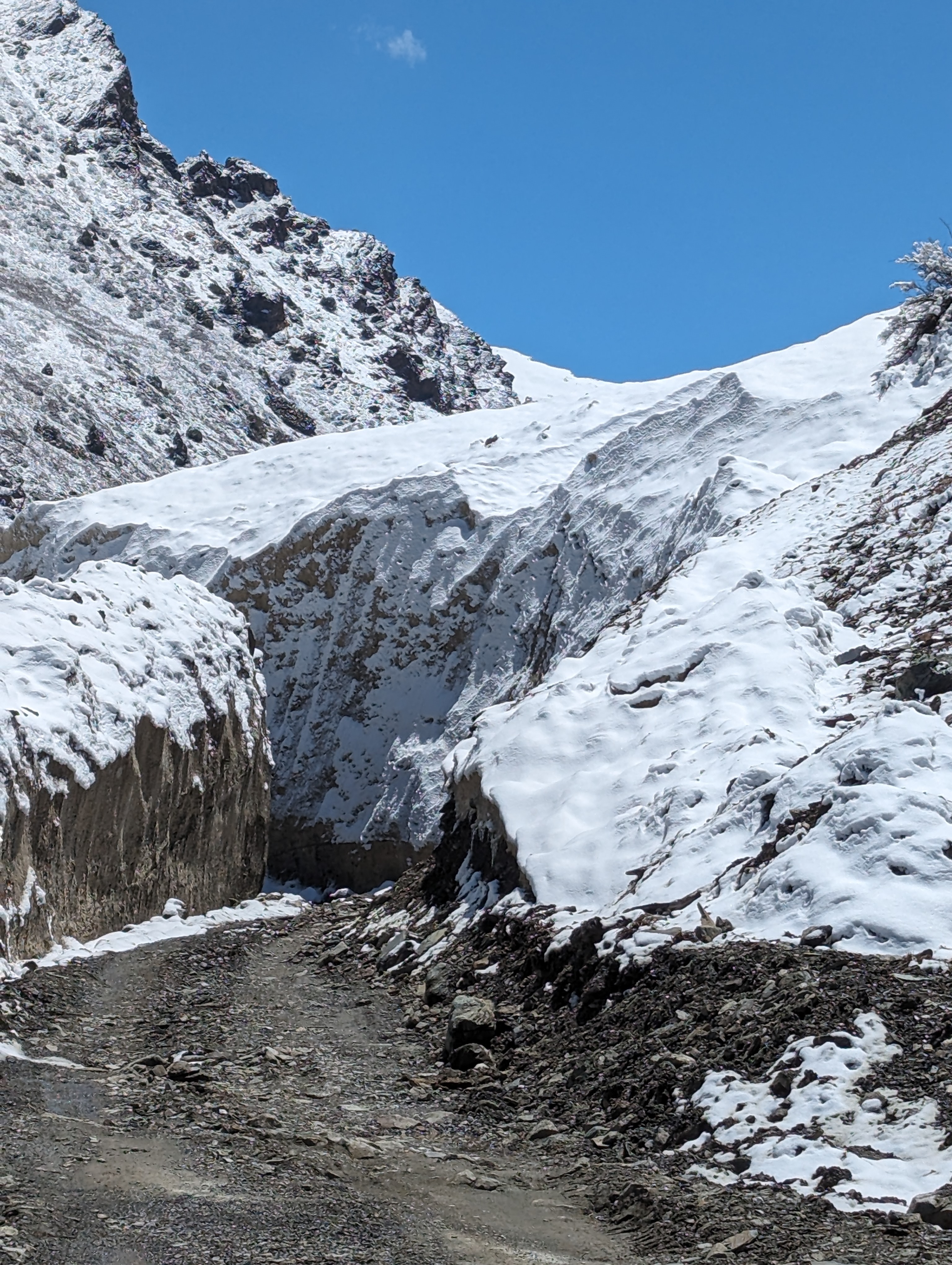
The latest case is a road illegally built by China in Pakistan-occupied Kashmir (PoK). While in the old days, it would have taken months or years to discover the road passing close to India’s Siachen Glacier, satellite imagery of the new road was splashed over the Indian and foreign media.
The road, located in the Shaksgam Valley, branches out from an extension of Highway G219 (also known as the Aksai Chin road) and “disappears into mountains at a place approximately 50 km north of India’s northernmost point, Indira Col in Siachen Glacier,” according to India Today.
The construction that passes through Aghil Pass (India’s frontier with Xinjiang before 1947), was first flagged on X (formerly Twitter) by ‘Nature Desai’, an observer of the Indo-Tibetan boundary.
Tom Hussain, a Pakistani journalist who writes for The South China Morning Post, gave the Chinese motivation: “Pakistan is looking to develop new overland border crossings with China that would potentially boost the allies’ military interoperability against Indian forces in Ladakh and the rest of Kashmir.”
The Hong Kong newspaper asserted that the Gilgit-Baltistan region, today under Pakistan’s control, had proposed a new transit and trade route linking Xinjiang to Kashmir “[which] will increase Beijing and Islamabad’s military interoperability against Indian forces in the region”.
The spokesperson of the Indian Ministry of External Affairs (MEA) immediately asserted: “Shaksgam Valley is a part of the territory of India. We have never accepted the so-called China-Pakistan Boundary Agreement of 1963, through which Pakistan unlawfully attempted to cede the area to China. …We have registered our protest with the Chinese side against illegal attempts to alter facts on the ground. We further reserve the right to take necessary measures to safeguard our interests.”
It is, however, necessary to understand the history behind the Shaksgam Valley.

The Role of Western Powers
When China invaded northern India in October or November 1962, Delhi had no alternative but to ask for the help of Western nations, particularly the United States and Great Britain. At first, the United States seemed only too happy to offer support, thus gaining leverage over India, which until then had been ‘non-aligned’; this ‘neutrality’ often meant an alignment with Moscow, while Pakistan, a member of the SEATO and the Baghdad Pacts, always sided with the West.
When, at the end of November 1962, Washington realised that north India was in danger of being invaded by Chinese troops, it immediately declared its support for Delhi, but instead of helping India, London and Washington chose instead to try to settle the Kashmir dispute between their Pakistani ally and India.
On November 22, Averall Harriman, the American Under-Secretary of State, and Duncan Sandys, the British Commonwealth Secretary, visited the two capitals of the subcontinent to persuade the enemy brothers that it was time to bury the hatchet and find a solution to their fifteen-year-old dispute. Harriman and Sandys eventually signed a joint communiqué and asked the two countries to resume negotiations.
Although India, in an extremely weak position, had some doubts about the possibility of obtaining positive results from negotiations conducted in such particular circumstances, Nehru accepted.
On December 22, 1962, Nehru wrote to the Chief Ministers of the provinces: “I shall briefly refer to Indo-Pakistan problems, notably Kashmir. In another four days’ time, Sardar Swaran Singh will lead a delegation to Rawalpindi to discuss these problems. We realise that this is not a good time to have such a conference because the Pakistani press and leading politicians have vitiated the atmosphere with wild abuse and attacks on India. Nevertheless, we have agreed to go and to try our best to arrive at some reasonable settlement. It is clear, however, that we cannot agree to anything that is against our basic principles and ultimately injures the cause of Indo-Pakistan friendship.”
In the end, the two delegations held a series of six meetings, but nothing much came out of them. The first negotiations took place in Rawalpindi, where Swaran Singh and Zulfikar Ali Bhutto, the two foreign ministers, confined themselves to a historical presentation of the problem and a reiteration of their respective points of view.

Derailing Talks
But soon the negotiations went off on a tangent: the Pakistan government announced that it had reached an agreement in principle with China on its northern border problem (with Xinjiang). Hardly a month after the end of the Sino-Indian war, Pakistan was prepared to give China a piece of India’s territory (as per the August 1948 UN Resolutions).
Advertisement
What a slap in the face for India!
This agreement between China and Pakistan was obviously meant to derail the Kashmir talks.
It is indeed surprising that Pakistan, an ally of the United States and the Western world, should have chosen this moment to make the announcement. It was yet another proof that Pakistan expected nothing from the talks with Delhi, even though they had been initiated by their mentor, the US; at the same time, the support expected by India from the US for India’s northern borders had gone in smoke.
Nehru remained optimistic all the same, or perhaps, like the ostrich, preferred not to see anything. In a letter to the Chief Ministers, he remarked: “The talks have produced no results as far as our problems are concerned, except that they have reduced, to a small extent, the barriers of fear and mistrust that make it difficult to approach these problems.”
Negotiations continued, without tangible results, between 16 and 19 January in Delhi and 8 and 11 February in Karachi. Pakistan was only interested in a plebiscite for Kashmir, but India insisted on prior demilitarisation of the regions occupied by Pakistan.

The Treaty Discussed
On February 25, 1963, the government was asked in Parliament if the Note of Protest sent by Delhi to Pakistan regarding the Sino-Pakistan border treaty drew any response; if yes, what it said; and if the text of the agreement was available.
Dinesh Singh, the Deputy Minister in the MEA, answered: (a) No formal reply has been received to our protest note so far. (b) Does not arise. (c) No Sir.
At that time, Delhi did not even have a copy of the agreement.
Later, on the same day, Harish Chandra Mathur of the Congress asked again about the government’s reaction. Nehru answered: “The Government of India’s reaction is obviously unfavourable.” That was all.

The Treaty Cedes India’s Territory
China and Pakistan signed the agreement on March 2, 1963, by Bhutto and Chen Yi, the foreign ministers of the two countries. According to the two parties, this agreement was intended to promote “the development of good neighbourly relations and friendly relations and the safeguarding of peace in Asia and the world.”
In Article 1, it was acknowledged that the border had never been formally demarcated, and that the two countries wanted to draw it on the basis of “the traditional and customary border.”
As the Pakistani and Chinese maps did not match exactly, it was decided that the topographical features on the ground would be decisive.
It should be noted that in its description of the border, the agreement mentions the Karakoram Pass as the eastern end of the border. In practice, this seems to mean that the Siachen Glacier was occupied by Pakistan at the time. This was, of course, not the case. In fact, the Siachen glacier, long unexplored, has never been occupied by Pakistan, and it was only in 1984 that India took control of it.

Article 6
More interesting is Article 6, in which Pakistan and China agreed that after the settlement of the Kashmir dispute between Pakistan and India, “the sovereign authority concerned will reopen negotiations on the boundary with the Chinese Government so as to sign a formal boundary treaty to replace the present agreement.”
It means that even if the 1963 agreement was considered ‘legal’, which it is not, China is today building a road on a territory that is only temporarily with China. It is clearly a provocation in retaliation for India refusing to budge in Depsang and Demchok in Ladakh.
It remains that the new infrastructure could give a tremendous advantage to China in case of a new conflict with India in the region.
After maps of the new roads were published, External Affairs Minister S Jaishankar reasserted that Pakistan-occupied Kashmir is part of India; he also mentioned the resolution of the Indian Parliament, which states that PoK is part of the country, and observed, “So, what will happen in the future? Very difficult to tell. But, I always tell people one thing, today PoK is in the consciousness once again of the people of India.”
In the meantime, the people of Gilgit-Baltistan have started revolting against the Pakistani state. The game is certainly not over.

Tail End: India will soon have the occasion to protest again; Pakistan and China plan to ‘realign’ the Karakoram Highway to avoid Attabad Lake, which is prone to landslides.

Thursday, May 23, 2024

The Last Indian Villages On Tibet Border

My article The Last Indian Villages On Tibet Border appeared  in Rediff.com

Here is the link...

'It is a breathtaking journey towards the Tibet border, especially since the Border Road Organisation has accomplished a fabulous feat in black-topping the road till the border.'

'One is left with a salute for the dauntless Indian soldiers who spend the winter in these majestic, though inhospitable areas (we were told that the temperature comes down to minus 40 in winter),' recounts Claude Arpi.


After searching for years in the old dusty files of the National Archives of India to unveil some of the secrets on a specific subject, one becomes rather familiar with the object of one's research ... but on paper only.
Often the physical reality is vastly different.
This is what happened to me when I recently visited a remote area in Uttarkashi district of Uttarakhand.
The places are Nilang (also written as Nelang), a village located in the Jadh Ganga valley, Jadhang (or Jadhung) and Pulam Sumda, the latter two lying on the upper reaches, towards the India-Tibet frontier. The Line of Actual Control (LAC) with the Chinese army occupying Tibet is located on top of the ridge.
The particularity of the place is that the area was claimed by Tibet before India's independence (and subsequently by China) as part of Tsaparang in Tsamda county of Ngari Prefecture of Western Tibet.

Today, when China claims any area, its Liberation Army first physically takes over the place and later Beijing announces that it is ready for discussions; the disagreement between the Lhasa government and the administration of the erstwhile princely Tehri state (and by extension British India) was different, it continued for decades, at the end of which no mutually acceptable solution was found, but the 'dispute' did not result in any physical clashes or even an increase of the police personnel posted on the border.
A large amount of correspondence took place between Tibet (Lhasa and the Dzongpen or commissioner in Tsaparang) and the princely states of Tehri‐Garhwal, Bashahr (today Kinnaur) as well as the provincial governments of the United Provinces, Punjab and, of course, the Foreign and Political Department of British India in Delhi.

The Brief History of the Dispute

The Gumgum nalla. Not really a border

Let us first look at the long history of the area.
The difference of perception seems to have arisen when the Dzongpen of Tsaparang, the nearby Tibetan district, visited the Gumgum nala in 1914. He publically announced his decision of setting up a boundary pillar on the spot near a bridge.
When the local villagers objected, the Dzongpen left without any further action.


A few kilometres beyond Gangotri, I kept asking my guide, "Where is this Gumgum nalla?" Finally, he pointed out a most insignificant place ...without a real nalla.
It is where the Tibetans had unilaterally decided to 'fix' their border with India. Of course, the watershed principle or other features determining a boundary were unknown to them.
Four years later, in 1918, the Tehri State decided to erect 3 pillars on the top of the watershed, at Tsang Chok‐la, following the watershed principle.
In 1920, the Tehri State surveyed for the first time the area and prepared cultivation maps of the Nelang area. The Jadh Ganga valley was then included in the maps of the princely state.
In 1921, the Tsaparang Dzongpen visited Nelang again. This time, he sent a letter to the Raja of Tehri requesting him to nominate an official to sort out the boundary issue; at that time, it was not yet considered a 'dispute'; it was only a 'difference of perceptions' between friendly neighbours.
The Raja answered that the issue had to be raised through the Government of India as it involved a problem between two foreign governments.
In 1924, it was finally proposed by British India to appoint a boundary commission, but due to the poor communications and the fact that these areas could only be visited in summer, the commission could meet only in the summer of 1926.
Travelling in the Valley, you first note the inaccessibility of the area. On the opposite side of the road, perched on a cliff, is the Gartang Gali (bridge), built some 150 years ago, by Pathans who are said to have come from Peshawar to build this bridge at a height of 11000 feet.
It was finally slightly easier for the villagers to move in the valley and eventually visit the trade marts in Tibet. This wooden step bridge path was closed after the 1962 War; today it has been opened for tourists.
The 3.5 km bridge is indeed a marvel of wooden architecture, worth the visit.

Gartang Gali, a wooden bridge, said to be built by Pathans from Peshawar

The Acton Commission
To return to history, in June 1926, T J C Acton, an officer of the Indian Civil Service, was nominated as the British representative to discuss the issue with Tibetan officials near the Gumgum nala.
The Tibetans claimed that the Tehri people had removed their boundary marks after they had returned to Tibet.
The British commissioner commented: 'Their attitude, I think, was that His Highness [His Holiness] the Dalai Lama had said that the boundary was the Gumgum nala, and that any criticism of that decree would be a dangerous form of blasphemy.'
It was the first of several commissions which would try to solve the problem with the Buddhist neighbour during the following years.

The Chor Gad, another route to Tibet.
At one point, the British, great adepts of compromise, suggested that Nelang could remain with Tehri State while Jadhang would go to Tibet. But a complication soon cropped up, Jadhang (and even Nelang) was claimed by the Bashahr state.
The Tibetan claim of a frontier in line with the Gumgum nala remained 'clearly absurd', according to Acton.

A moraine, a pile of unconsolidated debris, usually soil and rock
left behind by a moving glacier

The Saga Continues

Two years later, on November 14, 1930, Colonel J L R Weir, the political officer in Sikkim, informed the foreign secretary in Delhi that he had received a letter from Lhasa about the Tibet‐Tehri boundary question.
Weir commented: 'This Tehri boundary is one to which much importance is attached by the Tibetan Government so much so that they paid me a special visit to discuss the matter that day.' Nothing came out of a new enquiry.
Colonel Weir was replaced by Frederick Williamson as the political officer in 1932. During a tour in Western Tibet from August to October 1932, Williamson was requested by the Government of India to look into the 'Tehri‐Tibet' dispute again.
In his report, the political officer mentions the Acton Report which 'reported in favour of the watershed boundary claimed by Tehri, but the Government of India considered that the evidence showed that Tibet was entitled to a frontier further to the west.'
Williamson commented 'with the exception of the northwest corner, this tract appeared to my untrained mind to be practically valueless. But the south‐west corner contains valuable deodar forest.'
The discussions continued till Independence.

Nelang Village
Post Independence: The valley occupied
In the early 1950s, the government moved fast following the Himmatsinghji Committee report prepared by the Government of India. One of the actions suggested by the Committee was that areas such Tawang and Nelang should be immediately occupied by Indian forces.

Already in May 1950, the ministry of external affairs had sent a note to the ministry of defence asking the latter to comment on the feasibility to occupy the Nelang/Jadhang area; the Political Officer in Sikkim had noted: 'The guiding principle in the new circumstances must however be the Government of India's ability to vindicate what they would regard as the appropriate frontier.'
While visiting the area today, one realises the difficulty to sustain a permanent occupation of these villages. 

On April 4, 1950, the ministry of defence answered: 'The area under dispute is an extremely difficult country physically and climatically with hardly any communications. It therefore follows that operations in the area will have to be confined to short periods and undertaken by specially trained infantry.'

Six years later, China walked into the area.

On May 2, 1956, the ministry of external affairs complained about a Chinese intrusion. The ministry said: 'Nilang at the area right up to Tsang Chok‐la pass is clearly within Indian territory and has always been in our possession.'

Apart from the fact that the border follows the watershed, the area is clearly Hindu with two small mandirs being maintained by the Indian Army on behalf of the Jadh population.
Today, what remains of the villages of Nelang and Jadhang has been opened to visitors and the Government of India has decided to repopulate the villages under the Vibrant Village programme. This is a fine initiative, though it is not certain that the scheme will immediately succeed. In the meantime, the villages are worth visiting.

 As I entered the Jadh Ganga valley, the story of George Fernandes, the then defence minister, sending babus to the Siachen Glacier to study the topography of the place, instead of getting their knowledge from the files alone, came back to mind.
It is indeed an entirely different experience to travel on a road between two majestic ridges and slowly go up in altitude, from the base camp in Harsil village.
It is a breathtaking journey towards the Tibet border, especially since the Border Road Organisation has accomplished a fabulous feat in black-topping the road till the border.
One is left with a salute for the dauntless Indian soldiers who spend the winter in these majestic, though inhospitable areas (we were told that the temperature comes down to minus 40 in winter).
When India had a peaceful neighbour such measures were not necessary, but today Delhi has no other choice.

Jadh Ganga


Thursday, May 16, 2024

Xi in Europe: How Chinese President posed as ‘ruler of world’ while Europeans 'begged' a solution for Ukraine

My article Xi in Europe: How Chinese President posed as ‘ruler of world’ while Europeans 'begged' a solution for Ukraine appeared in Firstpost

Here is the link...

Macron probably wanted to impress the French public with his diplomatic skills before the European elections in June. Unfortunately for him, banners and flags were unfurled by Uyghur, Tibetan and Chinese activists on the streets of Paris
Xi in Europe: How Chinese President posed as ‘ruler of world’ while Europeans 'begged' a solution for Ukraine


Observers could see that France was fascinated by China when President Xi Jinping of China paid a three-day visit to France; he was lavishly received by his French counterpart, President Emmanuel Macron.
What is strange is that at a time when President Vladimir Putin of Russia is considered to be the supreme villain in France (and in Europe in general), Xi is seen as a decent person that France needs to engage with.
But is Xi really different from Putin? Does he treat his minorities better? Have the Chinese people more freedom than the Russians? Certainly not. But Europeans and Westerners in general remain fascinated by China and prefer to bury their faces in the sand about the dark side of the Middle Kingdom.
Let us not forget that it is thanks to China that, for the past two years, Russia has survived all the US and European sanctions.
Putin may not be what one can call a ‘good human being, but unlike India, France has been unable to find a balanced relationship with Russia and China.
What were Macron’s motivations to receive so elaborately Xi Jinping and his wife Peng Liyuan (a major general of the People’s Liberation Army) with red carpets all over Paris and even in the snows of the Pyrenees mountains?

France’s Short Memory
In France, as elsewhere, political leadership has a short memory.
Who remembers February 23, 2017, when French Prime Minister Bernard Cazeneuve went to Wuhan to inaugurate a ‘P4’ virology laboratory? That day, Cazeneuve declared, “France is proud and happy to have contributed to the construction of the first high biological security ‘P4’ laboratory in China.”
The French Prime Minister further explained: “This cutting-edge tool is a central element in achieving the 2004 intergovernmental agreement on Franco-Chinese cooperation for the prevention and fight against emerging infectious diseases.”
This investment did not prevent or even foresee the forthcoming disaster, though it showed the level of trust between the two countries.
My point is that, despite having a very privileged relationship with India, Paris would not have trusted New Delhi enough to build a P4 lab in India.
But thankfully, during the following years, relations between New Delhi and Paris have grown in strength and depth.

First Visit to China

During his first state visit to China in 2018, the French President brought with him two key messages.
One was the huge possibility of cooperation between China and Europe and France’s commitment to that effort.
The other is a warning to not underestimate growing concern and frustration in Europe and elsewhere with what many regard as China’s unfair trade practices (such as investment restrictions).
At that time, Mathieu Duchatel, deputy director of the Asia and China Programme at the European Council of Foreign Relations, stated: “[Macron] wants to present himself as a leader of the EU, but at the same time, I think he wants to send a signal that Europe and the EU are in better shape than many think in China.”
In 2018, in a speech in Xi’an, in northwestern China’s Shaanxi province, Macron admitted that China faced a “united front from developed countries against its unfair trade practices”.
Nothing has changed since then. This has become acutely worse after the COVID crisis (made in Wuhan), though today the Chinese leadership desperately needs to be accepted by the world. This explains the Chinese President’s first outing after five years (to France, Serbia, and Hungary).

A Failure?
In an article published in Le Figaro (belonging to the Dassault family), President Xi Jinping spoke of “carrying forward the spirit that guided the establishment of China-France Diplomatic Relations [in 1964], working together for global peace and development.”
Xi wrote that he was bringing three messages with him: “China will work with France to carry forward the spirit that guided the establishment of their diplomatic ties, build on past achievements, and open new vistas for China-France relations.” He further observed: “I think it’s important to have a dialogue, everyone together, so we can all go in the same direction. It’s very important for French and Chinese people to communicate. China is a very important country."
He added that China understands the repercussions of the Ukraine crisis on the people of Europe, adding that the longer the Ukraine crisis drags on, the greater harm it will do to Europe and the world.
Good intentions indeed, but will they be followed by resolute action when an economic war is raging between China and the United States?

The French Motivations
Since the beginning of the war in Ukraine, Macron has expressed his desire to ‘play a role’, but it was doubtful from the start that he could influence Beijing, which has its own interests with Russia; despite the official declarations, China has always stood firm behind Putin.
Further, the French President has stated several times that he does not rule out sending ground troops to Ukraine. Is it compatible with ‘playing a role’?
In an interview with The Economist earlier this month, Macron reaffirmed his previous statements backing Ukraine: “If the Russians were to break through the front lines, if there were a Ukrainian request, which is not the case today, we would legitimately have to ask ourselves this question,” he said.
Isabelle Lasserre in Le Figaro frankly noted: “Emmanuel Macron failed to win over his Chinese counterpart, reflecting France’s lack of clout in the face of China.”
Speaking of the joint press conference, she wrote: “Behind the tense face of the French president…and that of the Chinese president, uncomfortable and closed, we could not see the ‘friendship’…but the confrontation between two worlds that oppose each other on everything.”
It is indeed two opposite worlds.

Special Friendly Outing
In a very special gesture, Emmanuel Macron and his wife Brigitte took Xi Jinping and his wife to the Col du Tourmalet in the Pyrenees, where they watched folk local dancers and enjoyed local gastronomy.
Does it remind you of an outing in Mahabalipuram?
They had lunch on the spot; on the menu, typical Pyrenean dishes were chosen by Dominique Bouchait, the local chef. For starters, garbure, the traditional local soup. Then shoulder of lamb confit, with ham from Porc Noir de Bigorre cut into pieces, accompanied by Tarbais beans and porcini mushroom heads. After a cheese platter, for dessert, the chef had prepared a pastry known only to the local Béarnais: le russe (the Russian). It is made with an almond-based cookie and praline paste and is said to originate from Crimea.
However, in view of the war in Ukraine, this dessert, particularly appreciated by Emmanuel and Brigitte Macron, was at the last minute replaced by a banal blueberry tart. Diplomacy and politics prevailed.

Not Much Progress
The bilateral negotiations did not see much progress, though China will allow imports of pig origin protein feed as well as pork offal from France. However, European hopes for an Airbus plane order have been dashed, with the two sides only agreeing to expand cooperation.
A European diplomat said Xi was the ‘winner’ of the visit, having ‘cemented his image as the ‘ruler of the world’ where westerners are begging him to solve European problems in Ukraine’.
Macron probably wanted to impress the French public with his diplomatic skills before the European elections in June. Unfortunately for him, banners and flags were unfurled by Uyghur, Tibetan, and Chinese activists on the streets of Paris. “Free Tibet. Dictator Xi Jingping, your time is up!” stated a large white banner that his motorcade had to drive under on the Outer Boulevard. On the top of the banner was the flag of Tibet, a symbol of the Tibetan independence movement.
The protesters were joined by Chinese, Taiwanese, Mongolian, and Vietnamese human rights activists, as well as Hong Kong pro-democracy supporters, because after all, France is a democracy and people can express their views.

Indo-French Relations
More discreet but perhaps more concrete, on May 13 in Versailles, France will host its seventh edition of the ‘Choose France Forum’.
A French official told Business Today Television: “Seven Indian CEOs will meet President Macron on the 13th. There will be a Franco-India forum where the Indian CEOs will interact with the French CEOs."
The official objective is to welcome more Indian investments in France and to increase further partnership between both countries.
This may not bring votes for the European elections to Macron’s party, but it will certainly enhance relations between France and India.
The South China Morning Post summarised Xi’s three-nation tour: “Xi Jinping, his tour over, leaves behind a Europe split by how to deal with China,” adding: “Despite long-standing ties to President Emmanuel Macron, [Xi] made few if any concessions to reduce the flood of Chinese imports into the European Union.” And no concession on Ukraine either.
But for Xi, these few days must have been a relief from the pressure under which he lives in Beijing.

Saturday, May 11, 2024

Nepal’s flimsy claims on Kali River will not change ground realities, but India must be vigilant

Adi Kailash
My article Nepal’s flimsy claims on Kali River will not change ground realities, but India must be vigilant appeared in Firstpost.

Here is the link...

Though China does not have any claim in the area, it is clear that Chinese have been inciting Nepal to claim Kalapani and beyond, and this is probably to destabilise India


Nepal’s flimsy claims on Kali River will not change ground realities, but India must be vigilant
Kathmandu seems to have forgotten that the location of the Kali river on the maps of the Sino-Nepali treaty matches with the Indian stand: Kalapani is on Indian territory. Image: Wikimedia Commons
A recent visit to the border areas of the Central Sector of the Indo-Tibet boundary was an eye-opener. The first thing that I witnessed was the considerable efforts that have been made by the Central government (through the Border Road Organisation of the Indian Army) to connect to ‘the world’ in these remote locations.
The accounts of travellers, yogis (particularly Swami Pranavanada in the 1930s), yatris (to Kailash Mountain), or Indian officials posted in Gartok in western Tibet always struck me for the description of the harsh terrain near the tri-junction of India, Tibet, and Nepal; till recently, the journey was indeed extremely perilous.
To give an example, a few years ago, it took up to a 27-day walk for a yatri to travel from Darchula to Lipulekh and later come back (in Tibet, they were taken by buses to the Kailash base camp). Today the road reaches a few hundred metres from the top of Lipulekh, the border pass separating Kumaon (near the trijunction with Tibet and Nepal) from Purang County (Dzong) in Tibet.
The black-topping of the road between Darchula and Lipulekh is not yet fully completed, but it is a matter of a few more months before the tar will be laid all the way to the pass.
The implication of this development is that access to the Indian Army and the Indo-Tibet Border Police (ITBP) is far easier; today, the defence forces can answer any contingencies in the shortest possible time, which also makes the lives of the local population simpler.
Though this area did not witness any confrontation during the 1962 War with China and is not directly claimed by Beijing, it remains ‘disputed’ through China’s proxy, Nepal.

In the News Again
The issue was recently in the news when Kathmandu decided to incorporate on their 100-rupee banknotes a new political map of Nepal, covering the so-called disputed territories of Lipulekh, Limpiyadhura, and Kalapani as part of the Nepali territory.
External Affairs Minister S Jaishankar was quick to answer: “I saw that report. I have not looked at it in detail, but I think our position is very clear. With Nepal, we were having discussions about our boundary matters through an established platform. And then, in the middle of that, they unilaterally took some measures on their side. But by doing something on their side, [Nepal is] not going to change the situation between us or the reality on the ground,” said Jaishankar.
Nepal, which now tries to unilaterally change the maps, has not always claimed the Indian village of Kalapani, the main resurgence of the Kali river, which has its origin in a rivulet near Lipulekh.
In May 2020, an argument erupted between India and Nepal; the immediate reason was an 80-km road from Darchula to Lipulekh.
Strategically, this road is crucial for India, but also important for the yatris and local traders, Lipulekh being one of the three landports between India and Tibet.
It was only in 1998 that the CPN-ML faction led by Bam Dev Gautam started claiming some Indian territory in the vicinity of Kalapani as Nepalese. According to Buddhi Narayan Shrestha, a former Director General of the Land Survey Department, the ‘Kali River’ was the Kuti Yankti river that arises below the Limpiyadhura range and not the Kali accepted by India; Nepal began then claiming an entire area of 400 km².

But why was no claim put forward by Nepal for the previous 150 years?
This has never been explained by Kathmandu, and some flimsy historical excuses are being used today.
A Nepali argument is that the flow of the Kuti river is more significant, though this does not prove anything. In his book, History of the Kailash-Mansarovar, Swami Pranavananda, who extensively wrote on the subject, mentioned the confluence of the Kali and Kuti rivers “at a distance of 2 or 3 furlongs down below the road. Though the River Kuti is almost twice or thrice as big as Kali, the Kali is taken to be the main river.” The Swami also noted that the local population attached to Garbyang village is not of Nepali stock.
Advertisement

Tracing the History
After a war between British India and Nepal in 1814, the Nepalis were sent back across the Kali River in May 1815, and subsequently, the Sugauli Treaty was signed on March 4, 1816. Article 5 of the Treaty stated: “The Rajah of Nepaul renounces for himself, his heirs and successors, all claim to or connexion with the countries lying to the west of the River Kali, and engages never to have any concern with those countries or the inhabitants thereof.”
Unfortunately, no map was attached, which could have authoritatively shown the exact alignment and source of the Kali River.
In any case, at that time, no scientific survey worth the name could be carried out; it was only by the mid-19th century that the Himalayan border was first surveyed by the Great Trigonometrical Survey of India (a precursor of the Survey of India), in a more scientific manner.
Today, the Nepalis base their claims on an old map that is neither accurate nor authentic. From 1998 until 2020, the Nepalese government continued to keep quiet, but in May 2020, Kathmandu for the first time released a map incorporating the entire area east of the Kuti Yankti River as part of their territory. To make it worse, on June 13, a bill seeking to give legal status to the new map was unanimously approved by the lower house in the Nepal Parliament.
The political struggle within the ruling party in Nepal further complicated the issue.

The Border in the 1950s
Interestingly, in the early 1950s, the Indian police already manned a check post at Kalapani. In his diary, Lakshman Singh Jangpangi, the Indian Trade Agent in Gartok, wrote: “July 10, 1955. I could not start on 9th, as my clerk suddenly ran a very high temperature and was unable to leave his bed. The Compounder was sent with the advance party on 6th. This clerk was today better and fit to travel, I started and camped at Kalapani Police Post. A section of P.A.C. [Provincial Armed Constabulary] under Subedar Sher Singh has been stationed here since June 28, 1955. The Garbyang villagers have cultivated land close to the post.”
When the police post was set up by the Uttar Pradesh government, probably in 1952, Nepal did not object.

The 1961 Sino-Nepal Treaty
But there is more, the “Boundary Treaty between the People’s Republic of China and the Kingdom of Nepal,” signed by President Liu Shaoqi of China and King Mahendra of Nepal on October 5, 1961, shows the Kali River as per the Indian stand. Article I (1) defines the China-Nepal boundary line, which “starts from the point where the watershed between the Kali River and the Tinkar River meets the watershed between the tributaries of the Mapchu (Karnali) River on the one hand and the Tinkar River on the other hand”.
More telling are the precise maps attached to the treaty and signed by both parties; Kathmandu seems to have forgotten that the location of the river on the maps of the Sino-Nepali treaty matches with the Indian stand: Kalapani is on Indian territory.

Other Proofs in Favour of India’s Stand
The Memorandum between the Government of the Republic of India and the Government of the People’s Republic of China on the Resumption of Border Trade, signed on December 13, 1991, and the Protocol on Entry and Exit Procedures for Border Trade, signed on July 1, 1992, are other examples confirming that China agreed with India on the border in this area.
For Beijing, the border pass was (and still is today) Lipulekh. Once again, Kathmandu did not protest.

The Chinese Stakes
Though China does not have any claim in the area, it is clear that Chinese have been inciting Nepal to claim Kalapani and beyond, and this is probably to destabilise India.
The visit of Wang Junzheng, the TAR party secretary, to Kathmandu last November set the ball rolling. The Tibet delegation (without any Tibetans) announced that they wanted to maintain the “good momentum of high-level exchanges between the two countries”. During his stay, Wang met, among others, Prime Minister Pushpa Kamal Dahal ‘Prachanda’.
A five-year initiative for Nepal’s northern border districts was then created; it offered different kinds of logistical and material support, mostly for building schools and health posts, installing solar electricity in the 15 northern districts of Nepal.
A preparatory meeting was recently held in Lhasa on April 23 and 24; all this means a more important Chinese presence in Nepal, including in Darchula district (of Nepal), bordering India.
Besides these political aspects, the stunning and majestic beauty of the area (particularly the Om Parvat and the Adi Kailash) will hopefully attract more and more Indian visitors in the years to come. After all, it is Indian territory.

The border in the Kalapani/Lipulekh sector

Om Parvat near the trijunction India-Tibet-Nepal at Tinkar Pass


Cave in which Maharishi Vyasa meditated and wrote the Mahabharata (near Kalapani)

Chinese map showing Chinese claims (green) and Nepali claims (mauve)

First Pillar on Sino-Nepal border near Tinkar Pass