 |
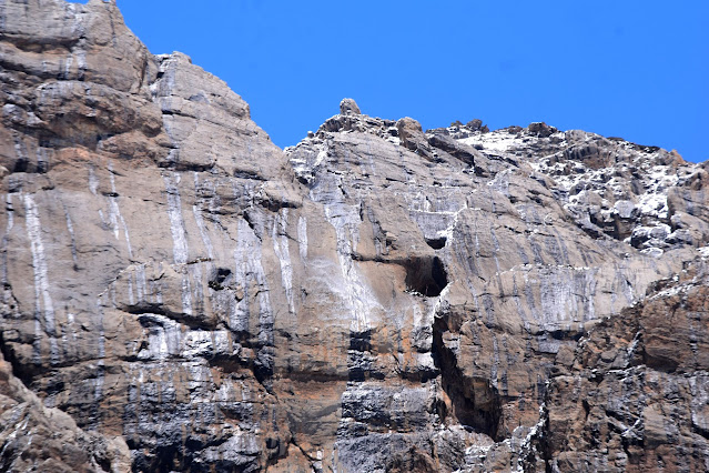
Adi Kailash
|
My article Nepal’s flimsy claims on Kali River will not change ground realities, but India must be vigilant appeared in Firstpost.
Here is the link...
Though China does not have any claim in the area, it is clear that Chinese have been inciting Nepal to claim Kalapani and beyond, and this is probably to destabilise India
Nepal’s flimsy claims on Kali River will not change ground realities, but India must be vigilant
Kathmandu seems to have forgotten that the location of the Kali river on the maps of the Sino-Nepali treaty matches with the Indian stand: Kalapani is on Indian territory. Image: Wikimedia Commons
A recent visit to the border areas of the Central Sector of the Indo-Tibet boundary was an eye-opener. The first thing that I witnessed was the considerable efforts that have been made by the Central government (through the Border Road Organisation of the Indian Army) to connect to ‘the world’ in these remote locations.
The accounts of travellers, yogis (particularly Swami Pranavanada in the 1930s), yatris (to Kailash Mountain), or Indian officials posted in Gartok in western Tibet always struck me for the description of the harsh terrain near the tri-junction of India, Tibet, and Nepal; till recently, the journey was indeed extremely perilous.
To give an example, a few years ago, it took up to a 27-day walk for a yatri to travel from Darchula to Lipulekh and later come back (in Tibet, they were taken by buses to the Kailash base camp). Today the road reaches a few hundred metres from the top of Lipulekh, the border pass separating Kumaon (near the trijunction with Tibet and Nepal) from Purang County (Dzong) in Tibet.
The black-topping of the road between Darchula and Lipulekh is not yet fully completed, but it is a matter of a few more months before the tar will be laid all the way to the pass.
The implication of this development is that access to the Indian Army and the Indo-Tibet Border Police (ITBP) is far easier; today, the defence forces can answer any contingencies in the shortest possible time, which also makes the lives of the local population simpler.
Though this area did not witness any confrontation during the 1962 War with China and is not directly claimed by Beijing, it remains ‘disputed’ through China’s proxy, Nepal.
In the News Again
The issue was recently in the news when Kathmandu decided to incorporate on their 100-rupee banknotes a new political map of Nepal, covering the so-called disputed territories of Lipulekh, Limpiyadhura, and Kalapani as part of the Nepali territory.
External Affairs Minister S Jaishankar was quick to answer: “I saw that report. I have not looked at it in detail, but I think our position is very clear. With Nepal, we were having discussions about our boundary matters through an established platform. And then, in the middle of that, they unilaterally took some measures on their side. But by doing something on their side, [Nepal is] not going to change the situation between us or the reality on the ground,” said Jaishankar.
Nepal, which now tries to unilaterally change the maps, has not always claimed the Indian village of Kalapani, the main resurgence of the Kali river, which has its origin in a rivulet near Lipulekh.
In May 2020, an argument erupted between India and Nepal; the immediate reason was an 80-km road from Darchula to Lipulekh.
Strategically, this road is crucial for India, but also important for the yatris and local traders, Lipulekh being one of the three landports between India and Tibet.
It was only in 1998 that the CPN-ML faction led by Bam Dev Gautam started claiming some Indian territory in the vicinity of Kalapani as Nepalese. According to Buddhi Narayan Shrestha, a former Director General of the Land Survey Department, the ‘Kali River’ was the Kuti Yankti river that arises below the Limpiyadhura range and not the Kali accepted by India; Nepal began then claiming an entire area of 400 km².
But why was no claim put forward by Nepal for the previous 150 years?
This has never been explained by Kathmandu, and some flimsy historical excuses are being used today.
A Nepali argument is that the flow of the Kuti river is more significant, though this does not prove anything. In his book, History of the Kailash-Mansarovar, Swami Pranavananda, who extensively wrote on the subject, mentioned the confluence of the Kali and Kuti rivers “at a distance of 2 or 3 furlongs down below the road. Though the River Kuti is almost twice or thrice as big as Kali, the Kali is taken to be the main river.” The Swami also noted that the local population attached to Garbyang village is not of Nepali stock.
Advertisement
Tracing the History
After a war between British India and Nepal in 1814, the Nepalis were sent back across the Kali River in May 1815, and subsequently, the Sugauli Treaty was signed on March 4, 1816. Article 5 of the Treaty stated: “The Rajah of Nepaul renounces for himself, his heirs and successors, all claim to or connexion with the countries lying to the west of the River Kali, and engages never to have any concern with those countries or the inhabitants thereof.”
Unfortunately, no map was attached, which could have authoritatively shown the exact alignment and source of the Kali River.
In any case, at that time, no scientific survey worth the name could be carried out; it was only by the mid-19th century that the Himalayan border was first surveyed by the Great Trigonometrical Survey of India (a precursor of the Survey of India), in a more scientific manner.
Today, the Nepalis base their claims on an old map that is neither accurate nor authentic. From 1998 until 2020, the Nepalese government continued to keep quiet, but in May 2020, Kathmandu for the first time released a map incorporating the entire area east of the Kuti Yankti River as part of their territory. To make it worse, on June 13, a bill seeking to give legal status to the new map was unanimously approved by the lower house in the Nepal Parliament.
The political struggle within the ruling party in Nepal further complicated the issue.
The Border in the 1950s
Interestingly, in the early 1950s, the Indian police already manned a check post at Kalapani. In his diary, Lakshman Singh Jangpangi, the Indian Trade Agent in Gartok, wrote: “July 10, 1955. I could not start on 9th, as my clerk suddenly ran a very high temperature and was unable to leave his bed. The Compounder was sent with the advance party on 6th. This clerk was today better and fit to travel, I started and camped at Kalapani Police Post. A section of P.A.C. [Provincial Armed Constabulary] under Subedar Sher Singh has been stationed here since June 28, 1955. The Garbyang villagers have cultivated land close to the post.”
When the police post was set up by the Uttar Pradesh government, probably in 1952, Nepal did not object.
The 1961 Sino-Nepal Treaty
But there is more, the “Boundary Treaty between the People’s Republic of China and the Kingdom of Nepal,” signed by President Liu Shaoqi of China and King Mahendra of Nepal on October 5, 1961, shows the Kali River as per the Indian stand. Article I (1) defines the China-Nepal boundary line, which “starts from the point where the watershed between the Kali River and the Tinkar River meets the watershed between the tributaries of the Mapchu (Karnali) River on the one hand and the Tinkar River on the other hand”.
More telling are the precise maps attached to the treaty and signed by both parties; Kathmandu seems to have forgotten that the location of the river on the maps of the Sino-Nepali treaty matches with the Indian stand: Kalapani is on Indian territory.
Other Proofs in Favour of India’s Stand
The Memorandum between the Government of the Republic of India and the Government of the People’s Republic of China on the Resumption of Border Trade, signed on December 13, 1991, and the Protocol on Entry and Exit Procedures for Border Trade, signed on July 1, 1992, are other examples confirming that China agreed with India on the border in this area.
For Beijing, the border pass was (and still is today) Lipulekh. Once again, Kathmandu did not protest.
The Chinese Stakes
Though China does not have any claim in the area, it is clear that Chinese have been inciting Nepal to claim Kalapani and beyond, and this is probably to destabilise India.
The visit of Wang Junzheng, the TAR party secretary, to Kathmandu last November set the ball rolling. The Tibet delegation (without any Tibetans) announced that they wanted to maintain the “good momentum of high-level exchanges between the two countries”. During his stay, Wang met, among others, Prime Minister Pushpa Kamal Dahal ‘Prachanda’.
A five-year initiative for Nepal’s northern border districts was then created; it offered different kinds of logistical and material support, mostly for building schools and health posts, installing solar electricity in the 15 northern districts of Nepal.
A preparatory meeting was recently held in Lhasa on April 23 and 24; all this means a more important Chinese presence in Nepal, including in Darchula district (of Nepal), bordering India.
Besides these political aspects, the stunning and majestic beauty of the area (particularly the Om Parvat and the Adi Kailash) will hopefully attract more and more Indian visitors in the years to come. After all, it is Indian territory.
 |
The border in the Kalapani/Lipulekh sector
|
 |
| Om Parvat near the trijunction India-Tibet-Nepal at Tinkar Pass |
 |
Cave in which Maharishi Vyasa meditated and wrote the Mahabharata (near Kalapani)
|
 |
Chinese map showing Chinese claims (green) and Nepali claims (mauve)
|
 |
First Pillar on Sino-Nepal border near Tinkar Pass
|


No comments:
Post a Comment