Tuesday, January 19, 2021

The Chinese Village in India and the Pure Crystal Mountain Pilgrimage

New Village inside India's Territory

It has been reported by NDTV that China has constructed a new village consisting of about 101 homes, inside Arunachal Pradesh.
The TV channel acquired satellite imagery dated November 1, 2020 and the images “were analyzed by several experts approached by NDTV, who confirmed that the construction, approximately 4.5 kms within Indian territory of the de facto border.”
It is of huge concern to India, added the channel: “Though this area is Indian territory, according to official government maps, it has been in effective Chinese control since 1959. However, earlier only a Chinese military post existed, but this time a full-fledged village that can house thousands has been built. The village, located on the banks of the River Tsari Chu, lies in the Upper Subansiri district, an area which has been long disputed by India and China and has been marked by armed conflict.”

NDTV quoted me; here is the link to the article.

New Village near Longju
Interestingly, the village is located near Longju, a highly symbolic place, where the first clash between India and China took place on August 25, 1959 (5 months after the arrival of the Dalai Lama in India).
Here is India's complaint:

Note given to the Foreign Office of China by the Indian Ambassador, 28 August 1959

The Government of India have recently brought to the notice of the Chinese Government a number of instances in which Chinese troops have violated the international frontier and trespassed into Indian territory.
On the 11th August the Chinese Government were informed of a violation of the border at Khinzemane [Tawang sector] and on 13th August detailed information was provided about Chinese intrusion in the Spanggur region [Ladakh sector]. No replies have been received so far to these notes.
Another serious instance of violation of the Indian border and unlawful trespass into Indian territory by Chinese forces has just been brought to the notice of the Government of India. On the 25th August a strong Chinese detachment crossed into Indian territory south of Migyitun on the NEFA border and fired without notice on an Indian forward picket. They arrested the entire picket which was twelve strong but eight Indian personnel somehow managed to escape. Thereafter the Chinese detachment outflanked the Indian outpost at Longju and opened fire on it from a distance of about 800 yards.Their object clearly was to overpower our outpost which was well within our territory about two miles south of the international border. There could be no doubt about the international frontier in this area and this is a case of deliberate aggression on Indian territory. The Government of India take very serious notice of this latest incident which as we have said above, is one of a number [during] recent weeks.

My old 2016 post

The Tibetan calendar is based on a sixty-year cycle using a combination of the twelve animal signs (Mouse, Ox, Tiger, Rabbit, Dragon, Snake, Horse, Sheep, Monkey, Bird, Dog and Pig) with the five elements (Wood, Fire, Earth, Metal, Water).
We have just entered into the Monkey-Fire Year.
Monkey and Fire have often produced special years.
Take the last Monkey-Fire Year was 1956.
The Dalai Lama and the Panchen Lama honoured India with their visit on the occasion of the 2500th anniversary of the birthday of the Buddha in that year.
But Year 1956 witnessed another significant event: the last Tsari Pilgrimage.
In the Tibetan psyche, Tsari has always been synonymous of ‘sacred place’. With the Mount Kailash and the Amye Machen in eastern Tibet, the pilgrimage around the Dakpa Sheri, the ‘Pure Crystal Mountain’ has, since centuries, been one of the holiest of the Roof of the World. 

The ‘Pure Crystal Mountain’ lies at 5,735 meters above the sea in the Tsari district of southern Tibet.
Toni Huber, one of the foremost scholars on the subject, wrote a great deal about the site of the pilgrimage, located between Tsari and the Upper Subansiri district of Arunachal Pradesh: “The large-scale, 12-yearly circumambulation of Tibetan Buddhist pilgrims around the mountain known as the Rongkor Chenmo, had the character of a state ritual for the Ganden Phodrang [Tibetan Government]. Pilgrims in this huge procession crossed the McMahon Line below the frontier village of Migyitün in Tsari district,” wrote Huber.
After crossing the McMahon line, the procession would proceed southwards along the Tsari Chu (‘river’) and then suddenly turned westwards to follow the Subansiri, to finally cross back into Tibet to reach the first frontier village in Chame county.
The southern leg of the Rongkor procession crosses the tribal areas of Upper Subansiri. This was the territory of the Mara clan of the Tagin tribe who lives downstream the Tsari Chu valley and around its confluence with the Subansiri at Gelensiniak.

According to Huber, there was an elaborate system of ‘compensations’ or ‘taxes’ depending from which side one experienced the holy pilgrimage.
Payments in kind were regularly made to both the Mara and Na tribes by the Tibetan Government to allow the passage of tens of thousands of pilgrims via the tribal areas. The ‘assistance’ to the local population was compulsory for the sacred journey to proceed smoothly, south of the McMahon Line.
During the 1914 Simla Conference between Tibet and British India, Capt Frederick Bailey, an intelligence officer who had mapped the area with his colleague Capt Henry Morshead, informed Sir Henry McMahon about the sensitivity of the issue and it is probably on their recommendation that a condition was inserted in the border agreement to reassure the Tibetans and persuade them to agree to the Red Line.
The condition for the Tibetan acceptance was that the Government of India would allow the smooth continuation of the Tsari pilgrimage on the Indian side of the Tibet-India border.
Bailey and Morshead had visited the place in 1913 during their journey ‘beyond the snowline’. The young captain later recalled: “The great pilgrimage took place every twelve years, in the Monkey Year. 100,000 [perhaps less] pilgrims usually made the pilgrimage, many of them coming from Pome [in Kongpo province]. The Pobas [Tibetans] sent a hundred soldiers; fifty were sent from Trasum in Kongpo and thirty from the frontier village of Tron on the Chayul river. These were to protect the pilgrims from attack by the tribals, through whose territory the pilgrims had to travel when making the Great Pilgrimage.”
The pilgrims used to embark on their circumambulation from Migyitün which was the acknowledged border-post; the McMahon Line, drawn a few months later only reiterated this fact. Then, there was a several-day journey into Indian territory before returning to Tibet.
There is a clear racial distinction between the Tibetans and the Indian tribes, known as Lopas by the Tibetans; as Bailey put it: “The Lopas were not allowed to travel up the Tsari valley beyond the frontier village of Migyitün because the Tibetans feared they would damage their shrines. They were induced to give the pilgrims unmolested [sic] passage through their own country with the Tibetan government lavishing on them presents of woolen cloth, tsampa (barley flour) and swords.”
A few months later, the findings of Bailey and Morshead would be used by Sir Henry during the Simla Conference to draw the famous line.
When they scouted this most inaccessible area in 1913, the two Britishers probably heard about the clash which occurred during the previous Rongkor, in 1906, between some border tribes and the Tibetans. Indian tribals were enticed to abandon their traditional trade with the village of Tron located not far from the Cristal Mountain, in Chayul Dzong. Highly disturbed by this loss of trading revenues, the villagers of Tron killed more than a hundred tribals in a cold-blooded revenge. The Tibetan government had to send five hundred troops to punish the tribal attackers, thereafter the Tibet-tribal relations would never be the same.
To come back to the pilgrimage, Alex McKay, in a review of Huber’s work explained: “In terms of logistics, the event resembled a military exercise. Around 20,000 pilgrims from all parts of the Tibetan cultural world took part in this circuit with direct support from the central Government, whose agents negotiated safe passage from the various tribal groups through whose territory the pilgrims passed.”
In some ways, it was a clash of civilization. The tribes of the NEFA did not belong to the Tibetan world, but it was for them an occasion to interact and eventually extract their dues for the passage of the pilgrims on their territory.
With the recurrence of these clashes, the Tibetan government in Lhasa decided to take control the entire religious exercise. In 1920, Tibet’s strong man, Tsarong was sent to Tsari to overlook the preparations for that year’s Rongkor. The religious pilgrimage thus became a State affair, with all the implications for the future relations between India and Tibet …and today China.
The last Rongkor was performed in 1956; the Chinese had then begun occupying most of the strategic axis in Tibet and had reached north of the Indian border, i.e. the McMahon Line.
By that time, the Tibetans were also aware that the Government of India meant business, especially after Major Bob Khathing took over the Tawang area in February 1951. Elsewhere in NEFA, the Indian State was also fast pushing its administration towards the Red Line.
The 1956 Rongkor passed off peacefully with only a few noticeable incidents; according to Huber: “the Lhasa government had given a satisfactory tribute payment, made them all swear the oath successfully, and performed the appropriate rituals,” he adds: “However, it is almost certainly the fact that a vigorous decade of Indian administrative contacts had already either broken the spirit of the upper Subansiri tribes or made conditions too inconclusive for them to attempt any aggravation of their northern neighbors and risk a political incident during this increasingly critical period of Tibetan, Indian, and Chinese relations.”
For the first time during the 1956 Rongkor procession, a foreign presence was seen; the Chinese PLA camped in the Mandala Plain of Tsari from where the Pilgrimage assembles; the Chinese however kept their participation rather discreet, merely providing medicines for the pilgrims.
Huber however saw their presence differently: “These apparently innocent medical teams are now seen by Tibetans as an important reconnaissance leading up to the Chinese occupation and border claims of 1959, a view not without substance.”
Only three years after the last Pilgrimage, hostilities started on what was now the Sino-Indian border. New actors had occupied the border areas: it was no longer the Tibetans vs. the local tribals of the Upper Subansiri, but the Indian State vs the Chinese State.
The fact remains that till August 1959, the border was not really disputed in this area; it corresponded to the customary border. This however did not prevent the first serious clash between India and China.
It occurred in a small village called Longju, a few hundred meters south of Migyitün, the first Tibetan village north of the McMahon Line. This clash took place a few months after the escape of the Dalai Lama to India following the aborted Tibetan uprising in Lhasa. After India granted asylum to the Tibetan leader, the relations between Beijing and Delhi became tenser by the day. The Longju incident led to an uproar in the Indian parliament and for the first time, Nehru was questioned about his frontier policy. Ever since, the Longju area has become a bone of contention between India and China.
One should remember that traditionally the Himalayan range was never an ‘impenetrable’ barrier; on the contrary, it was a realm of exchange between people who were socially, ethnically and culturally different. Due to the geography, the contacts between the Tibetans and the tribals had not always been smooth, but the Rongkor pilgrimage institutionalized regular and business-like contacts.
With the invasion of Tibet by the Chinese People’s Liberation Army, the situation changed dramatically. Though previously, every 12 years the Upper Subansiri area was a point of contact between the Tibetan world and the subcontinent, it is no longer the case.
Sixty years after the last Rongkor, the area remains one of the most impenetrable and inaccessible parts of the entire Himalaya.
Will we have to wait another Fire-Monkey Year, i.e. 60 years, to see this stunningly luxuriant area become again a bridge between two words?
Today, no solution is in view to solve the border dispute between China and India. The reopening of the Rongkor pilgrimage could be a great Confidence Building Measure between India, China …and the Tibetans.
Unfortunately, Arunachal is today busy with politics, with crores of rupees flying above the Himalayan ranges, spoiling the democratic process.
Who thinks of reviving the Great Pilgrimage?
In the meantime, China still claims the entire Arunachal as hers!

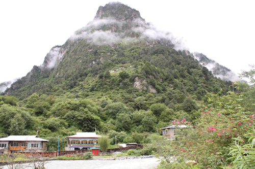
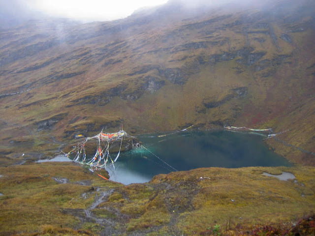
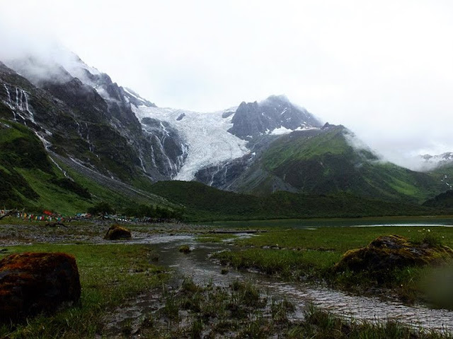
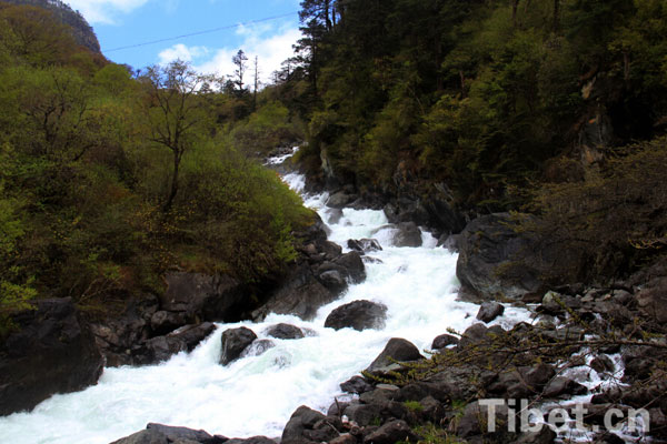
(Here are some of the rare pictures of Tsari and its surroundings found on the Internet)
Tsari today

Monday, January 18, 2021

Xi's mega projects: Should India worry?

Mining in the Aksai Chin
My article Xi's mega projects: Should India worry? appeared on Rediff.com

Here is the link...

After the Ladakh fiasco where Xi Jinping did not expect the Indian Army to resist his land-grabbing tactics, he has to save face before his colleagues in the Communist party.
To bring the threat of a mega-dam to the northern Indian border is a clever move, observes Claude Arpi.

On the occasion of the New Year, President Xi Jinping called the Communist Party “a gigantic vessel that navigates China's stable and long-term development;” he stated: “Upholding the principle of putting people first and remaining true to our founding mission, we can break the waves to reach the destination of realizing the great rejuvenation of the Chinese nation …China will embark on a new journey of development in 2021 and strive to achieve socialist modernization by the year 2035.”
Traditionally, the Chinese people’s respect for their Emperor increases when the latter undertakes projects that no human mind can conceive of. After all, the Emperor is the Son of Heaven, and only in Heaven can projects such as the Grand Canal or the Great Wall be dreamt of. It is also the role of the Emperor to bring Heaven’s vision down on earth. If he fails, his Mandate is terminated by Heaven and a Revolution or a Rebellion occurs.
This is what might soon happen to Xi Jinping, but in the meantime, he is thinking big.
The Seventh Tibet Work Forum (TWF), a mega meeting which decides the fate of Tibet for the years to come (to which rare Tibetans are invited), was held in Beijing on August 28 and 29, 2020.
The Seventh TWF was a crucial event not only as it concerns the fate of the Roof of the World, but also for the presently tense Indian frontiers and the precarious situation in Ladakh.
The TWF usually defines the policies for China’s western border (this explains the presence of the entire Central Military Commission, as well as the service chiefs, including the Chief of the PLA Navy at the Forum).
During the meeting, infrastructure development was linked with Border Defence; the construction of Xiaokang (moderately well-off) villages on India’s border, was mentioned.
A few weeks later, some massive projects were announced; first, the Pai-Metok (Pai-Mo) Highway linking Nyingchi to Metok, north of Upper Siang district of Arunachal Pradesh will be opened in July 2021.
After the completion of the highway, the length of the road from Nyingchi City to Metok County will be shortened from 346 kilometers to 180 kilometers and the driving time will be shortened from 11 hours to 4.5 hours. The Highway starts in Pai Town in Milin County of Nyingchi and uses a long tunnel to pass through the Doshong-la Mountain, ending South of Metok town, close to the Indian border (Tuting Circle). Though only 67 kilometers long, in strategic terms the highway will be a game changer and greatly accelerate the developments of new model villages, and therefore relocation of populations on the border. But more importantly, it will pave the way for a mega hydropower plant (HPP).
In December 2020, The Global Times announced Beijing’s plan to build a large hydropower plant (HPP) on the Yarlung Tsangpo River (which becomes the Siang and later the Brahmaputra in India).
The tabloid admitted that “it has raised concerns in India over potential political and ecological threats as the river passes through Southwest China, India and Bangladesh”, it however asserted that Chinese experts “refuted the claim that Chinese hydropower project have political aims, and said the project could help alleviate power shortage problem in northern India and boost regional economy.”
The Metok County government confirmed that the project would be built north of the McMahon Line. The mouthpiece of the Party added: “The head of Power Construction Corp of China (POWERCHINA) suggested the planned hydropower station - which is expected to have three times as much generating capacity as the world-leading Three Gorges power station - aims to maintain water resources and domestic security.”
After the Ladakh fiasco where President Xi Jinping did not expect the Indian Army to resist his land-grabbing tactics (‘salami slicing’ or whatever you call them), he has to save face in front of his colleagues of the Central Committee and Politburo. To bring the threat of a mega dam to the Northern Indian border is a clever move. The fact that the news came out in The Global Times, the mouthpiece of the Communist Party of China, is telling.
Xi believes that the Party (meaning himself) is always right, how could he have blundered in Ladakh; to regain some standing, he has to intimidate India. A mega dam or hydropower plant, thrice the size of the Three Gorges Dam, threatening the life in the North-East is the best way to divert the attention from the Pangong tso.
But it is not all, already in 2016, The China Daily had reported the construction of a 1,629-kilometer Sichuan-Tibet railway. It has now entered a crucial phase.
At that time, Lobsang Gyaltsen, the then Chairman of the Tibet Autonomous Region government, (Gyaltsen has recently ‘disappeared’ like Jack Ma), announced during the fourth session of the TAR’s 10th People's Congress in Lhasa: “The government will start a preliminary survey and research of the Kangding-Nyingchi railway project this year, and accelerate the construction of Sichuan-Tibet railway in the 13th Five-Year Plan (2016-20) period." Kangding is known as Dardo or Dartsedo in Tibet; it is today the capital city of Gartse Tibetan Autonomous Prefecture.
The railway will be connecting Lhasa to Chengdu; it will be divided into three sections from west to east: Lhasa-Nyingchi, Nyingchi-Kangding, and Kangding-Chengdu. The railway line will run some 1,000 km on the Tibetan plateau. The construction of the western and the eastern sections already started last year. The entire project is expected to be completed in mid 2030s.
The China Daily quoted Lin Shijin, a senior civil engineer at China Railway Corp, who stated: “The accumulated height it will climb reaches more than 14,000 meters, and it will cross many fault zones. It's like the largest rollercoaster in the world. With a designed service life of 100 years, it is believed to be one of the most difficult railway projects to build on Earth …it presents difficulties to overcome, such as avalanches, landslides, earthquakes, terrestrial heat, karst caves and underground streams, yet, it is still a worthwhile project."
It takes today 42 hours by train and three days by road to travel from Chengdu to Lhasa; the new rail line will shorten the travel time to less than 15 hours.
It will have incalculable strategic implications for India as the train will pass near the Indian border, north of the McMahon Line in Nyingchi City (Prefecture).
An even more formidable project is a new road between Xinjiang and Tibet.
The National Highway 216 (known as G216) may one day link northern Xinjiang to Kyirong County in Tibet (the border town with Nepal). It would be the second road link between the two restive provinces of Tibet and Xinjiang (the first one is the G219 or Aksai Chin road, running through Indian territory).
For obvious reasons, Beijing does not want to announce it as yet; the road should serve the under-developed parts of Gerze county of Western Tibet (Ngari Prefecture) ...and reached Nepal. It is probably an important part of the Belt & Road Initiative between Central and South Asia, dreamt by Xi Jinping.
But this is not the trickiest part of the project. How will the Chinese engineers manage to cross the Kunlun range?
Once on the plateau, the terrain (probably via Gerze county) will be easier.
Today many still believe that it is impossible to cross the Kunlun.
But Beijing has probably done its home work and studied the 19th century Western explorers such as Sven Hedin or Aurel Stein who moved around the area and found slightly-easier passages to cut across the formidable natural barrier.
Last, but not the least, Xi is planning to start a mega lead-zinc mining project in Huoshaoyun area, in the China-occupied Aksai Chin; according the Shanghai Nonferrous Metals Network: “In September 2016, Xinjiang geological prospecting made a new major breakthrough. Among them, the Huoshaoyun super large lead-zinc mine has a proven resource of 17.08 million tons, ranking seventh in the world, second in Asia, and first in China. …as early as the end of 2016, Guanghui Zinc, a subsidiary of Guanghui Group, had tendered for open-pit mining, explosive supply and blasting services at the Huoshaoyun lead-zinc mine. It was initially scheduled to be organized from April 2017 to the end of December 2019. At present, some areas of Huoshaoyun Mine have entered the exploration stage.”
Though the three first projects (the HPP in the Yarlung Tsangpo, the Sichuan Railway and the G216 Highway) are all affecting India, the last one (the mining in the Aksai Chin) is located on Indian territory.
Nobody seems to have thought about the pollution generated by these mines, it is a great tragedy in the making; moreover for India, the development of the ‘dual-use’ (civil and military) infrastructure in the Ladakh sector will take place on a much larger scale than today.
It is interesting to watch how the Mandarins of South Block will react. They will probably try to keep the information under the carpet as long as possible, not wanting “to hurt the Chinese sensibilities.”
But if they wait too long, it may be too late.
India will face a new fait-accompli.

Monday, January 11, 2021

Beware, India! China’s Most Strategic Road

My article Beware, India! China’s Most Strategic Road is Coming appeared in The Daily Guardian

Here is the link...


Beijing starts construction of strategic Xinjiang-Tibet highway, which will bring the greatest strategic change for India since the 1950s, as it will be an alternate artery for the Dragon to fortify its presence along the LAC.

On 27 May 1951, the Ashi Shan (mountain) volcano erupted in the Xinjiang province of China. It began with a loud detonation, followed by the ejection of large blocks of lava, emitting thick black smoke, and lasted for a number of days.
The Ashi volcano, the highest volcano in the northern hemisphere, is part of a group of about 70 cinder cones in the Kunlun range, at the border of Tibet’s Northern Plain (Changthang). The 1951 eruption remains the most recent volcanic activity in China. What is unknown is the other story behind the eruption in this most desolate area.
In the early 1950s, Mao Zedong’s People’s Liberation Army (PLA) was desperate to link its two recently acquired provinces of Sinkiang (today Xinjiang) and Tibet. The country of the Uighurs, also known as Eastern Turkestan, had been annexed in December 1949, while Eastern Tibet was invaded in October 1950. It was a matter of national priority to discover a route between Xinjiang and Tibet.
In 1951, when the PLA decided to cross the massive Kunlun range along the Keryia Ancient Road in Hotan County, it encountered the Ashi Shan. It is then that the volcano erupted. Many road workers were killed in the mishap, and the plan to build a road through the Keryia route was abandoned. Mao had no choice but to find an alternative.
It is how the G219 National Highway Xinjiang-Tibet Road, as we know it today, was selected. The road crossed through Indian territory in the Aksai Chin, but this was not an issue which bothered the Great Helmsman.
Chinese leaders never forget the dreams of their predecessors. Today, one of the most secret projects of President Xi Jinping is to open a new link between Xinjiang and Tibet, the two restive autonomous regions bordering India.
It appears that China has recently started the construction of the National Highway 216 (known as G216), linking northern Xinjiang to Kyirong County in Tibet (the border town with Nepal). But for India, the G216 will bring the greatest strategic change since the 1950s, as it will be an alternate artery for China to reinforce the northern India front.
According to the ‘National Highway Network Planning (2013-2030)’, the G216 runs from Hongshanzui Port (in Altay County, north of the Xinjiang Uyghur Autonomous Region or XUAR) in direction of Baluntai in Hejing County, where it joins China National Highway 218, then moves to Luntai County entering the Taklamakan desert till Minfeng County. It then proceeds to Garze County in Tibet, to finally reach Kyirong.
For obvious reasons, Beijing does not want to announce as yet that it has started the construction of the highly-strategic road-link. For Beijing, it is also an important part of Xi Jinping’s Belt and Road Initiative (BRI) between Central and South Asia, and in case of a conflict with India, it will be a great boon for the PLA.
The crossing of the Kunlun range is still the trickiest part of the project. How will the Chinese engineers manage to cross the mountainous range? Once on the plateau, the terrain (via Gerze County) will be easier. But old dreams of megalomaniac rulers cannot be dropped.
Today, there is little information on the G216. However, a Chinese website provides some details on the history of the road. It says: “Xinjiang and Tibet are two giant autonomous regions occupying nearly one-third of China’s landmass; the boundary between the two autonomous regions is more than 1,300 kilometres.”
The main issue for Beijing is that, “due to the barrier of the Kunlun Mountains and the harsh natural environment of the northern Tibet Plateau, the number of practical passages is limited… Therefore, in history, the Western Regions and the Tibetan Plateau were relatively independent geographical areas, and they did not communicate closely with each other”.
It then makes an interesting remark: “The boundary between Tibet and Xinjiang is not divided according to the boundary of the plateau, but roughly the southern foot of the main Kunlun Mountains is Tibet.” It practically means that the Kunlun range is still the natural frontier between India and China. The crossing of the Kunlun range is clearly the passage between two worlds.
There were several ancient routes to Tibet crossing the Kunlun mountains. In the early days, there were several passages: The Keliyang trail, southwest of Hotan, leading to Aksai Chin, the Sanju ancient trade road, which is now being revived, and the Keriya Trail, which was abandoned due to the 1951 volcano eruption, but is still “the shortest of several ancient roads and also the most difficult and dangerous one”.
The Keliyang and the Sanju ancient roads end up in Shahidullah (‘martyr’ in Uighur). In 1949, it continued to be a main hub in the region after “the actual control of the two places returned to the central government [Beijing].” The conclusion is: “to strengthen the communication and ties between the two regions, the linking of the highways is urgently needed to be put on the agenda.”
The article further confirms that according to the national highway network plan, during the period 2013-2030, two new corridors will be built to connect Xinjiang with Tibet. The G216 National Highway is one of them: “Its main section is almost parallel to the ancient Keryia Road and is located on the east side of the ancient road, creating a closest connection line from Urumqi to Lhasa.”
The author adds: “In addition, the Hotan area also has a local road network ‘three horizontal and three vertical’ plans, and these ‘three verticals’ are all related to crossing the Kunlun Mountains.”
One of the verticals is the G580 National Highway, the second vertical is the Keryia Highway (G216) which enters Tibet near Heishi Lake, and the third vertical is the Sanju Highway constructed almost along the route of the Sanju ancient road in Pishan County. “As a result, the highway across the Kunlun Mountains will become a network,” concludes the article.
Interestingly, the article mentions the proposed Tibet-Xinjiang railway running via the Aksai Chin: “Since the final route plan of the Xinjiang-Tibet Railway has not yet been released, Yecheng Station, which is temporarily regarded as the starting point of the Xinjiang-Tibet Railway, will also be continuously improved for the Xinjiang-Tibet highway network. If the Yecheng Station is not really where the train arrives, Moyu (Karakash) Station or Hotan Stations might be the starting point.”
All this is worrying. Will the Indian government follow its usual ostrich-like policy or will it react? If it does not, it will have implications for several decades for India, like the Aksai Chin blunder in the 1950s.

Friday, January 8, 2021

The Most Serious Strategic Development on Indian Frontiers

The G216 under construction
One of the most secret projects of President Xi Jinping is to open a new link between Xinjiang and Tibet. The two restive Autonomous Regions border India, particularly the Ladakh region, which is witnessing a serious military confrontation since May 2020.

The Changthang National Nature Reserve
A few years ago, I wrote about the project of a road through the Changthang or ‘Northern plain’ (in Tibetan), which occupies a large part of the Tibetan plateau. With the approval of the State Council, the Changthang National Nature Reserve, located in northern Tibet, south of the Kunlun Mountains, had become a national reserve in April 2000.
The reserve spreads on a total area of 391,200 km2, which makes it the second largest nature reserve in the world, after the Northeast Greenland National Park.
With the recently-established adjoining reserves, there is now a total of 496,000 km2 of connected Nature Reserves.
The Changthang National Nature Reserve lies at an average elevation of 4,500 meters. Administratively, it comes under the Prefectures of Nagchu and Ngari of the Tibet Autonomous Region. Some parts of the Reserve are located in the County of Rutok, bordering Ladakh and particularly the occupied Aksai Chin.
Only a few Tibetan nomads permanently live there, but it is a paradise for wild animals such as wild yak (Bos grunniens), Tibetan wild ass or kiang (Equus kiang), Himalayan blue sheep or Bharal (Pseudois nayaur), Argali (Ovis ammon), Mongolian gazelle (Procapra gutturosa) and Tibetan antelope or chiru (Pantholops hodgsonii). The list of predators is also long; it includes snow leopards (Panthera uncia or Uncia uncia), Tibetan wolves (Canis lupus chanco), Turkestan lynx (Lynx lynx isabellinus) and Tibetan blue bears (Ursus arctos pruinosus).
This reserve will soon be disturbed by the bulldozers, GCBs and thousands of migrant workers.
China is planning a new highly-strategic highway in the area; this will forever change the ecology,  demography and military importance of the area.

Cutting through the Desert
On May 16, 2020, impressive pictures of workers driving bulldozers on a construction site in the Taklamakan Desert were released by Xinhua.
The caption explained: “The construction of Yuli-Qiemo highway, the third north-south route running through Taklamakan Desert, has entered the final rush. Workers of China Communications Construction Company Ltd are working on the largest dune in this project, with an estimated volume of 1.2 million cubic meters of sand to deal with.”
Xinhua’s caption continued: “They established camps next to the dune for the convenience of work, and receive daily necessities on a regular basis. The completion of the highway is expected to improve the transport conditions in southern Xinjiang and promote local development.”
The Yuli-Qiemo County Highway, 330 kilometers in length was the third north-south in the Taklamakan desert; soon there will be five road. The next one interests us (the fifth one is the G580).

The proposed G216 Highway

Old 216 National Highway
A new road will soon runs parallel the Yuli-Qiemo highway: the National Highway 216 (known as G216) linking northern Xinjiang to Kyirong County in Tibet (the border town with Nepal).
For India, the construction of the G216 will bring the greatest strategic change since the 1950s.
National Highway 216 runs from Altay City in the Xinjiang Uyghur Autonomous Region in direction Baluntai in Hejing County, where it joins China National Highway 218.
City name and distance from starting point:

Altay     0
Beitun     62
Fu Yun     202
Chakurtu Town     263
Ganhezi     629
Fukang     661
Urumqi     762
Ballenter     857

A few years ago, I had mentioned the possibility of having a second road-link between the two restive provinces of Tibet and Xinjiang (the first one is the G219 or Aksai Chin road, running through the Indian territory).
According to the 'National Highway Network Planning (2013-2030)', the G216 will run from Hongshanzui Port (in Altay County) to Luntai County, then to Minfeng County; Gerze County in Tibet, to finally reach Kyirong.
For obvious reasons, Beijing does not want to announce as yet that it has started the construction of highly-strategic road-link, which, China says, will serve the under-developed parts of Gerze county of Western Tibet (Ngari) ...before reaching Nepal.
For Beijing, it is an important part of Xi Jinping’s Belt and Road Initiative (BRI) between Central and South Asia, but in case of conflict with India, he will be a great boon for the People’s Liberation Army.
The crossing of the Kunlun range is the trickiest part of the project.
How will the Chinese engineers managed to cross the mountainous range?
Once on the plateau, the terrain (via Gerze County) will be easier.
Today, many still believe that it is impossible to cross the Kunlun, but Beijing has probably done its home work and studied the 19th century Western explorers such as Sven Hedin or Aurel Stein who moved around the area and found slightly-easier passages to cut across the formidable natural barrier.
As we shall see, it is an old dream of the megalomaniac rulers of China.

The Xinjiang Production and Construction Corps
Incidentally, on May 14, 2020, the Xinjiang Production and Construction Corps (XPCC) announced that it would pump a lot of funds into transportation projects in 2020.
According to Xinhua: "The [Xinjiang] authorities will invest 9.5 billion yuan (about 1.34 billion U.S. dollars) in 60 major road projects, with plans to build or upgrade roads with a combined length of 2,281 km, according to the local transportation bureau. Of the investment, the Xinjiang Production and Construction Corps will allocate 5.7 billion yuan to its areas of jurisdiction in the southern part of Xinjiang."
Soon after the outbreak of the Corona virus, it was reported that the XPCC had already resumed work on a number of major transportation projects. It is ominous for the Ladakh border, where the Chinese have aggressively attacked India on the LAC.

The route of the new G216 Highway

An Environmental Impact Assessment
To come back to the Changthang Reserve, a few years ago, a “Public Announcement for the Environmental Impact Assessment [EIA] of the New Reconstruction Project of National Highway No. 216 (Tibet Area)” was made from Ngari Prefecture in Western Tibet.
According to the published abstracts of the EIA: "The State Environmental Protection Bureau of the National Highway 216 (Tibet area) area has basically completed the project environmental impact, for pollution prevention and control.”
The new section of the highway will be 857 kilometres in length and link Xinjiang to Tibet; the EIA says: “Control measures analysis and evaluation have been completed in accordance with the relevant provisions of the Interim Measures for Public Participation in Environmental Impact Assessment”.
Some ‘relevant’ contents of the EIA were then made public.
The Overview provided an idea of the route followed by the new highway starting from Xinjiang.
The Highway will be connecting Xinjiang and Tibet via Minfeng, before crossing the Kunlun range, which will be crossed slightly eastward compared to the earlier plans to use the Keryia Pass as an entry into Tibet.
One of the many worrying aspects of the project is that it crosses the highly eco-sensitive Changthang National Nature Reserve.
It will run for 110 km in the main reserve, about 270 km in the buffer zone and some 100 km in the ‘experimental area’. The total investment for the project is RMB 6.453 billion (more than 1 billion US dollars). 

Another map of the proposed highway (G216)

Very few Information about the G216.
However, a Chinese website provides some details about the history of the road; it explains: “Xinjiang and Tibet are two giant autonomous regions occupying nearly one-third of China’s landmass; the boundary between the two autonomous regions is more than 1,300 kilometers.
It mentions the main issue for Beijing: “Due to the barrier of the Kunlun Mountains and the harsh natural environment of the northern Tibet Plateau, the number of practical passages is limited. …Therefore, in history, the Western Regions and the Tibetan Plateau were relatively independent geographical areas, and they did not communicate closely with each other. This can be seen in the distribution of ethnic groups in the autonomous regions, north and south of the (Kunlun). But this does not mean that there were no contacts between the two regions.”
It then makes an interesting remark: “the geographic tag corresponding to Tibet is the Qinghai-Tibet Plateau. However, the boundary between Tibet and Xinjiang is not divided according to the boundary of the plateau, but roughly the southern foot of the main Kunlun Mountains is Tibet. ...It means that a part of the land of the northern Tibet plateau is part of Xinjiang.”
The article adds: “Moreover, the southern and northern foothills of the Kunlun Mountains, especially the edge of the Aksai Chin Basin in the West, are home to a series of ethnic settlements such as Kirgiz (Kyrgyz), (Mountain/Selekul) Tajik, and Uygur, while the Tibetans are completely absent.”
It practically means that the Kunlun range is the natural frontier; we can deduct from this that the Chinese accept the Kunlun as the geographical border and therefore the Aksai Chin is part of Ladakh (India)? It seems a logical conclusion.
According to the same paper: “Most of the actual administrative rights in this area fall under Hotan (or Hetian or Khotan) in Xinjiang, and only a small part of the southern part belongs to the Ngari region in Tibet. In general, the arid climate to the north of this boundary line corresponds to the oasis civilization in Xinjiang, and the alpine climate to the south corresponds to the plateau civilization in Tibet. Its segmentation effect is quite obvious.”
The crossing of the Kunlun range is clearly the passage between two worlds.

Historical Background
The article observes: “Before the Tang Dynasty, the Western Regions and the Qinghai-Tibet Plateau did not have much contact.”
After the establishment of the ‘Tubo dynasty’ (from the 7th to 9th centuries AD, the Tibetan Empire was unified as a large and powerful empire; it ruled an area considerably larger than the Tibetan Plateau, stretching to parts of East Asia, Central Asia and South Asia; it is called by China the ‘Tubo Empire). The article notes: “Songsen Gampo gradually unified the Qinghai-Tibet Plateau and integrated the internal resources of the plateau, Tubo prospered and took the steps to conquer abroad.”
It admits that for centuries “the central government had limited control over the remote occupied areas.”
Later, the Tibetan Empire declined, and the oasis on the southern edge of the desert (Taklamakan in Xinjiang) gradually returned to the Uighurs.
The construction of the G216 will be the first large-scale meeting between the Qinghai-Tibet Plateau and the Western Regions (Xinjiang): “The road from the Western Regions to the Qinghai-Tibet Plateau is being  ...especially the tunnels that cross the Kunlun Mountains,” will make this possible.

Proposed routes in the early 1950s

Not an Easy Task to Cross
The website continues to explain: “Crossing the Kunlun Mountains is not an easy task. Compared with several other projects in Tibet, the difficulty coefficient is the highest.”
There were several ancient routes to Tibet crossing the Kunlun Mountains, but, though it is looks impossible, the Kunlun can be crossed, believe the Chinese engineers.
It says that ‘in the early days’ there were several passages through the Kunlun Mountains:

•    Keriya Trail 克里雅 古道, south of Keryia leading to Tibet
•    Keliyang trail 克里阳 古道, southwest of Hotan leading to Aksai Chin
•    Sanju ancient road 桑株 古道 south west of Hotan leading to Aksai Chin

The first route, the Keryia Trail “is the shortest of several ancient roads, and also the most difficult and dangerous one.”
It starts from Pulu (?) village in Hotan County in the north, crosses several mountain pass up to the Keryia Pass (the boundary between the New Tibetan Territory or Xinjiang) and Tibet: it runs between the western and the middle section of the Kunlun Mountains before reaching the Changthang uninhabited area in northern Tibet. After that, it uses the Tibetan transportation network to reach Garze and then Gartok.
The Keriya River is on the east. 

Shahidulla and the Sanju Trail
The second is the Keliyang Ancient Road. Because its starting point is located in the core area of the ancient Yerkand Khanate, it is also called the Yerkand Road. Starting from Keliyang Township in Pishan County on the northern slope of Kunlun Mountain in the north, passing Akernier Village and then running up the Keliyang River Valley, it crosses Keliyang Daban on today’s G219 National Highway Tibet Highway.

The third is the Sanju Ancient Road, also known as the Yarkand Road or Kunlun Mountain ‘Pack Horse’ Road. The terminus of the trail and that of the Keliyang Ancient Road is the same: Shahidullah (or Saidula). It starts from Sanju Township (Sanju Village) in Pishan County in the north, passes through Kangkeer Kirgizi Nationality Township, and climbs up the Sanju River Valley over Sanju-la (pass). During the Tang Dynasty, this was one of the routes used by the Tibetans to attack Hotan. Before the opening of the Xinjiang-Tibet Highway (G219), it was also used as one of the supply routes for the PLA troops entering Tibet.

A  1953 CIA Report
An interesting report if the CIA mentioned the road construction (including the Aksai Chni road) in 1953. I am quoting from it here:

Road Construction, Sinkiang to Tibet and Ladakh

1. In late 1952, the 2 Cavalry Regiment, commanded by HAN Tse-min, had its headquarters at Gartok (N 31-45, E 80-22). This regiment had 800 camels. A unit of this regiment, numbering 150 men, was garrisoned at Rutok (N 33-27, E 79-42). At the year’s end, 35 Uighurs and 3 or 4 Kazakhs from the Rutok detachment planned to desert and escape to Kashmir, but their plan was detected and the men put under arrest.
2. Another Chinese Communist regiment was stationed on the Tibetan side of the Tibet-Ladakh border near Koyul (N 32-53, E 79-13), between Gartok and Rutok.
3. The leader of the 2 Cavalry Regiment announced the following road-building projects:
a. Road from Khotan (N 37-07, E 79-55) to Rutok, under construction, to be completed in June or July 1953. (According to the Urumchi radio, this road has been completed ). [This is the Aksai Chin road]
b. Road from Rutok to Keryia (N 36-52, E 81-42), of which the construction is contemplated. [It was never built]
c. Motorable road from Khotan to Suget Karaul (N 36-20, E 78-07), under construction, and expected to terminate at Vabjilga. [Approximately N 35-50, E 78-15].
HAN Tse-min said that when these roads were completed, the Chinese Communists would close the Tibet Ladakh border to trade.
4. The Chinese Communists in Sinkiang were telling the people that Ladakh belongs to Sinkiang. [Approximately N 35-50, E 78-15].
5. The Maiksha [Approximately N 35-38, E 78-17] area has suitable terrain for the construction of airfields.

Point 4 is interesting. Beijing's mindset is probably the same today.

Ruins of Shahidulla Fort

Strategic situation of Shahidullah
‘Shahidullah’ means ‘martyr’ in Uighur, is located at the pass of the Karakash River Valley. The Chinese article states: “The Johnson Line was born during this period, and the background of aggression in those two years became the ‘territorial claim’ that India put forward on the Aksai Chin region.”
The article mentions General Zuo Zongtang (November 1812 – September 1885), a Chinese statesman and military leader of the late Manchu dynasty. In 1875, Zuo was appointed Imperial Commissioner to supervise military action against the Dungan Revolt (1862–1877) or Hui Muslim Minorities War which was fought at the end of the 19th-century in Western China, mostly during the reign of the Tongzhi Emperor (r. 1861–1875) of the Manchu).
By the late 1870s, Zuo had crushed the Revolt and recaptured Xinjiang Province from the ‘rebel’ forces. In 1878, in recognition of his achievements, Zuo was promoted from a first class count to a second class marquis.
Zuo established his base camp in Shahidullah as it was a hub of transportation in the Kunlun Mountains. The place could be reached through the Kudi Ancient Road to the north to Yecheng and Kashgar, and to the east via the Sanju Ancient Road or Kashgar. The ancient road in Liyang can reach Pishan and Hotan, to the south to the Aksai Chin Basin; Changthang in northern Tibet and the Ngari region in the East and the Karakoram Mountains in the West.
After 1949, Shahidullah continued to be a crossroad “with the peaceful liberation of Xinjiang and Tibet after the founding of the People’s Republic of China, the actual control of the two places returned to the central government. In order to strengthen the communication and ties between the two places, a building linking the two areas Highway issues urgently need to be put on the agenda,” says the article.
Today, Shahidullah, a town in Pishan County, is strategically located on the upper Karakash River, just to the north of the Karakoram Pass on the old caravan route between the Tarim Basin and Ladakh; it lies next to the G219 between Kashgar and Tibet, 25 km east of Mazar and 115 km west of Dahongliutan.
In 1951, when the People's Liberation Army built the Xinjiang-Tibet Highway (G219 or ‘Aksai Chin’ road) along the Keryia Ancient Road, it encountered Kunlun Mountain, near the Sulfur Daban.
The Ashkule volcano erupted on May 27, 1951 and many road workers were killed; thereafter, the plan to build a road through the Keryia route in Hotan County was abandoned and replaced by the G219 National Highway Xinjiang-Tibet Road as we know it today.

Description of the G219
The article then describes the G219 starting from Yecheng and crossing the Kunlun Mountains to the Aksai Chin Basin via the Akazi Ancient Road and then continuing southward to the Changthang plateau of Northern Tibet, before reaching the Indus River in Ngari: “After the G219 national highway arrives at Ngari Town (Senge Tsangpo or Shiquanhe in Chinese), it has basically completed its mission of connecting the two districts of Tibet. After that, other national highways or a combination of county highways can be used to reach Lhasa.”
An interesting detail, the article: “After the Kongka Pass incident occurred in 1959, India threatened to blow up the New Tibet Highway [Aksai Chin Road]. For the Chinese side, it is [therefore] absolutely necessary to construct some alternate routes.” It sounds like ‘fake news’.
The website also mentions (with photos) that some of the sections Xinjiang-Tibet Highway are in extremely poor conditions: “The pavement has not been repaired so far. Collapses often occur, and alternate routes are needed.”

The Kanxiwar Memorial
The New Road
The article clearly states that according to the national highway network plan, during the period 2013-2030, two new corridors will be built to connect Xinjiang with Tibet.
The first one is the G580 National Highway, Hotan-Moyu (Karakach)-Uluwati-Inditashidaban-Kanxiwar (the boundary of Hotan County and Pishan County): “Although the main body is only in Xinjiang, it can keep the Xinjiang-Tibet passage far away India’s actual control area and shortening the distance between Tibet.”
Incidentally, a War Memorial is located in Kanxiwar; it is said that the tombs of the Chinese soldiers who died during 1962 conflict with India (Rezang-la battle) are kept here.

Other Roads
The other main road will soon be the G216 National Highway, which, as we have seen starts from the Hongshanzui Port in Northern Xinjiang, and then passes through the Luntai Desert Highway to Minfeng, then Gerze and finally to Kyirong Port in Shigatse City, at the border with Nepal: “Its main section is almost parallel to the ancient Keryia Road and is located on the east side of the ancient road, creating a closest connection line from Urumqi to Lhasa.”
The author adds: “In addition, the Hotan area also has a local road network ‘three horizontal and three vertical’ plans, and these ‘three verticals’ are all related to crossing the Kunlun Mountains.”
One of the verticals is the G580 National Highway; the second vertical is the Keryia Highway constructed almost along the route of the Keryia Ancient Road. The key section is Xianbai Baza-Pulu Village-Keryia Pass-Red Tu Daban in Keryia County.
The three verticals are the Sanju Highway constructed almost along the route of the Sanju Ancient Road, Muji-Sanju-Kangkel-Sangzhudaban-Shahidullah in Pishan County: “As a result, the highway across the Kunlun Mountains has become a network,” concludes the website.

The projected Tibet-Xinjiang Railway Line

The New Tibet-Xinjiang Railway
Even more interesting, the article mentions the new Tibet-Xinjiang railway going through the Aksai Chin: “Since the final route plan of the Xinjiang-Tibet Railway has not yet been released, Yecheng Station, which is temporarily regarded as the starting point of the Xinjiang-Tibet Railway, will also be continuously improved for the Xinjiang-Tibet highway network. If the Yecheng Station is not really when the train arrives, Moyu (Karakash) Station or Hotan Stations will be the starting point, “because the starting point of the other roads is to continue southward into Tibet from the vicinity of Hotan.”

Will India protest if a railway line is laid across the Indian territory?

A Bridge between Xinjiang and Tibet
The article concludes: “The difficult passages between Tibet were used as a bridge for warfare and trade communication between the two major geographic regions [Xinjiang and Tibet] in ancient times.”
In modern times, they have become an important network for China to maintain the peaceful reunification of the western frontier. Tourists also deeply appreciate the vastness of China's territory while moving on these routes.
In addition, the original Xinjiang-Tibet G219 highway will be extended from both ends, Yecheng in Xinjiang and from Sakya in Tibet towards Kampa Dzong, Tsona, Lhuntse, Metok, Zhayul.

Wednesday, January 6, 2021

Will 2021 be China’s & Xi’s annus horribilis?

My article Will 2021 be China’s & Xi’s annus horribilis? appeared in The Asian Age/Deccan Chronicle

Here is the link...

Has Beijing succeeded in intimidating India with its brazen info warfare?

As the end of the year approaches, it is customary to look at the past twelve months and try to draw conclusions about the closing year’s happenings.
2020 will undoubtedly remain as an awful year, not only for India, but also for humanity and one country (or more correctly one regime) is behind this planetary misery: China and its Communist Party.
As a World Health Organization (WHO) team prepares to travel to Wuhan in January 2021 to investigate the origins of Covid-19, you can be sure that the WHO will not find any clues. In an interview with the BBC, Prof Shi Zhengli (the ‘bat woman’) who has been associated with the P4 ‘French’ lab in Wuhan, recently denounced “unsubstantiated claims that the coronavirus leaked from her laboratory.”
But even without speaking of Wuhan, when the BBC team tried to visit the remote district of Tongguan, in Yunnan, to enquire about Prof Shi’s field work, they could not reach the place: “Plain-clothes police officers and other officials in unmarked cars followed us for miles along the narrow, bumpy roads, stopping when we did, backtracking with us when we were forced to turn around. We found obstacles in our way, including a ‘broken-down’ lorry, which locals confirmed had been placed across the road a few minutes before we arrived.”
The fact remains that many whistleblowers have now disappeared and it will be difficult to prove anything as the lab has been cleaned of all traces of mishaps.
Even the conservative National Center for Scientific Research (CNRS) of France admitted that “The origin of SARS-CoV-2 is being seriously questioned”.
In an interview, eminent CNRS virologist Étienne Decroly discussed the various hypotheses, including that of an accidental leak from a laboratory.
When asked if the virus could have escaped from a laboratory, the professor said: “The hypothesis cannot be ruled out, given that SARS-CoV, which emerged in 2003, has escaped from laboratory experiments at least four times.”
One factor which has been ignored (or conveniently forgotten): the Chinese authorities gave the control of the ‘Top-Secret’ lab in Wuhan to the People’s Liberation Army (PLA) when the world was still unaware of the coming pandemic. The high technology transferred to China was done under the garb of Indo-French advanced scientific collaboration; the ‘Top Secret’ label ensures that nobody is allowed to seriously inquire why France left the project after 2017.
However, we know that at the end of January 2020, a Chinese PLA general took over the civilian Institute in Wuhan; Maj Gen Chen Wei, a researcher at the Military Medical Research Institute of the Academy of Military Sciences, became the laboratory ‘in charge’; by March 2020, the lady general claimed to have found the first vaccine against the virus. All this raises many serious questions which very few are ready to discuss openly.
In February already, a group of Chinese scholars led by Botao Xiao of the South China University of Technology wrote a paper for the Natural Science Foundation of China; it dealt with “The possible origins of 2019-nCoV coronavirus.”
After searching around the Seafood market in Wuhan, said to be the epicenter of the outbreak, they identified two laboratories conducting research on bat coronavirus. The first one, the Wuhan Center for Disease Control & Prevention is located 280 meters from the market where the virus is supposed to have emerged. The scientists found that “surgery was performed on the caged animals and the tissue samples were collected for DNA and RNA extraction and sequencing. The tissue samples and contaminated trashes were a source of pathogens.” It was not a proof, but a strong lead.
The second laboratory, the Wuhan Institute of Virology of the Chinese Academy of Sciences is located 15 kilometers from the seafood market; this is the ‘French’ lab taken over by Gen Chen Wei.
Xiao and his colleagues concluded: “In addition to origins of natural recombination and intermediate host, the killer coronavirus probably originated from a laboratory in Wuhan. Safety level may need to be reinforced in high risk bio-hazardous laboratories.” The study quickly disappeared from the Net.
It is in these circumstances that China decided to ‘teach’ India a lesson.
From all available information today, Gen Zhao Zongqi, the Commander of the Western Theater Command (WTC) facing India, managed to convince Xi Jinping, Chairman of the Central Military Commission that China could advance in a few areas in Ladakh at little cost for Beijing.
Zhao had already masterminded the Doklam incident in 2017. In May, the PLA began to move in Ladakh, but it soon turned to be a ‘misadventure’ for Beijing; the Chinese generals had not planned for Delhi’s strong reaction.
The good news is that on December 18, Zhao has been replaced by a rather unknown officer who has never set foot in the WTC; he has no experience of the Indian border. It is too early to say what it means for the future negotiations in Ladakh, but it probably indicates that Beijing will be more ‘flexible’. If confirmed, this is certainly a good thing for India as Zhao has been the main hardliner.
Retrospectively, what Xi has achieved in 2020?
The virus has made the world acutely aware of the dark sides of China; the image of the totalitarian Party will not improve in 2021.
Today Xi finds himself in lose-lose situation, as he has realized that he can’t bully India in Ladakh. Will the Darbuk–Shyok–Daulat Beg Oldi Road that Gen Zhao tried to stop, be shelved by India, the answer is ‘No’. Will India drop its suzerainty claims over Gilgit Baltistan? No.
Gen Zhao Zongqi will certainly not get a seat in the Central Military Commission as he expected to. Has China gained some strategic advantages in Ladakh? Hardly. And in August, the ridges, South Pangong tso on the Kailash range, were lost to the PLA.
Has Beijing succeeded in intimidating India with its brazen Information Warfare? Absolutely not. Has Xi’s prestige been enhanced after the Ladakh episode? Certainly not; on the contrary it showed the PLA’s limitation faced with a determined adversary. Economically too, Beijing has lost a lot, especially with Indian banning number of Chinese Apps and the decision to not award big contracts to China.
One could add many issues to the list.
All this makes me think that 2021 will an Annus Horribilis for China and its news Great Helmsman. It would only be justice …in the meantime, can the WHO go to the bottom of the origin of the virus? Probably not.