Showing posts with label Nilang. Show all posts

Thursday, May 23, 2024

The Last Indian Villages On Tibet Border

My article The Last Indian Villages On Tibet Border appeared  in Rediff.com

Here is the link...

'It is a breathtaking journey towards the Tibet border, especially since the Border Road Organisation has accomplished a fabulous feat in black-topping the road till the border.'

'One is left with a salute for the dauntless Indian soldiers who spend the winter in these majestic, though inhospitable areas (we were told that the temperature comes down to minus 40 in winter),' recounts Claude Arpi.


After searching for years in the old dusty files of the National Archives of India to unveil some of the secrets on a specific subject, one becomes rather familiar with the object of one's research ... but on paper only.
Often the physical reality is vastly different.
This is what happened to me when I recently visited a remote area in Uttarkashi district of Uttarakhand.
The places are Nilang (also written as Nelang), a village located in the Jadh Ganga valley, Jadhang (or Jadhung) and Pulam Sumda, the latter two lying on the upper reaches, towards the India-Tibet frontier. The Line of Actual Control (LAC) with the Chinese army occupying Tibet is located on top of the ridge.
The particularity of the place is that the area was claimed by Tibet before India's independence (and subsequently by China) as part of Tsaparang in Tsamda county of Ngari Prefecture of Western Tibet.

Today, when China claims any area, its Liberation Army first physically takes over the place and later Beijing announces that it is ready for discussions; the disagreement between the Lhasa government and the administration of the erstwhile princely Tehri state (and by extension British India) was different, it continued for decades, at the end of which no mutually acceptable solution was found, but the 'dispute' did not result in any physical clashes or even an increase of the police personnel posted on the border.
A large amount of correspondence took place between Tibet (Lhasa and the Dzongpen or commissioner in Tsaparang) and the princely states of Tehri‐Garhwal, Bashahr (today Kinnaur) as well as the provincial governments of the United Provinces, Punjab and, of course, the Foreign and Political Department of British India in Delhi.

The Brief History of the Dispute

The Gumgum nalla. Not really a border

Let us first look at the long history of the area.
The difference of perception seems to have arisen when the Dzongpen of Tsaparang, the nearby Tibetan district, visited the Gumgum nala in 1914. He publically announced his decision of setting up a boundary pillar on the spot near a bridge.
When the local villagers objected, the Dzongpen left without any further action.


A few kilometres beyond Gangotri, I kept asking my guide, "Where is this Gumgum nalla?" Finally, he pointed out a most insignificant place ...without a real nalla.
It is where the Tibetans had unilaterally decided to 'fix' their border with India. Of course, the watershed principle or other features determining a boundary were unknown to them.
Four years later, in 1918, the Tehri State decided to erect 3 pillars on the top of the watershed, at Tsang Chok‐la, following the watershed principle.
In 1920, the Tehri State surveyed for the first time the area and prepared cultivation maps of the Nelang area. The Jadh Ganga valley was then included in the maps of the princely state.
In 1921, the Tsaparang Dzongpen visited Nelang again. This time, he sent a letter to the Raja of Tehri requesting him to nominate an official to sort out the boundary issue; at that time, it was not yet considered a 'dispute'; it was only a 'difference of perceptions' between friendly neighbours.
The Raja answered that the issue had to be raised through the Government of India as it involved a problem between two foreign governments.
In 1924, it was finally proposed by British India to appoint a boundary commission, but due to the poor communications and the fact that these areas could only be visited in summer, the commission could meet only in the summer of 1926.
Travelling in the Valley, you first note the inaccessibility of the area. On the opposite side of the road, perched on a cliff, is the Gartang Gali (bridge), built some 150 years ago, by Pathans who are said to have come from Peshawar to build this bridge at a height of 11000 feet.
It was finally slightly easier for the villagers to move in the valley and eventually visit the trade marts in Tibet. This wooden step bridge path was closed after the 1962 War; today it has been opened for tourists.
The 3.5 km bridge is indeed a marvel of wooden architecture, worth the visit.

Gartang Gali, a wooden bridge, said to be built by Pathans from Peshawar

The Acton Commission
To return to history, in June 1926, T J C Acton, an officer of the Indian Civil Service, was nominated as the British representative to discuss the issue with Tibetan officials near the Gumgum nala.
The Tibetans claimed that the Tehri people had removed their boundary marks after they had returned to Tibet.
The British commissioner commented: 'Their attitude, I think, was that His Highness [His Holiness] the Dalai Lama had said that the boundary was the Gumgum nala, and that any criticism of that decree would be a dangerous form of blasphemy.'
It was the first of several commissions which would try to solve the problem with the Buddhist neighbour during the following years.

The Chor Gad, another route to Tibet.
At one point, the British, great adepts of compromise, suggested that Nelang could remain with Tehri State while Jadhang would go to Tibet. But a complication soon cropped up, Jadhang (and even Nelang) was claimed by the Bashahr state.
The Tibetan claim of a frontier in line with the Gumgum nala remained 'clearly absurd', according to Acton.
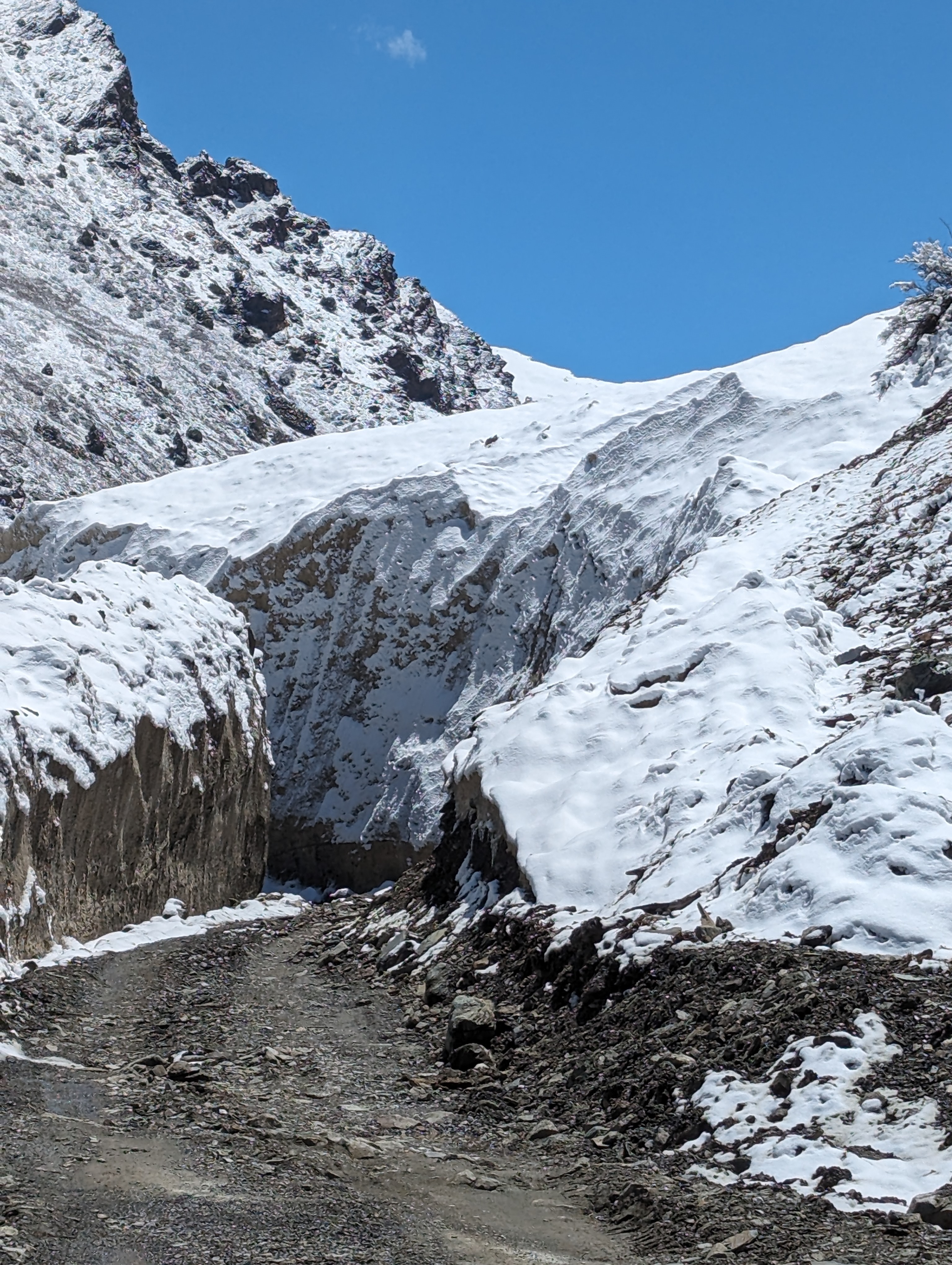
A moraine, a pile of unconsolidated debris, usually soil and rock
left behind by a moving glacier

The Saga Continues

Two years later, on November 14, 1930, Colonel J L R Weir, the political officer in Sikkim, informed the foreign secretary in Delhi that he had received a letter from Lhasa about the Tibet‐Tehri boundary question.
Weir commented: 'This Tehri boundary is one to which much importance is attached by the Tibetan Government so much so that they paid me a special visit to discuss the matter that day.' Nothing came out of a new enquiry.
Colonel Weir was replaced by Frederick Williamson as the political officer in 1932. During a tour in Western Tibet from August to October 1932, Williamson was requested by the Government of India to look into the 'Tehri‐Tibet' dispute again.
In his report, the political officer mentions the Acton Report which 'reported in favour of the watershed boundary claimed by Tehri, but the Government of India considered that the evidence showed that Tibet was entitled to a frontier further to the west.'
Williamson commented 'with the exception of the northwest corner, this tract appeared to my untrained mind to be practically valueless. But the south‐west corner contains valuable deodar forest.'
The discussions continued till Independence.

Nelang Village
Post Independence: The valley occupied
In the early 1950s, the government moved fast following the Himmatsinghji Committee report prepared by the Government of India. One of the actions suggested by the Committee was that areas such Tawang and Nelang should be immediately occupied by Indian forces.

Already in May 1950, the ministry of external affairs had sent a note to the ministry of defence asking the latter to comment on the feasibility to occupy the Nelang/Jadhang area; the Political Officer in Sikkim had noted: 'The guiding principle in the new circumstances must however be the Government of India's ability to vindicate what they would regard as the appropriate frontier.'
While visiting the area today, one realises the difficulty to sustain a permanent occupation of these villages. 

On April 4, 1950, the ministry of defence answered: 'The area under dispute is an extremely difficult country physically and climatically with hardly any communications. It therefore follows that operations in the area will have to be confined to short periods and undertaken by specially trained infantry.'

Six years later, China walked into the area.

On May 2, 1956, the ministry of external affairs complained about a Chinese intrusion. The ministry said: 'Nilang at the area right up to Tsang Chok‐la pass is clearly within Indian territory and has always been in our possession.'

Apart from the fact that the border follows the watershed, the area is clearly Hindu with two small mandirs being maintained by the Indian Army on behalf of the Jadh population.
Today, what remains of the villages of Nelang and Jadhang has been opened to visitors and the Government of India has decided to repopulate the villages under the Vibrant Village programme. This is a fine initiative, though it is not certain that the scheme will immediately succeed. In the meantime, the villages are worth visiting.

 As I entered the Jadh Ganga valley, the story of George Fernandes, the then defence minister, sending babus to the Siachen Glacier to study the topography of the place, instead of getting their knowledge from the files alone, came back to mind.
It is indeed an entirely different experience to travel on a road between two majestic ridges and slowly go up in altitude, from the base camp in Harsil village.
It is a breathtaking journey towards the Tibet border, especially since the Border Road Organisation has accomplished a fabulous feat in black-topping the road till the border.
One is left with a salute for the dauntless Indian soldiers who spend the winter in these majestic, though inhospitable areas (we were told that the temperature comes down to minus 40 in winter).
When India had a peaceful neighbour such measures were not necessary, but today Delhi has no other choice.

Jadh Ganga


Friday, August 28, 2020

A Series on Chinese 'Claims' in the Central Sector

Chuva and Chuje: Obscure Chinese Claims in the Central Sector
It was recently reported that the populations of the Lahaul and Spiti, and Kinnaur districts of the Himachal Pradesh were becoming increasingly nervous; they expressed serious concerns as China has been building roads leading to the Indian villages near the border.
The Hindustan Times wrote: “Road construction along the Indo-China border, on no man’s land, came to fore after villagers of Kunnu-Charang in Kinnaur raised an alarm and informed the local administration and border patrol party.”
The article further noted: “China has accelerated work of road construction along the Indian border in Tango and Yamrang regions, which are close to Chitkul and Charang villages on the Indian side. Both Yamrang and Tango in China are controlled [by the] Tibetan Autonomous Region.”
Though there is no known village by these names in Tsamda (Zanda) county of Ngari Prefecture, it is possible that these are new villages or the names have been changed.
A villager told the media that China was building a road to the Yamrang village. “There is no mobile network in the region and road connectivity is poor on the Indian side. There is fear among villagers that the Chinese troops could invade the Indian territory,” said the article.

The Indian Army and the Indo-Tibetan Border Police manning the border, are now on high alert.
 While most of the Indian media reported that the area was not ‘disputed’ by China, it is not the case. Areas called by China, Chuva and Chuje have been on their long ‘shopping’ list to extend their territory since the end of the 1950s.

The Case of Shipki la
After looking at the ‘dispute’ in Chuva-Chuje area, we continue eastward and look at the case of Shipki la (pass), also in Himachal Pradesh.
This is another tenuous claim from China, with no historical, cartographical or geographical backup. Presently it is a dormant claim, but with Beijing in the mood to claim Tajikistan’s Pamir Region and Vladivostok (and Ladakh), it is worth looking into the facts.
The first Chinese incursions inside India’s northern border, took place in Barahoti in June 1954, hardly two months after the signature of the Agreement on Tibet. 

In a way, Barahoti could be explained by the fact that Indian negotiators omitted to insist on Tunjun-la as a pass notified in the 1954 Tibet Agreement. This gave an opportunity to the Chinese to claim an area south of the border pass.
But what happened two years later, cannot be justified under the same principle. In Shipki-la, it was plain violation of the Indian territory, without any justifications.

The Nilang/Jadhang 'dispute' with Tibet
Nilang/Jadhang is the third places ‘disputed’ by China in the Central Sector (going westward).
This ‘dispute’ is different from the two precedents, Chuva-Chuje (Kaurik sector) and Shipki-la, in the sense that the Nilang-Jadhang area (South of Tsangchok-la) was disputed by the Tibetan government before Independence.
But it was a ‘gentle’ dispute between neighbours sharing the same values.
For the Tibetans, their claim was based on the fact that the Thirteenth Dalai Lama would have said that the border was located at a bridge on the Gumgum nala on the way to Gangotri.
For the British, the principle of the watershed was the prime deciding factor and therefore Tsangchok-la was the border (India has since Independence followed this principle).
Soon after the Chinese occupied Tibet in 1950/51, the situation which had been pending for decades, suddenly became pressing and Delhi had no other options but to send police patrols and take control of the place in 1952.
The issue was discussed at length during the meetings of the Officials of India and China in 1960, but China did not accept the Indian stand.
I will come back to the area, as China created further confusion, soon after by mixing up two places, having a bit similar names (Pulang and Pulam).
One of main historic upshots of the relation between Tibet and the Himalayan region has been the Sino‐Indian border dispute along the 4,000 km mountainous range.
In some cases, the present ‘dispute’ with China has its origin in disagreement between the Lhasa government and the administration of Himalayan princely states (and by extension British India). This is true for NEFA.
Our case study relates to Nilang/Jadhang area in today’s Uttarakhand.
It is particularly interesting due to the large amount of correspondence between Tibet (the Kashag in Lhasa and the Dzongpen (or Dzongpon) in Tsaparang) and the princely states of Tehri‐Garhwal, Bashahr as well as the provincial governments of the United Provinces and the Punjab and of course, the Foreign and Political Department of British India in Delhi.
The ‘negotiations’ lasted some 12 years, at the end of which no mutually acceptable solution could be found (it fact, it lasted till India's Independence).
The entire story is extracted from a couple of files today in the British Archives. A few years ago, I had the good fortune to come across them and I thought it would be interesting to share this unknown aspect of the Himalayan relations.

Pulamsamda vs Pulang Sumdo, a Fresh Absurd Dispute
It is necessary to mention the case of Pulamsumdo, which is also part of the Nilang-Jadhang region.
Here too the Chinese claims are laughable.
The ‘dispute’ came from two places whose names sound slightly similar.
Let us remember the basics to determine a border, as explained in the Report of the Officials of India and China in 1960/61; the Indian Report says: “In the Middle Sector both sides had referred to the watershed boundary and were clear as to where the watershed lay. In fact, the two alignments coincided for the most part along the main watershed. The Chinese alignment departed from it only at Gyuand Kauirik, Shipki, Nilang-Jadhang, Barahoti, Lapthal and Sangchamalla. All these departures from the watershed were also the points of divergence from the Indian alignment, and were, curiously enough, to the south and west, so as to include Indian territory in Tibet, and in no case the other way round. These isolated and small departures always in one direction were difficult to comprehend and emphasized that the correct traditional boundary lay along the watershed itself.”
It was therefore clear that what was south of the watershed was India and north Tibet. This is a universally accepted principle to demarcate borders.
The Report of 1960 further noted: “In this sector the Chinese alignment are conformed for the most part to the traditional Indian alignment. Only in four areas did it diverge from the watershed to include certain pockets of Indian territory in China-the Spiti are (Chuva and Chuje), Shipki pass, the Nilang-Jadhang area (Sang and Tsungsha) and Barahoti (Wu-je) Sangchamalla and Lapthal. In this sector, therefore, it would be sufficient to prove the traditional and customary basis of the Indian alignment in these four areas.”
The Indian delegates argued that the traditional and customary boundary in this sector lay along the watershed range, marked by the passes of Tsangchok La, Mana, Niti, Tunjun La, Balcha Dhura, Kungri Bingri, Darma and Lipulekh; therefor “Nilang, Jadhang and Pulamsumda were in Uttarkashi district (formerly Tehri-Garhwal State), Barahoti in Garhwal district and Sangchamalla and Lapthal in Almora district, in Uttar Pradesh State.”
Apart from Nilang-Jadhang, this principle had never been disputed by the Tibetans.

The History of Barahoti Plain

The next ‘disputed’ place has often been in the news: it is Barahoti.
Here too the Chinese claim to the area are fictitious (not to say frivolous) as the area is clearly located south of the watershed.
On November 20, 1950, during a question and answer session in the Parliament, Prime Minister Nehru was asked: “Will the Prime Minister be pleased to state whether India has got any well-defined boundary with Tibet?”
His answer was: “The border from Ladakh to Nepal has probably not been the subject of any formal agreement between India, Tibet and China but it is well established by custom and long usage. The Historical Division are investigating if there are any formal agreements. There have been a few boundary disputes in this area but they have been peacefully settled.”
It is a historical fact that the Indo-Tibet frontier had been peaceful. It is probably why the Indian diplomats who four years later negotiated the Panchsheel Agreement foolishly ‘forgot’ to mention the border during the talks (and in the final text). India would pay dearly for this lapse.
Over the years, China have kept changing the posts, claiming new areas, often not knowing the coordinates of the places.
In this context, it is interesting to study the historical background of the ‘disputed’ area, called Barahoti by India and Wu-Je by China.

The Unnecessary Controversy of Lapthal and Sangchamalla

In August 1980, SN Gopalkrishnan, Senior Research Officer of the Historical Division of the Ministry of External Affairs explained once again the factors on which are based a border's delineation.
Referring to the meetings of the Officials of India and China in 1960, he noted: “The Indian side brought forward clear and conclusive evidence to show that the alignment as shown by them in the Middle Sector had, throughout its length a traditional and customary basis reaching back through many centuries, and that, in addition, this boundary had been recognized by Chinese Governments and been confirmed through diplomatic exchanges, treaties and agreements. The Indian side also brought forward a large of representative evidence relating to different aspects of administration, to show that Indian Governments had exercised full, continuous and uninterrupted control over all the areas right up to the traditional alignment.”

Glimpses of the Land Dispute with Nepal

On May 8, 2020, an argument erupted between India and Nepal; the immediate reason which triggered the debate was an 80 km road between Darchula to Lipulekh, the border pass near the trijunction with Tibet and Nepal, inaugurated by Defence Minister Rajnath Singh.
The road is to be used by the Indian pilgrims visiting Kailash-Mansarovar, located some 90km from the pass, as well as the local traders; Lipulekh being one of the three landports between India and China. Strategically, this road is also crucial for India.
PTI then explained: “The Lipulekh pass is a far western point near Kalapani, a disputed border area between Nepal and India. Both India and Nepal claim Kalapani as an integral part of their territory.”

Tuesday, August 25, 2020

Signs of trouble in central sector too

My article Signs of trouble in central sector too appeared in The Economic Times

Here is the link...

On August 11, Chief of Defence Staff (CDS) Gen Bipin Rawat informed the Parliament's Public Accounts Committee (PAC) that the Indian armed forces in Eastern Ladakh were ready to handle any eventualities along the Line of Actual Control (LAC). He added that the troops were well-prepared for a long haul.
The parliamentary committee wanted to hear from the top brass, about the need for procurement of high-altitude clothing for the soldiers.
This clearly means the Chinese intrusions in Ladakh will not end soon; it is therefore time to ask: is there a possibility of the PLA opening a second front in the Central Sector of the northern boundary?
On May 17, IANS reported that Chinese helicopters violated Indian airspace twice in Himachal Pradesh in April: “The first intrusion was reported on April 11 and the second on April 20. In both incidents, a Chinese helicopter was observed flying on the Indian side of the international border close to Sumdo in Spiti subdivision,” an official told the agency.
Furthermore, activities of Peoples Liberation Army (PLA) seem to have recently increased along the frontier in this sector. The Hindustan Times reported: “China has accelerated work of road construction along the Indian border in Tango and Yamrang regions, which are close to Chitkul and Charang villages on the Indian side.” Though it is not clear where these Tibetan villages are located (for the simple reason that China keeps changing the names of the localities), it is rather worrisome.
In this context, it is worth looking at the ‘historic’ claims made by Beijing in the Central Sector. For Beijing, there are four ‘disputed’ areas which stretch over the states of Himachal Pradesh and Uttarakhand; namely Chuva-Chuje near Sumdo in Kinnaur district, an area south of Shipki-la (pass) in the same district, Nilang-Jadhang and Barahoti-Lapthal-Sangchamalla in Uttarakhand, to which should be added Lipulekh, recently engulfed in Nepal’s new maps.
On July 30, 1980, the historical division of the Ministry of External Affairs (MEA) sent a secret note to the East Asia (EA) Division, dealing with China; they wanted to know if there was any Chinese claims in the Central sector.
The note described the area thus: “This sector of the boundary has natural features of watersheds, mountain passes and river valleys.” These geographical features marked the border.
It was explained that during the 1960 talks with China, the Indian officials brought forward conclusive evidence: “to show that the alignment had throughout its length a traditional and customary basis reaching back through many centuries.”
In November 14, 1962, while the border war with China was raging, in a letter to Zhou Enlai, Nehru told his counterpart: “The Chinese government has never had any authority south of the main Himalayan watershed ridge, which is the traditional boundary in this sector.” The Indian Prime Minister however admitted that “Tibetan officials along with some Chinese troops did intrude into Barahoti on various occasions since 1954;” in 1958, as an unnecessary compromise, Delhi agreed to both sides withdrawing their armed personnel from the locality, “[even though] Indian civilian personnel have throughout been functioning [there].”
Interestingly, all these Chinese claims, including the 1960 Line that Beijing would today like to make the LAC in Ladakh, are not based on any of the principles normally used to demarcate a boundary, i.e. watershed, river, customary routes, grazing rights, etc.
As long as Beijing uses its own variable rules, promoting first and foremost its own interests and refusing to follow universally recognised conventions, it is difficult to envisage a quick solution and India should be ready to deal with trouble in these ‘dormant’ Chinese claim areas in the Central Sector.

Saturday, August 22, 2020

Pulamsamda vs Pulang Sumdo, another dispute in the Central Sector

I continue today my study of the Middle Sector of the 4056-Kilometer boundary between India and China (this figure includes the areas occupied today by Pakistan – Gilgit and Baltistan). 

After looking at:

areas, it is necessary to mention the case of Pulamsumdo, which is also part of the Nilang-Jadhang region.

The Basics
Let us remember the basics to determine a border, as explained in the Report of the Officials of India and China in 1960/61; the Indian Report says: “In the Middle Sector both sides had referred to the watershed boundary and were clear as to where the watershed lay. In fact, the two alignments coincided for the most part along the main watershed. The Chinese alignment departed from it only at Gyuand Kauirik, Shipki, Nilang-Jadhang, Barahoti, Lapthal and Sangchamalla. All these departures from the watershed were also the points of divergence from the Indian alignment, and were, curiously enough, to the south and west, so as to include Indian territory in Tibet, and in no case the other way round. These isolated and small departures always in one direction were difficult to comprehend and emphasized that the correct traditional boundary lay along the watershed itself.”
It was therefore clear that what was south of the watershed was India and north Tibet. This is an universally accepted principle to demarcate borders.
The Report of 1960 further noted: “In this sector the Chinese alignment are conformed for the most part to the traditional Indian alignment. Only in four areas did it diverge from the watershed to include certain pockets of Indian territory in China-the Spiti are (Chuva and Chuje), Shipki pass, the Nilang-Jadhang area (Sang and Tsungsha) and Barahoti (Wu-je) Sangchamalla and Lapthal. In this sector, therefore, it would be sufficient to prove the traditional and customary basis of the Indian alignment in these four areas.”
The Indian delegates argued that the traditional and customary boundary in this sector lay along the watershed range, marked by the passes of Tsangchok La, Mana, Niti, Tunjun La, Balcha Dhura, Kungri Bingri, Darma and Lipulekh; therefor “Nilang, Jadhang and Pulamsumda were in Uttarkashi district (formerly Tehri-Garhwal State), Barahoti in Garhwal district and Sangchamalla and Lapthal in Almora district, in Uttar Pradesh State.”
Apart from Nilang-Jadhang, this principle had never been disputed by the Tibetans.

A Fresh Absurd Dispute
The ‘dispute’ came from two places whose names sound slightly similar.
On April 29, 1954, India and China signed an agreement in Beijing: “The Government of the Republic of India and The Central People's Government of the People's Republic of China, Being desirous of promoting trade and cultural intercourse between Tibet Region of China and India and of facilitating pilgrimage and travel by the peoples of China and India, have resolved to enter into the present Agreement.”
This is remembered as the Panchsheel Agreement; let us forget about the pompous principles which will in any case, never be respected by China.
Article II (2) says:
The Government of China agrees to specify (1) Gartok, (2) Pulanchung (Taklakot), (3) Gyanima-Khargo, (4) Gyanima- Chakra, (5) Ramura, (6) Dongbra, (7) Pulang-Sumdo, (8) Nabra, (9) Shangtse and (10) Tashigong as markets for trade; the Government of India agrees that in future, when in accordance with the development and need of trade between the Ari [Ngari] District of Tibet Region of China and India, it has become necessary to specify markets for trade in the corresponding district in India adjacent to the Ari [Ngari] District of Tibet Region of China, it will be prepared to consider on the basis of equality and reciprocity to do so.”
Now, the Chinese came up with the argument that Pulamsumda in Nilang-Jadhang was Pulang-Sumdo mentioned in the 1954 Agreement.

More Explainations
The Indian Officials explained several times: “In spite of clear and repeated proofs furnished by the Indian Government in the 1954 negotiations and in the correspondence of recent years between the two Governments, the Chinese side once more brought forward their untenable claim that Puling [or Pulang] Sumdo, which is mentioned in the 1954 Agreement as one of the trade markets in the Ari [Ngari] District or Tibet is the locality in the Nilang-Jadhang area called Pulamsumda.”
In 1954, the Indian Delegation had communicated in writing to the Chinese side that the co-ordinates of Puling Sumdo (31° 19' North and 79° 27' East).
The co-ordinates of Pulamsumda, however were different (31° 18' North and 79° 8' East) as Pulamsumda was located on the south of the Sutlej-Ganges watershed and over twenty miles distance from Puling Sumdo on the north of the watershed and while Pulamsumda was a camping ground and Puling Sumdo had been a trademart in Tibet for the people of Nilang-Jadhang.
The Report of the Officials observed: “The reference in the 1954 Agreement was obviously to Puling Sumdo, because the Agreement formalized Indo Tibetan trade at customary trade marts. Clearly, therefore, there was no reason at all for confusing Puling Sumdo in Tibet and Pulamsamda in India. The Chinese side, however, persisted in doing so even though they were unable to bring forward any evidence that would even suggest that the two places were the same. They, for example, brought forward no evidence to show that Pulamsamda was a trade mart, which according to their argument it would have to be.”

India showed the evidence of administration of the area:

The Shikami Fard (List of Landowners and Tenants) of 1920 gave a list of the marusidars (owners of land) and Khaikars and Sirtans (tenants).
The Muntakib Parcha (Record of Holdings) listed the owners of holdings, areas of fields and the classes of soils, the names of marusidars who paid revenue to the Government, the names of sub-tenants who cultivated the lands of the marusidars, and the serial numbers of the fields allotted at the survey.
Among the grazing places mentioned were Pulamsumda, Rangmonchi and Thingthia, all in the Nilang-Jadhang area right up to the boundary alignment. It also says: “The Paro Mawesia (List of Camping Grounds), also prepared during the 1919-1920 settlement, listed the 136 camping grounds in the Tehri State. Forty-eight of these belonged to the Taknore Patti, and included Pulamsumda.”
No Quid pro quo earlier
There was no quid pro quo as long as Tibet was independent (though the entire Nilang-Jadhang area was claimed by Lhasa).
However in 1960, the Report of the Officials quoted a letter from the Chinese Premier Zhou Enlai accusing India of having invaded the ‘Chinese’ territory’.
The Report said: “The Indian side were most surprised that despite many and detailed explanations given by the Indian Government during the last six years, the Chinese side had again put forward a claim to Pulamsumda, which was well within Indian territory. The fact that the Chinese side quoted the letter of the Prime Minister of India of 26 September 1959 only showed that they had misunderstood that letter. When Premier Chou-En-lai, in his letter of 8 September 1959 [http://www.claudearpi.net/wp-content/uploads/2016/12/WhitePaper2NEW.pdf], accused India of having ‘invaded and occupied’ Puling Sumdo, the Indian Government were amazed, for Puling Sumdo was a Tibetan trade-mart north of the watershed, which had never been occupied by India.”
The Indian Officials further explained: “The only place whose name sounded at all like Puling Sumdo was Pulamsumda, and the Indian Government could only believe that the Chinese Government had confused the two places. So the Prime Minister of India stated in his reply of 26 September 1959 that when the Chinese Prime Minister spoke of Indian ‘occupation’ of Puling Sumdo, he doubtless had in mind Pulamsumda, a camping-ground in the Nilang-Jadhang area.”
The Indian Government reiterated: “But there was no cause for such a mistake, because even in the negotiations of 1954 the co-ordinates of the two places had been supplied to the Chinese Government. Pulamsumda was a camping-ground south of the watershed which had always been under Indian administration, whereas Puling Sumdo was a customary trade mart north of the watershed in Tibetan territory, and had never been occupied by India. It had been a trade-mart for centuries and it was as such a customary trade mart that it had been recognized in the 1954 Agreement.”

A Trade Mart for Decades
The Indian negotiators had given a copy of the report of the Trade Agent at Gyantse of 1942; it clearly stated that Puling Sumdo was a trade-mart in Tibet frequented by traders from Tehri State; there was, therefore, “no question of Pulamsumda and Puling Sumdo being the same place and the Chinese side had brought forward no evidence that could even faintly suggest that this was so.”
This shows that the Chinese were often coming unprepared for important meetings.
The question remains, can Beijing continue to claim Pulamsumda today?
It certainly could if the Communist leadership decides to create trouble on a grant scale in the Central Sector; niceties such watershed principle, customary borders, historical facts or even pure logic do not come into play for Beijing.

Monday, August 10, 2020

The Nilang/Jadhang 'dispute' with Tibet

This is the third post of a series on the places ‘disputed’ by China in the Central Sector. 

This one is different from the two precedents, Chuva-Chuje (Kaurik sector) and Shipki-la, in the sense that the Nilang-Jadhang area (South of Tsangchok-la) was disputed by the Tibetan government before Independence.
But it was a ‘gentle’ dispute between neighbours sharing the same values.
I had mentioned it on this blog five years ago, when the government opened the road to Nilang.

For the Tibetans, their claim was based on the fact that the Thirteenth Dalai Lama would have said that the border was located at a bridge on the Gumgum nala on the way to Gangotri.
For the British, the principle of the watershed was the prime deciding factor and therefore Tsangchok-la was the border (India has since Independence followed this principle).
Soon after the Chinese occupied Tibet in 1950/51, the situation which had been pending for decades, suddenly became pressing and Delhi had no other options but to send police patrols and take control of the place in 1952.
The issue was discussed at length during the meetings of the Officials of India and China in 1960, but China did not accept the Indian stand.
In a future post, I will come back to the area, as China,  to create confusion, soon started mixing up two places, having a bit similar names (Pulang and Pulam).

In case China decides to open a new front in the Himalaya, it could certainly on the selected place as it would be a way to deny the primacy of the watershed principle.


Here are extracts of my longish paper entitled History of the dispute between Tehri State and Tibet:

One of main historic upshots of the relation between Tibet and the Himalayan region has been the Sino‐Indian border dispute along the 4,000 km mountainous range.
In many cases, the present ‘dispute’ with China has its origin in disagreement between the Lhasa government and the administration of Himalayan princely states (and by extension British India). This is true for NEFA.
Our case study relates to Nilang/Jadhang area in today’s Uttarakhand.
It is particularly interesting due to the large amount of correspondence between Tibet (the Kashag in Lhasa and the Dzongpen (or Dzongpon) in Tsaparang) and the princely states of Tehri‐Garhwal, Bashahr as well as the provincial governments of the United Provinces and the Punjab and of course, the Foreign and Political Department of British India in Delhi.
The ‘negotiations’ lasted some 12 years, at the end of which no mutually acceptable solution could be found (it fact, it lasted till India's Independence).
The entire story is extracted from a couple of files today in the British Archives. A few years ago, I had the good fortune to come across them and I thought it would be interesting to share this unknown aspect of the Himalayan relations. 

Map prepared by HE Richardson (1945)

Location and Description
The area disputed by Tibet and Tehri‐Garhwal State2 lies between longitude 78.53 and 79.25 East and latitude 31 and 31.26 North.
For the sake of the different Commissions which went into the dispute between 1926 and 1935, different colours have been assigned to the respective claims on a map prepared by the British surveyors:
The boundary between the Tehri‐Garhwal state and Garhwal district of the United Provinces is shown in green.

  • The boundary claimed by the Tehri‐Garhwal State is shown in red. It is the watershed between the western sources of the Bhagirathi river and the valley of the Sutlej river, known in Tibet as Langchen Khabab.
  • The boundary claimed by Tibet is shown in yellow; their frontier claim is unclear at several places as the Tibetan representatives often claimed ‘a single point as the boundary’, that is the junction of the Gumgum nala with the Bhagirathi (one mile West of Jangla Forest Bungalow).

The Brief History of the Dispute
The dispute seems to have arisen when the Dzongpen of Tsaparang, the nearby Tibetan district, visited the Gumgum nala in 1914. He publically announced his decision of setting up a boundary pillar near the bridge. When the local villagers objected, the Dzongpen left without any further action.
In 1918, the Tehri State decided to erect 3 pillars on the top of the Tsang Chok‐la (31.30 North and 79.16 East). Some versions claimed that the pillars had already been there in the past and were only ‘repaired’.
Two years later, the Tehri State surveyed the area and, for the first time, prepared cultivation maps of the Nilang region (31.7 North and 79.4 East). The Jadhang valley (31.11 North and 79.6 East) was also included in the maps.
In 1921, the Tsaparang Dzongpen visited Nilang again. This time, he sent a letter to the Raja of Tehri requesting him to send an official to sort out the boundary issue; at that time, it was not yet considered a ‘dispute’; it was more a ‘difference of perceptions’ between neighbours. The Raja answered that the issue had to be raised through the Government of India as it involved a problem with two foreign governments.
During the next warm season, the Dzongpen visited Nilang again and collected a tax of Rs.1 from the local people of Nilang and Jadhang. He thus collected a total of Rs 300.
In 1924, it was finally proposed by British India to appoint a boundary Commission, but due to the poor communications and the fact that these areas could only be visited in summer, the Commission could meet only in the summer of 1926.

The Acton Commission
On June 12, 1926, TJC Acton, an officer of the Indian Civil Service who had been nominated as the British representative, met the Tibetan officials near the Gumgum nala. The Tibetan representatives were Pishi Sunam Kunga, Postmaster General of Tibet and the Dzongpen of the Shekhar, the district near Mount Everest. They met near the small bridge over the nala.
Though the Tibetan representatives had no authority to negotiate any sort of compromise, they had received strict instructions from Lhasa to go to the Gumgum nala and claim the bridge as the frontier of Tibet.
Later Acton wrote in his Report: “I had tea with them and talked the matter over, and offered to go back with them the next day to the Gumgum nala and see the place claimed as the frontier. I did this”.
The Tibetans claimed that the Tehri people had removed their boundary marks after they returned to Tibet. The two parties inspected an inscription in red paint on a cliff face, as well as some marks of an obliterated inscription (also in red paint), and a roughly rectangular crevice (about 9 inches by 6 inches) in the rock. One of the Tibetan witnesses affirmed that it had contained the base of a boundary pillar. However there was no trace of the pillar.
Action explains: “The existing inscription on the cliff was ‘Om na ma si dhang’ in Hindi over a hieroglyphic in the form of a seven‐pointed star”. The British Commissioner commented that this could be an invocation to a deity, ‘it is commonly used by the people of these hills’.
Both inscriptions on the rock were exposed to the weather conditions; “it could not have lasted for more than a few years”, thought the British representative, who added: “Scratches on the four corners of the crevice in the rock seemed to show that a stone had been inserted in the crevice, but there was no sign of the stone and the place was in the middle of the path leading to the bridge and a small stone in such a position could not have been an ancient boundary pillar.”
Acton thought that it was probable that a stone had been fixed during the Dzongpen’s visit in 1914, it was then claimed as the boundary, while the obliterated inscription dated from a year before Acton’s visit, when a junior Tibetan official of Tsaparang district came from Tibet. The Rupen (Junior Commissioner) affirmed that he saw the pillar at that time.
The British Commissioner commented: “Their attitude, I think, was that His Highness [His Holiness] the Dalai Lama had said that the boundary was the Gumgum nala, and that any criticism of that decree would be a dangerous form of blasphemy.”
Acton returned to Lamathatha (31.4 North and 79.1 East) the same day, and on June 14, he went on to Nilang. The Tibetans joined him on June 15.

To continue reading the paper, click here.

Here are some conclusions
The dispute is interesting at several levels.
First, the dispute is typical of a border dispute in the Himalaya for the simple reasons that a number of areas/places belonged to two separate worlds, the Tibetan and the Indian. Though the facts such ethnicity, customs, etc. tend to prove that the villagers of Nilang and Jadhang were Bhotias. For centuries, they moved freely fro and to Tibet; the trade was still unhindered.
Another observation is that during the time of our main study, Tibet was then an independent state dealing with another independent State (Great British) as an equal without referring to the Chinese government. During this period, there was not even a Chinese representative in Lhasa; the Nationalist Government probably never got informed of the ‘dispute’ and the subsequent talks between Lhasa and Delhi.
For the Tibetan government, Nilang was a question of prestige, mostly because the Dalai Lama had stated that the Gumgum bridge was the border. There was therefore no question of compromising on this issue.
Williamson was probably wrong when he believed that the Tibetans were only interested in securing trade. It need not have changed much to the trade between Tehri and Tibet, had the border been one side or another. In fact the status quo, allowed both States to have a convenient place of exchange both for the Indian and the Tibetan traders and both local administrations could have continued to tax the local grazers and traders.

Epilogue
The rapport de force changed after the Chinese invaded Tibet in 1950/51. India had a new neighbour. Though it took some years for the Communists to get acquainted with the intricacies of the border area, India knew that it had to move fast.
The occupation of Nilang remains shrouded in secrecy. It is probably an outcome of the Himmatsinghji Committee who prepared a report sent in two parts to the Government of India.
The first part consisted of its recommendations regarding Sikkim, Bhutan, NEFA and the Eastern frontier bordering Burma; it was submitted in April, 1951. The second part contained the recommendations on the borders in Ladakh, Punjab, Uttar Pradesh and Nepal and was submitted in September 1951. One of the action suggested by the Committee appears to be that areas such Tawang and Nilang should be immediately occupied by the Indian forces.
Already in May 1950, the Ministry of External Affairs has sent a note to the Ministry of Defence asking the latter to comment on the feasibly to occupy the Nilang/Jadhang area. The Political Officer (PO) in Sikkim had said: “the guiding principle in the new circumstances must however be the Government of India’s ability to vindicate what they would regard as the appropriate frontier, since it would be idle to claim territory which could not be effectively protected or controlled.”
On April 4, 1950, Ministry of Defence answered: “We are required to comment in the proposal with reference to the remark made by the PO… The area under dispute is an extremely difficult country physically and climatically with hardly any communications. It therefore follows that operations in the area will have to be confined to short periods and undertaken by specially trained infantry organized on an ad hoc basis with very scanty artillery support and no support whatsoever from either tanks or aircraft. The administrative problems connected with an operation would be considerable. Even if the defence area were narrowed down to the protection of the villages Nilang and Jadhang, with the present resources of the army, it would be well nigh impossible to guarantee the integrity of the above villages. It will be equally difficult to afford hundred per cent protection to the small inhabited localities lying with the Indian frontier within the Indian frontier in this area.”
The Ministry of Defence’s conclusion was: “Whatever solution the EA [External Affairs] Ministry adopt, it would be subject to the conditions set out above so far as the defence of the frontier will be concerned.”
A few years later, Beijing started to claim five areas in the central sector of the now Sino‐ Indian border.
On May 2, 1956, the Ministry of External Affairs wrote to the Counsellor in the Chinese Embassy in Delhi about a Chinese intrusion in the Nilang area. It protested: “We have learnt with surprise and regret from the Commander of our Border Security Force at Nilang that 12 Chinese soldiers including one officer equipped with tommy and sten guns and telescopes were sent half a mile east of Nilang at 12.30 hours of 28th April [1956].”
The Indian Ministry clarified: “Nilang at the area right up to Tsang Chok‐la pass is clearly within Indian territory and has always been in our possession. We have, therefore instructed the Officer Commanding our Border Security Force in Nilang to inform the Chinese officer to leave Indian territory immediately.”
On September 8, 1959, Zhou Enlai the Chinese Premier took the issue with Jawaharlal Nehru, his Indian counterpart: “Concerning the section of the boundary between the Ari [Ngari] Area of China's Tibet and India. It can be seen from your letter that you also agree that this section of the boundary has not been formally delimited by the two countries. Not only so, there have in fact been historical disputes between the two sides over the right to many places in this area. For example, the area of Sang and Tsungsha [Nilang and Jadhang], southwest of Tsaparang Dzong in Tibet, which had always belonged to China, was thirty to forty years back gradually invaded and occupied by the British. The local authorities of China's Tibet took up this matter several times with Britain, without any results. It has thus become an outstanding issue left over by history.”
During the 1960 talks, the issue of Nilang came back several times on the table, but India stick to its position that Tsang Chok‐la was the border, therefore its occupation of Nilang was fully legal.

Sunday, January 21, 2018

Doklam crisis is not over: India and China are headed for more conflicts

Nilang (now written Nelong Valley)
My article Doklam crisis is not over: India and China are headed for more conflicts appeared in Mail Today/DailyO

Here is the link...

Beijing has not been able to digest the fact that New Delhi supported Bhutan during the standoff.

On New Year's Eve, President Xi Jinping delivered an 11-minute televised speech to extend his greetings to all Chinese and… friends all over the world. Xi said that Beijing is dedicated to safeguarding peace. "China will act as a builder of world peace, a contributor to global development and an upholder of the international order."
Will this translate in peace on the border in 2018? Probably not! Rumours are circulating that troops of the People's Liberation Army (PLA) have intruded in Gelling sector in the Siang Valley of Arunachal Pradesh.

Standoff
China has not fully digested the fact that India stood up for Bhutan when the PLA was trying to build a road in June near the trijunction between Sikkim and Chumbi Valley in Tibet.
Quoting "experts", a PLA website admitted that China will be better prepared "next time": "the recent Doklam standoff had propelled China to perfect its strategy in its western part" said chinamil.com.cn.
Zhao Xiaozhuo, a research fellow at the Academy of Military Sciences is quoted by the same newspaper: "India never takes road construction as an opportunity… and only thinks about its own interest."
Was the road on Bhutanese territory really an opportunity for India? It makes no sense.
During a recent press conference, the spokesperson of the China's ministry of national defence said India "should strictly control its troops".
While China is getting ready for another standoff, Beijing deeply dislikes Delhi developing its side of the border.
The Global Times resented the recent visit of the Indian Union home minister Rajnath Singh to Nelong Valley in Uttarakhand; Singh spent the New Year with Indo-Tibetan Border Police (ITBP).
"An Indian road construction project connecting all border posts along the China-India frontier could lead to new military standoffs between China and India," warned another Chinese expert.
China is unhappy because Rajnath Singh asserted that "a number of border posts had already been connected with roads and many would soon be linked… this would enhance the operational efficiency of the officers and reduce mountain-related sickness among them."
While Beijing is going full steam to build infrastructure on its side of the McMahon Line, it complains about Delhi building roads on India's borders; amazing double standards.
Nelong Border Outpost (BoP), located at the height of 11,700 feet, is manned by the ITBP. Accompanied by ITBP director general, RK Pachnanda, the minister later visited Pulam Sumda (14,200 feet) and interacted with jawans and officers.

Investment

The area is disputed by the Chinese only because Beijing refuses to adhere to the universally-accepted principle of "watershed" used for demarcating borders. In Nelang, the watershed in the area is located at Tsangchok pass, beyond Pulam Sumda.
At the same time, Beijing does whatever it wants on its side of the border.
The China Daily recently reported: "Investment in infrastructure in the Tibet Autonomous Region (TAR) is helping to lift 628 villages along the border out of poverty."
The Chinese newspaper further asserted: "After getting access to electricity and the construction of new roads, tea farmers and herdsmen in a village some 200 kilometres southwest of Lhasa in Tsona county founded a cooperative that provides skills training and job opportunities for villagers."
Lepo, a tiny village, north of Khenzimane, the last border post on the McMahon Line is said to have received several thousands of visitors last year and adequate lodging facilities have been provided to them.
China further admitted: "Starting last year, more than 100 million yuan (Rs 99.4 crore) has been invested in infrastructure in villages of less than 100 families as a part of a broader construction project to build model villages in the border area."

Infrastructure
The China Daily estimated that by 2020, the road access rate in the area will reach 100 per cent and the per capita disposable income will double. Last week, Xinhua reported that China's least populated township had been connected to the national grid. It is Yume (also spelt Yulmed), the first hamlet north of Upper Subansiri district of Arunachal Pradesh.Remember, at that time of the 19th Congress, Xi Jinping had written a letter to two young Tibetan herders who had introduced their village to the Chinese president. It was the same Yume.
The Global Times commented: "A sparsely populated township has been connected to the state electricity grid, ending life without electricity for its 32 residents."
The contractor, a Xining-based electric power company who worked on the project is quoted saying: "The 15-kilometer 10-kilovolt power line, which took five months to complete, is connected via 108 electric poles over a 5,000-meter-high mountain."
There are many such examples along the Tibetan side of the McMahon Line. Year 2018 may not be serene despite the peaceful vows of President Xi.

Monday, January 1, 2018

Nilang Valley reopened

Home minister Rajnath Singh celebrated the New Year with Indo-Tibetan Border Police (ITBP) troops in Nelong (or Nilang) valley.
PTI commented: “This visit comes days after Chinese military said India should 'strictly control' its troops.”
It was Singh’s second visit to the Sino-Indian border area in Uttarakhand; in September, he had a 4-day tour of the region.
Nelong Border Outpost (BoP), manned by the ITBP personnel, is located at the height of 11,700 feet. The home minister visited the ITBP’s 12th battalion headquarters in picturesque Matli, located at 3400 feet on the banks of Bhagirathi river.
Later he was scheduled to visit Pulam Sumdha (altitude 14,200 feet), Kopang (8,700 feet) and Bhairon Ghati (9,150 feet). Accompanied by ITBP director general (DG) R K Pachnanda, Singh interacted with jawans and officers of the ITBP.
The 90,000-personnel strong ITBP is guarding the 3,488 km long Sino-India border stretching from Jammu and Kashmir (1,597 km), Himachal Pradesh (200 km), Uttarakhand (345 km), Sikkim (220 km) to Arunachal Pradesh (1,126 km).
A few years ago, I wrote about the history of the area.
The introduction of my paper is posted below.
The area is disputed by the Chinese because Beijing refuses to adhere to the universally-accepted principle of 'watershed' used to demarcate a border.
In 2017, the incident at the trijunction Tibet-Sikkim-Bhutan was triggered by the same wrong views from Beijing.
The watershed in the area is located at Tsangchok-la.

The watershed principle helps demarcate the Indo-Tibet border
In 2015, I had also mentioned the opening of the area to tourism.

Yesterday, The Hindustan Times (HT) carried an article on Nilang (spelt Nelong) in Uttarakhand.
It says: “The spectacular Nelong Valley - a cold desert like area - tucked in the Uttarakhand Himalayas, close to the Indo-China border, was opened to tourists earlier this year after 53 years of remaining out of bounds post the 1962 War. While the state government opened it with much enthusiasm in May, it failed to promote the destination as a result less than 200 tourists visited the valley in the last six months. The valley, which has a similar landscape as that of Ladakh, is not only rich in natural beauty but also houses remnants of the treacherous Indo-China trade route - like a hand-built wooden bridge - that was used for centuries by the locals prior to the war.”
It is not exactly true that the landscapes look like Ladakh, but the beauty of the place is indisputable.
Further, Nilang has an interesting historical background, probably not known to the reporter who describes the area thus: “The valley, situated at an altitude of around 11,000 feet above the sea level, falls under the Gangotri National Park in Uttarkashi district, is around 315 km from Dehradun. It is also only 23 kms away from Bhaironghati, a place just eight kms ahead of the famous Gangotri shrine.”
Not only did the entry to this ‘restricted area’ remain closed for civilians after the 1962 War, but the local Bhotiya population was shifted to Bagori and Dunda villages in Uttarkashi district.

This year, the area has been opened to some privileged tourists.
The Hindustan Times explains: “The government has put a cap on the number of vehicles entering the valley per day, which is maximum six with only four occupants in each. A permit letter from the sub-divisional magistrate is required to visit the area while entry of foreigners is banned. Though the government had opened the destination with high hopes, only 184 tourists visited the valley in six months.”
According to the HT, the reopening of Nilang valley has made the local population happy, as tourism could be a good source of income: “Prior to the war, trade with Tibet was the economic mainstay of the villagers in the valley. Few remnants of the trade route - the most prominent one being a narrow wooden bridge along the gorge - still remains intact. This valley could thus be highlighted as a heritage site,” a native of Nilang told the daily.
The Government of Uttarakhand believes that the valley has a great potential; it can be developed into a special tourism destination, like Valley of Flowers in Chamoli district which attracts thousands of tourists and nature lovers every year.
A retired senior bureaucrat, SS Pangtey told the HT that the area is “an untapped asset of natural splendor that could turn into a major attraction for domestic tourists if publicized properly. It is a remote, virgin area which has a huge potential to become an adventure tourism hotspot if only the state is able to publicise it amply”
Soon after the 1962 War, locals Bhotiyas, living in Nilang during the summer and who for generations had been trading with Tibet, were resettled in Bagori and Dunda villages: “Prior to the war, trade with Tibet was the economic mainstay of the villagers in the valley. Few remnants of the trade route - the most prominent one being a narrow wooden bridge along the gorge - still remains intact. This valley could thus be highlighted as a heritage site,” said Jot Singh, a native of Nilang valley, now living in a nearby village.

History of Nilang-Jadhang Valleys
A few years ago, I researched the history of the area, which, in the early 1930s had been disputed by Tibet (later on, it was claimed by China).
In fact, it is this dispute which forced the Government of India to reallocate the local population after 1962.
I post here the introduction to my paper, as well as some extracts of the Report of the Officials of the Governments of India and the Peoples’ Republic of China on the Boundary Question, published by the Ministry of External Affairs, Government of India in 1961.
There were a few such places claimed by Tibet, with any historical or geographical basis; later they became part of the Sino-Indian border dispute.
It is a positive sign that the Government of Uttarakhand has not agreed to reopen this area.
Hopefully, it will become a destination for eco-tourism only.

Here is the introduction to my paper

History of the dispute between Tehri State and Tibet: A Himalayan Case

One of main historic upshots of the relation between Tibet and the Himalayan region has been the Sino-Indian border dispute along the 4,000 km mountainous range.
In many cases, the present ‘dispute’ with China has its origin in disagreement between the Lhasa government and the administration of Himalayan princely states (and by extension British India). This is true for NEFA too.
Our case study relates to Nilang/Jadhang area in today’s Uttarakhand.
It is particularly interesting due to the large amount of correspondence between Tibet (the Kashag in Lhasa and the Dzongpen in Tsaparang) and the princely states of Tehri-Garhwal, Bashahr as well as the provincial governments of the United Provinces and the Punjab and of course, the Foreign and Political Department of British India in Delhi.
The ‘negotiations’ lasted some 12 years, at the end of which no mutually acceptable solution could be found.
The entire story is extracted from a couple of files today in the British Archives. A few years ago, I had the good fortune to come across them and I thought it would be interesting to share this unknown aspect of the Himalayan relations.

Location and Description

The area disputed by Tibet and Tehri-Garhwal State lies between longitude 78.53 and 79.25 East and latitude 31 and 31.26 North.
For the sake of the different Commissions which went into the dispute between 1926 and 1935, different colours have been assigned to the respective claims on a map prepared by the British surveyors:
  • The boundary between the Tehri-Garhwal state and Garhwal district of the United Provinces is shown in green.
  • The boundary claimed by the Tehri-Garhwal State is shown in red. It is the watershed between the western sources of the Bhagirathi river and the valley of the Sutlej river, known in Tibet as Langchen Khabab.
  • The boundary claimed by Tibet is shown in yellow; their frontier claim is unclear at several places as the Tibetan representatives often claimed ‘a single point as the boundary’, that is the junction of the Gumgum nala with the Bhagirathi (one mile West of Jangla Forest Bungalow).

The Brief History of the Dispute
The dispute seems to have arisen when the Dzongpen of Tsaparang, the nearby Tibetan district, visited the Gumgum nala in 1914. He publically announced his decision of setting up a boundary pillar near the bridge. When the local villagers objected, the Dzongpen left without any further action.
In 1918, the Tehri State decided to erect 3 pillars on the top of the Tsang Chok-la (31.30 North and 79.16 East). Some versions claimed that the pillars had already been there in the past and were only ‘repaired’.
Two years later, the Tehri State surveyed the area and, for the first time, prepared cultivation maps of the Nilang region (31.7 North and 79.4 East). The Jadhang valley (31.11 North and 79.6 East) was also included in the maps.
In 1921, the Tsaparang Dzongpen visited Nilang again. This time, he sent a letter to the Raja of Tehri requesting him to send an official to sort out the boundary issue; at that time, it was not yet considered a ‘dispute’; it was more a ‘difference of perceptions’ between neighbours. The Raja answered that the issue had to be raised through the Government of India as it involved a problem with two foreign governments.
During the next warm season, the Dzongpen visited Nilang again and collected a tax of Rs.1 from the local people of Nilang and Jadhang. He thus collected a total of Rs 300.
In 1924, it was finally proposed by British India to appoint a boundary Commission, but due to the poor communications and the fact that these areas could only be visited in summer, the Commission could meet only in the summer of 1926.

Report of the Officials
The Nilang-Jadhang area
Regarding Nilang-Jadhang, the Indian side produced a large amount of evidence to establish conclusively that this area had always been a part of India. The boundary alignment between India and Tibet in this sector had always been along the watershed range.
…The Chinese side then referred to the discussions regarding the boundary in this sector between India and Tibet during the years 1921 to 1928. This, however, could in no way substantiate the Chinese claim. During these discussions the Tehri state had produced a variety of records going back to the 17th century to prove its ownership of the area; and the Tibetan side could produce only one book in which the trade dues paid by the villages of Nilang and Jadhang to the Dzongpon of Tsaparang, when they visited the Tibetan trade marts of Poling and Toling, were entered as taxes. Again, while the Tehri representative gave a precise definition of the Tehri-Tibet boundary, the Tibetan representatives referred to only on point — Gum Gum or Gungoong bridge — on the alignment claimed by them and could not say how the line would run east and west of this point The compromise proposed at the time by colonel Bailey, and referred to by the Chinese side was offered not because Tehri's claim was weak but because the Government of India were anxious to settle a minor dispute lest it impair the prevailing friendly relations between India and Tibet.
It was not, therefore, true to say that the then Indian Government coerced the local inhabitants in order to alter the existing boundary.
Rather, it was the other way round. The people of Nilang and Jadhang, who during winter moved deeper south, in the summer, went to Tibet to trade. While in Tibet they were subjected to various vexatious dues and intimidated into declaring that they were subjects of Tibet and that the trade dues paid by them were land taxes. It was significant that the only documentary evidence brought forward by the Chinese side for this area were two 'avowals' alleged to have been made by the inhabitants in 1921 and 1927-i.e. after the commencement of the boundary dispute. It was such repeated coercion by the Tibetan authorities of the traders of Nilang and Jadhang that forced these villagers to cease going into Tibet for trade.

Saturday, July 5, 2014

Maps now and then

Recently published Chinese Map
Large tracks of Indian territory are shown as Chinese

My article Map Now and Then appeared today in The Statesman.

Here is the link...
 
Why is Delhi so quiet? Probably because ‘China and India are friends’! Friends like in 1954? It is very ominous.  It is perhaps time for Delhi to distribute the maps of India's borders. It will be useful for the general public, the press and for the Indian officials 

Last week, Beijing published its first official vertical national map of China, incorporating vast areas of the South China Sea. The South China Morning Post (SMCP) commented that the new map gave “equal weight to both land and sea, in [Beijing’s] latest move emphasising its claims of sovereignty over the disputed waters.”
Earlier maps showed the islands in the South China Sea on a smaller scale, in a separate box-out in a bottom corner of the map. Mainly due to the prominence given to the South China Sea on the new map, during several days, most commentators concentrated on the South China Sea; finally, the MEA decide to take note of the new map.
Why? Probably because the Indian media had discovered that the new map showed Arunachal Pradesh as part of China. South Block could not keep quiet anymore, especially at a time the Indian Vice-President was visiting China …to celebrate 60 years of “peaceful co-existence”.
The MEA was, however, quick to dismiss the new map by saying that “cartographic depiction did not change the reality that Arunachal was part of India.” The MEA spokesman further elaborated: “The fact that Arunachal Pradesh is an integral and inalienable part of India has been conveyed to the Chinese authority on several occasions including at the very highest level.”
What is more shocking is the fact that the spokesperson forgot to mention the central sector (Uttarakhand and Himachal) where large chunks of Indian territory (such as Barahoti and Nilang) appear on the Chinese map also …and similarly not a word for the Aksai Chin and areas around the Pangong Tso in Ladakh!
Why has the MEA nothing to say about these vast areas of India’s territory? It is all the more difficult to understand after the Indian press had reported: “On June 24, four Chinese high-speed interceptor boats were spotted moving from Srijap I posts around 8.25 am to Srijap VIII, VI and V detachments on the northern banks of the [Pangong] lake. Twenty minutes later, Indian troops on the four American-made boats moved from Thukang base and intercepted Chinese vessels. The two sides first were locked in a face-off and then conducted a so-called banner drill to remind the other side of the Line.”
According to South Block sources, the Chinese People’s Liberation Army (PLA) boats came 5.5 kilometres into the Indian side of the Pangong Lake (Tso) on 24 June. The incursion lasted over two hours, involving four high-speed Chinese interceptor boats that were pushed back by Indian troops, on their US-built interceptor vessels.
The Hindustan Times quoted government sources to affirm that the lake has seen 12 face-offs between Indian and Chinese troops this year alone: “In 2013, there were no less than 18 face-offs between Indian and Chinese troops in Pangong Tso due to serious difference in perception on the LAC and also due to massive Chinese infrastructure build-up close to the line.”
The non-reaction of the MEA is particularly surprising when one looks at the new Chinese map which shows large parts of Ladakh as belonging to China. China is a regular offender. A few months after the signature of the infamous Panchsheel Agreement, Nehru visited China. On his return, he wrote a note entitled ‘Implications of China Visit’; it was an internal note intended for the MEA officials. He described in detail his visit to Beijing (in October 1954): “During my visit to China, I had a number of talks with the Chinese leaders. I had long talks with Premier Zhou Enlai separately. I also had joint talks with Chairman Mao Zedong and his principal colleagues, Vice Chairman Zhu De, Chairman of the Standing Committee of the Peoples’ Congress Liu Shaoqi; Premier Zhou Enlai...”
The Prime Minister was accompanied by the Secretary General of the MEA, NR Pillai, and India’s Ambassador in Peking, N. Raghavan.
In other words, it was a Sino-Indian Summit.
The maps of China were discussed. Like today, they showed several parts of India’s territory as belonging to China. Nehru writes: “I referred to Chinese maps which still showed portions of Burma and even of India as if they were within Chinese territory. So far as India was concerned, I added, we were not much concerned about this matter because our boundaries were quite clear and were not a matter for argument. But many people took advantage of these old maps and argued that China had an aggressive intent, or else why continue to use these maps. In Burma also this caused apprehension.”
Zhou Enlai cleverly replied that “these maps were old ones and China had not done any surveying to draw new maps. Their boundaries even with Mongolia and the Soviet Union were still not clearly demarcated and there were discrepancies. I [Nehru] pointed out that this might be so. So far as India was concerned, I repeated, there was no doubt about our boundaries and I was not worried about them. But I wondered how China would feel if a part of Tibet had been shown as part of India in our maps.”
Amazing (and sad), while Beijing still speaks about the Five Principles, 60 years later, the situation on the ground is repeating itself. Let us not forget that China’s Survey and Mapping Administration has approved the controversial map published by Hunan Map Press, which in its announcement said the map was of “great significance in safeguarding the nation’s water sovereignty and territorial integrity”.
Why is Delhi so quiet? Probably because ‘China and India are friends’! Friends like in 1954? It is very ominous.
Another similarity with 1954:  60 years ago too, Beijing had ‘no problem’ with India; China’s problem was with the American imperialists.
During the Panchsheel commemoration, President Xi Jinping vowed that no violations of territorial integrity would be tolerated, adding though that no nation (read the US) should be allowed to monopolise global affairs. Xi however made it clear: “Sovereignty is the reliable safeguard and fundamental element of national interest. Sovereignty and territorial integrity should not be infringed upon. This is the hard principle that should not be cast aside at any time”.
And then, he started indirectly bashing the US: “All nations should be given equal footing in the global security framework, and share equal rights.”
Su Hao, a professor with China Foreign Affairs University, told SCMP: “The message is that China is not the source of the problem, and it is some external force violating principles of international relations and making chaos in the region.”
One more ‘detail’, but which is vital for India; on the new Chinese map, the size of the Chumbi Valley, located between Sikkim and Bhutan, is really bloated. Does China plan to grab more territory from Bhutan?
A few months before his 1954 visit to Beijing, Nehru had taken up the issue of Indian maps with the MEA Secretary-General. At that time, India was foolishly showing most of the Ladakh border as ‘undefined’. Nehru wrote: “All our old maps dealing with this frontier should be carefully examined and, where necessary, withdrawn. New maps should be printed showing our Northern and North-Eastern frontier without any reference to any ‘line’. These new maps should also not state that there is any un-demarcated territory. The new maps should be sent to our embassies abroad and should be introduced to the public generally and be used in our schools, colleges etc.”
It is perhaps time for Delhi to distribute the maps of India’s borders. It will be useful for the general public, the press and for the Indian officials.