Showing posts with label Tibet Environment. Show all posts

Friday, July 22, 2022

Hot 'Political' Summer on the Plateau

Wang Yang in Tibetan areas in Qinghai
In the recent months, several ‘important’ visits have taken place in Tibet.
One was of these visits was by Hu Chunhua, a member of the Politburo, a Vice-Premier of the State Council and head of the National Leading Group on Poverty Alleviation.
Last year in August, he had already 'inspected' many sites in Tibet.
Let us remember that at one point, Hu was Xi Jinping’s heir apparent.

In July 2021, Hu, who served several years ago in Tibet, “went deep into the eastern part of Ngari Prefecture, western Nagchu City and other extremely high altitude areas to investigate poverty alleviation and animal husbandry development.”
He had then to give a feedback to the leadership assembled in the seaside resort of Beidaihe for the annual ultra secret conclave.
At that time, it was reported that Hu Chunhua went to the home of herders in the remote Dawa village in Tsochen county in Ngari Prefecture to check the production and conditions of farmers and nomads living in high altitude areas.
It was probably the first time that these neglected populations met a politburo member.
The Chinese media had reported that Hu had 'successively' walked into the most remote counties of Ngari Prefecture; deep into villages while visiting enterprises and grassroots organizations (incidentally, Hu speaks good Tibetan).

Hu's 2022 Visit
According to Xinhua, Hu Chunhua was again on the ground in Tibet Autonomous Region (TAR) from July 1 to 4 “to supervise the work of consolidating and expanding the results of poverty eradication and revitalizing the countryside.”
Hu is said to have stressed the need “to thoroughly implement the spirit of General Secretary Xi Jinping's series of important speeches and important instructions, resolutely and forcefully consolidate and expand the results of poverty eradication, accelerate the comprehensive promotion of rural revitalization, ensure that there is no return to poverty on large scale, and strive to take the people out of poverty at even higher level.”
The ‘important’ speeches of Xi Jinping are leitmotivs in the Chinese official reports. Every officials, high or low has to pay homage to the Emperor.
The report of the news agency continues: “Tibet combines ethnic areas, border areas, high altitude areas in one, the development foundation is relatively weak, the task of consolidating and expanding the results of poverty eradication is very heavy. Hu Chunhua has come to Chamdo City, Biru County, Lhorong County, Pelbar County, Nagchu City, Lhari County, Lhasa City, Meldro Gungkar County.”
It was an in-depth field inspection for studying “poor village households, relocation community, agricultural products processing enterprises, schools and hospitals, etc.”
Hu Chunhua’s objective was to get a detailed understanding “of the employment of the masses out of poverty to increase income, the development of special agricultural and animal husbandry, the rural infrastructure construction and the public service development.”
The Vice Premier stated that “the areas out of poverty should continue to consolidate and expand the results of poverty eradication in the first place, so that the foundation of poverty eradication obtains more solid, more sustainable results.”
He encouraged the local leaders to rely on the plateau characteristic advantageous resources, “for better and stronger modern agriculture and animal husbandry, to speed up the development of agricultural products processing, the rural tourism and in order to realize the integration of the industries and the growth of the county rich people's industry, and promote the sustained income of people out of poverty.”
Hu has probably visited the area of Nagchu City (prefecture) from where large percentage of the population has been removed in order to be relocated South of Lhasa, near Gongkar airport (see our post last week). 

The objective of the Chinese government is said to “successively promote the development of ethnic areas, and promote the common unity and struggle of all ethnic groups, common prosperity and development.”
It is what Beijing says…

Wang Yang speaking to the children

Wang Yang Visit to Qinghai
A few days earlier, Wang Yang, a member of the Standing Committee of the Politburo and chairman of the National Committee of the Chinese People's Political Consultative Conference (CPPCC), visited several Tibetan areas in Qinghai Province “to research counterpart aid work for youth.”
During his tour, Wang, No 4 in the Party, stressed the need “to deeply understand the Communist Party's strategy for governing Tibet in the new era, adhere to the main line of casting a firm sense of Chinese national community, to bring innovative ideas for the youth-aid work, to enhance the comprehensive benefits of youth-aid, to help Tibet-related states and counties in their high-quality development, and not fall behind in the overall modernization process of the Chinese nation.”
From June 27 to 28, Wang went to Xining City (which had just come out a severe lockdown), Huangnan Tibetan Autonomous Prefecture; he also visited Shanghai-supported Xining Golok High School, Tianjin-helped Tsim Sha Tsui County Deji Village and other places. He wanted to understand the situation in detail, says the official report.
Wang asserted that since the 18th Party Congress (2012), provinces and cities as well as central state organs and central enterprises have implemented the directives of the Central Committee to support Qinghai: “to build a moderately prosperous society. …In the new journey, more attention should be helping the recipient to develop industries with special advantages as well as develop markets.”
Wang Yang urged the local cadres to make efforts to explore new approaches for ethnic minority areas and march towards modernization and common prosperity.

Learn Chinese and Blend
He also mentioned ‘intellectual support’ and the consolidation of the results of education assistance to Qinghai, i.e. helping people in ethnic areas to master the common language (read Mandarin): “More attention should be paid to encouraging ethnic minority people to go out, providing assistance for them to study, work and start businesses in the central and eastern regions, broadening the channels of income and wealth, and promoting exchanges and blending of ethnic groups.”
Wang Yang visited the Qinghai Tibetan Culture Museum, the Dragon Tree Painting Garden and ancient temples to understand the historical and cultural protection heritage.
The next day, Wang presided over a meeting on supervision and consultation over some key proposals concerning protecting and keeping alive the historical and cultural heritage in the course of planning and construction in urban and rural areas.
On June 29, Wang presided over a meeting for the supervision and consultation of some key proposals concerning protecting and keeping alive the historical and cultural heritage in the course of planning and construction in urban and rural areas.
He wanted that the CPPCC play its role in implementing related decisions and plans of the Central Committee. Wang further stressed that “from the height of enhancing historical consciousness, firm cultural confidence, in-depth understanding of General Secretary Xi Jinping on the protection of historical and cultural heritage heritage and effectively implement the relevant decisions of the Party’s Central Committee.”
Wang recommended that the revision of the Law on the Protection of Cultural Relics and the Law on Intangible Cultural Heritage should be accelerated, and local regulations be formulated to reasonably define the scope of protection and inheritance of cultural objects.
A census of historical and cultural heritage should be carried out and a database of immovable cultural relics should be established, he said and in order to strengthen the study of historical and cultural heritage, “excavate the historical stories, cultural values and spiritual connotations contained therein, to avoid the loss of its form and its essence.”
The Sinicization of Tibetan Buddhism, dear to Xi Jinping, was not mentioned.

Li Zhangshu inspecting an afforestation project

Visit of Li Zhanshu
Two more members of the Standing Committee of the Politburo visited Tibet around the same time that Xi Jinping was in Xinjiang.
First, Li Zhanshu, member of the Standing Committee of the Politburo and Chairman of the Standing Committee of the National People's Congress was in Tibet from July 12 to 15 “for research on ecological protection legislation on the Qinghai-Tibet Plateau.”
During his visit, he stressed the need to have a legislation to protect the ecology of the Qinghai-Tibet Plateau; his objective is “with Xi Jinping's thought of ecological civilization, to adhere to systematic protection, coordinated protection and special protection, and develop a good law that can stand the test of history and the people in the spirit of science.”
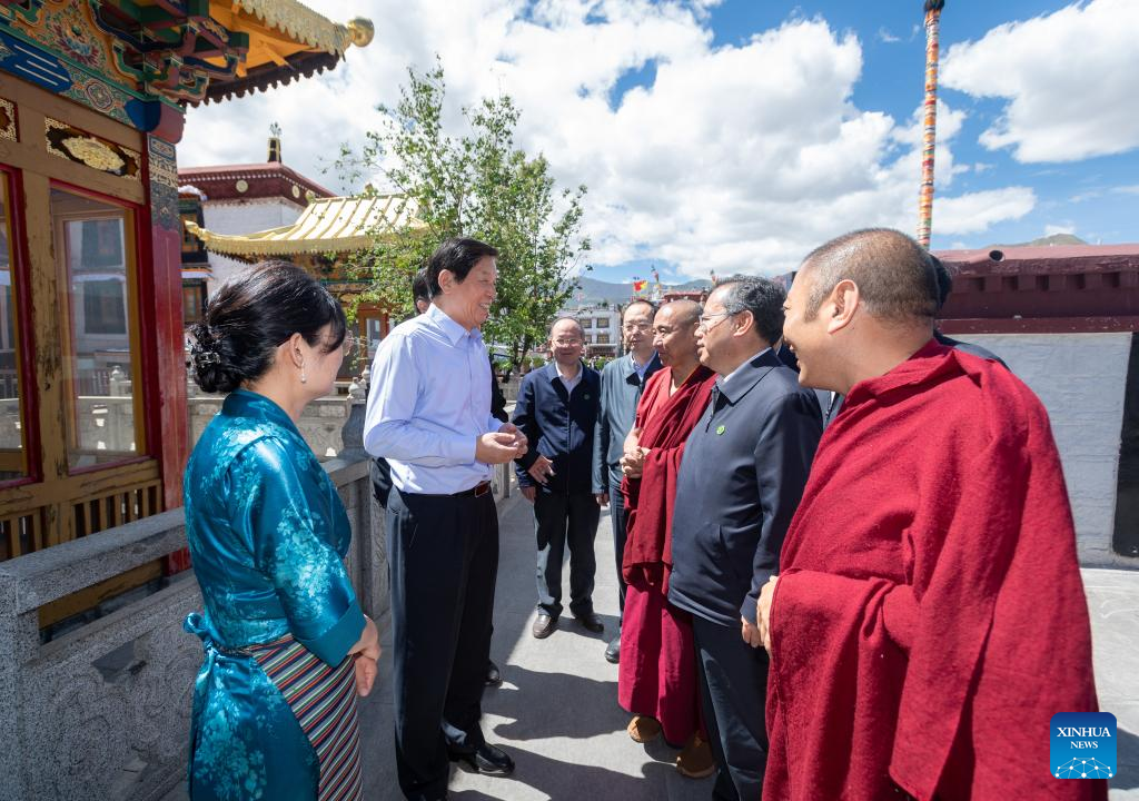
Li Zhanshu in the Tashilhunpo monastery

On July 13, Li Zhanshu went to Shigatse and visited the north bank of the South Woodland Ecological Demonstration Area of the Yarlung Tsangpo to investigate the planting of trees. He was accompanied by Wang Junzheng, the TAR Party Secretary.
Li Zhanshu inspected the protection of wetlands, river mudflats, reforestation projects, water resources protection, mine restoration among other things; during a forum, he listened to the views and suggestions of the stakeholders. He spoke of the great achievements made in ecological environmental protection on the Qinghai-Tibet Plateau, and discussed with everyone the key issues involved in the development of the new law.
Li Zhanshu noted that the Qinghai-Tibet Plateau Ecological Protection Law is a major initiative “to implement the important instructions of General Secretary Xi Jinping on the ecological protection of the Qinghai-Tibet Plateau: "The Qinghai-Tibet Plateau has a special ecological status and value, and plays an extremely important role in the national and even global ecological security."

Li Zhangshu In Tibet
A question could be asked: will tens of millions of tourists visiting the plateau every year conducive to the protection of the environment?


For Li, the Qinghai-Tibet Plateau Ecological Protection Law will be a special regional protection law, but its significance and impact will reach far beyond the plateau to which the law will apply; he said while drafting this law, it was necessary “to have a big picture of the overall situation and the very high altitude; the idea of the legislation is to support ecological protection policy initiatives and also reflect Tibet’s own characteristics.”
Li Zhanshu noted that to implement the new development concept, one should adhere to systemic thinking, in a scientific attitude and problem-solving spirit, in order to strengthen the protection, governance, restoration and risk prevention and control of each important ecosystem, and provide a strong rule of law protection for the ecological protection of the Qinghai-Tibet Plateau.”
Once again it sounds good (despite the verbiage), but what about the high speed development (roads, railway lines, airports) already started.
Li Zhanshu visited the Potala Palace, Jokhang Temple in Lhasa and the Tashilunpo monastery in Shigatse.
He said that “the most fundamental issue lies in the strong leadership of the Party Central Committee with Comrade Xi Jinping as the core, in the scientific guidance of Xi Jinping thought of socialism with Chinese characteristics in the new era, uncompromisingly put into practice the important statements of General Secretary Xi Jinping on the work of Tibet and the party's strategy for governing Tibet in the new era. It is necessary to further implement the strategic thought of "ruling the country must be ruling the border, and ruling the border must first stabilize Tibet", implement the Party's guidelines and policies on ethnic and religious work, make safeguarding the unity of the motherland and strengthening ethnic unity the focus and point of emphasis, achieve long-term peace and stability, and promote high-quality development.”
Li is clearly on Xi Jinping’s side in the power struggle ahead to the 20th Congress in November.
In Beidaihe, he will present a report on the ecological achievements of the General Secretary on the Plateau. The reality might be different.

Vice-Premier Han Zheng in Tibet

Han Zheng’s Visit
Xinhua also reported that Han Zheng, a member of the Politburo’s Standing Committee and Vice Premier of the State Council visited Nyingchi and Yushu in Qinghai province from July 14 to 15.
He stressed to unswervingly take the road of ecological green development and constantly promote high-quality development to achieve new results.
As usual, Han Zheng stressed the need to adhere “to the Xi Jinping thought of socialism with Chinese characteristics in the new era as a guide, in-depth implementation of the new development concept, unswervingly take the ecological priority, green development and solidly promote the construction of major projects and ecological protection, and constantly promote high-quality development to achieve new results.”
On July 14, Han inspection the Sichuan-Tibet Railway presently under construction (only the section between Nyinchi and Lhasa is completed).
Han Zheng went to the Serkhyem La pass at an elevation of 4.567m (14,983ft) above the sea level. The new railway line will go through a tunnel and the line will apparently run parallel China’s National Highway 318 (G318), also known as China-Nepal Highway and the Friendship Highway.
According to a website for tourists: “The road is asphalted. Usually impassable from October to June. The summit offers a breathtaking scenery. The road is long and arduous and crosses several mountain passes through remote areas, so you need to be prepared. Do not take this drive if you have respiratory problems or any type of heart condition. Notorious lack of oxygen that tests the organisms and a high degree of steepness. A major hazard of altitude is the sickness that can indiscriminately affect anyone regardless of age or fitness. The zone is prone to heavy mist and can be dangerous in low visibility conditions.”
This pass links Bayi and Bomi counties; on top of the pass, one gets the incredible view of Namcha Barwa (7756m) …when the weather is clear.
Han Zheng was shown an exhibition explaining the overall situation of the construction of the railway; he conducted a field inspection of the construction of the energy-saving and environmental protection features of the tunnel.
Han said that “the construction of the Sichuan-Tibet Railway will implement the new era of the party's strategy for the governance of Tibet a major initiative to promote the western region, especially the economic and social development of Sichuan and Tibet provinces.”
He added that during the construction of the project, everyone should adhere to the time and quality and to ensure the safety of the project. 

Han Zheng inspects the new railway line between Tibet and Sichuan

Probably more Worrying for India
Han Zheng first came to Milin County in Nyingchi City to “listen to the development of clean energy on the Yarlung Tsangpo River and he was briefed about the construction of the major hydropower development project.
Apparently, this refers to the mega HPP on the Yarlung Tsangpo, which has often been mentioned on this blog.
Han pointed out that “it is necessary to coordinate the rational development and utilization of water resources and protection, and build a national clean energy base. The construction of major projects should adhere to scientific evidence, comprehensive consideration of geological conditions, ecological environment and other multiple factors, and do a solid job in the preliminary work of the project.”
Han clearly bats for the giga project on the Yarlung Tsangpo, which will bring destruction in the Great Bent area ...and in India.
It means that China will go ahead with the project on the transnational river, which becomes the Siang in India and later the Brahmaputra.

The Sanjiangyuan National Park
The Sanjiangyuan (Chinese: Source of Three Rivers) is an area of the Tibetan Plateau in today’s Qinghai province; it is the headwaters of the Yellow, the Yangtze, and the Mekong which originate from this area. They come under the Sanjiangyuan National Nature Reserve (SNNR), or Three Rivers Nature Reserve.
According to Wikipedia: “The reserve consisted of 18 subareas, and each contained three zones which were managed with differing degrees of strictness. In 2015, the Chinese government decided to implement a new national park system, and created Sanjiangyuan National Park, which is set to open officially in 2020.”
To protect the grasslands, pastoralists are not permitted to graze their animals in designated called ‘core zones’ and grazing is supervised in the SNNR. In addition, residents have been resettled from these core zones and other grassland areas of the SNNR, and the rangelands have been fenced; they are in the process of being privatized throughout the Sanjiangyuan Area.
After his visit of the Yarlung Tsangpo, Han Zheng inspected the Yushu Ecological Environment Monitoring Center and was briefed on the ecological protection in Qinghai Province.
Han got a report on the construction of Sanjiangyuan National Park through the remote video monitoring system; he virtually visited the Sanjiangyuan projects, met grassroots cadres, he had a field inspection of the waters of the Tongtian River. He later went to the site of the Sanjiangyuan Nature Conservation Monument.
The Shi Chu (Tibetan) or Tongtian River is 1,012 km long; it flows within Qinghai Province. It is begins at the confluence of Togtog (or Mar chu) River and Dang chu River and flows towards southeast and becomes a Jinsha River near the border of Qinghai and Sichuan. The Jinsha River is a primary and westernmost tributary of the Yangtze River (‘Chang Jiang’).
Han Zheng noted the achievements of the construction of the Sanjiangyuan National Park; he mentioned the benefits of the project for the whole country, as well as for future generations.
He said that “to protect the Sanjiangyuan as the top priority of the construction of ecological civilization in Qinghai, to guard the natural ecology, conservation of natural resources, to protect the Chinese water tower.”
Han Zheng later went to the Qinghai Longbao (National) Nature Reserve where he interacted with the staff of the station.
The Longbao National Nature Reserve was established in 1986 and has an area of about 100 km2 covering wetlands and meadows. The reserve is located about 50 km northwest of Jyekundo, the Yushu County seat, lying just south of the highway connecting Yushu and Ritoe Counties. The reserve’s primary area of ecological importance is a wetland that is approximately 14 km long with a maximum width of about 3.5 km. The maximum depth of the wetland is reported to be about 4 m, but most of the wetland is generally much shallower. This wetland lies at an elevation of about 4,200 m in a broad mountain valley flanked by ridges that typically rise up to 750 m above the wetland. The wetland is fed by groundwater, streams, precipitation, and snow-melt, and it drains into the Yi Chu River to the northwest, a short tributary of the nearby Tongtian River.
Han Zheng stressed again the need “to actively promote the construction of wetlands, strengthen biodiversity protection, reduce human activity interference, promote the harmonious coexistence of man and nature, and continue to build a solid national ecological security barrier.”
The visit of the site of the mega HPP on the Yarlung Tsangpo should worry India.
In the meantime, a lot to discuss in Beidaihe next month...

HPPs on the Yarlung Tsangpo


Monday, April 5, 2021

The Yarlung Tsangpo HPP: Mega Tragedy in the Making

Dave Petley, Pro-Vice-Chancellor (Research and Innovation) at the University of Sheffield in the UK has a blog which provides scientific information on landslides or mudslides occurring worldwide.
On March 29, he noted: “Yarlung Tsangpo: another giant, high mountain landslide on March 22, 2021.”
He elaborated: “I received an email from Göran Ekstrom of Columbia University making a small group of us aware that he had detected, using seismic instruments, a probable large-scale landslide in the vicinity of the Yarlung Tsangpo in Tibet. As always, the seismic data gives an indication of location, but not a precise grid reference, and an idea of the mass (in this case about 100 million tonnes – a very large one indeed).”
Whether it was triggered by an earthquake in this highly seismic area, is still not clear.
As we shall see, it could also be due to torrential rain.

The British scholar continued: “Fastest out of the blocks was Marten Geertsema, who used partially cloudy Planet Labs satellite imagery to identify a possible site. Yesterday [March 28], Planet Labs data with low levels of cloud became available. Dan Shugar from the University of Calgary was able to identify that the location was correct, and that a large landslide had occurred.”
Shugar said: “Planet Labs’ images of the Tsangpo Landslide from Mar 13 and 28 show failure of some small hanging glaciers (similar to Chamoli in Uttrakhand) and likely rock material, which dropped 3900m (!!) from ~6600m to 2700m to Yarlung Tsangpo valley bottom, causing partial blockage (but some water flowing).”

Shugar published an image from Planet Labs image captured on March 28.
The coordinates of the site are given (29.815, 94.932). It is the 'epicenter' of the landslide or mudslide.
Pethley commented: “Dan and I slightly disagree with how this (and Chamoli) should be described (which is fine of course). Dan describes this event as the collapse of hanging glaciers, whereas I consider it to be a rockslide that has taken some ice with it. Researchers love semantics!”
Pethley further explained: “Either way, at Yarlung Tsangpo it is clear that a large amount of rock and ice have detached from the east side of the tributary valley, moving westwards and then to the south. Once again this has formed a catastrophic channelised flow that has travelled down the channel to deposit a large volume in the main channel. This was probably blocked briefly, but as the image above shows water is now flowing freely.”
He mentioned a huge increase in turbidity of the water downstream of the blockage on the Yarlung Tsangpo.
Stuart Dunning of Newcastle University noticed another aspect in his response to Dan Shugar: “This must be one of the most dynamic landslide locations on Earth. I have previously written about another landslide at exactly the same site. That event looks broadly similar to this one.”
I have written on this blog three years ago about another landslide in the same area.

The Location of the Mudslide
The slide is about 50 km downstream of projected giga hydropower plant (HPP) on the Yarlung Tsangpo and it is not presently directly connected with the forthcoming project.
According to The People's Daily, the Tibet Autonomous Region Meteorological Bureau announced on March 7 that during the week between March 8 to March 14, the temperature in most parts of Tibet would be high for the season, and it would be raining: “in the eastern part will receive rain and snow, and high-altitude road sections are prone to snow and ice.”
The meteorological department reminded the public “to pay attention to traffic safety and prevent secondary disasters such as mudslides. Relevant departments need to continue to strengthen fire prevention in grasslands, forests and cities.”
It spoke of possible ‘mudslides’.
The point is that the area around the proposed HPP is environmentally extremely fragile, but Beijing does not seem to care much about that.

The Earthquake of 2017
In November 2017, an earthquake shook the area around Mt Namcha Barwa, also near the Great Bend; as a result, the Siang/Brahmaputra suddenly became black.
An excellent article ('Muddy Siang is sign of danger ahead, wake up call for Indian authorities') described the developments on the Yarlung Tsangpo/Siang/ Brahmaputra. It was published by the South Asia Network on Dams, Rivers and People (SANDRP).
It said: “The current ongoing episode of Muddy Siang River water in Arunachal Pradesh is due to landslides in the upstream Tibet, triggered by the earthquakes starting on Nov 17, 2017 or possibly earlier. This is revealed by the satellite pictures and work of two researchers, first published in Arunachal Times on Dec 21, 2017. These landslides are partly blocking the Siang flow and could lead to massive floods in the downstream Arunachal Pradesh and Assam any day.”
The article raised two important questions.
Why the Chinese officials kept quiet for weeks, if it was ‘only’ a simple earthquake and why India remained ‘unaware’, when it was not too difficult to ‘know’ the facts with remote satellite imagery.
SANDRP questioned the role of the Indian officials in this.
According to the report quoted by SANDRP, a huge amount of debris accumulated and blocked three locations, forming natural dams on the river across a 12-kilometre stretch in Tibet. It was cause by a 6.4 (or 6.9) earthquake in the Great Bend region. It darkened the waters of the Yarlung Tsangpo.

Due to Heavy Rains?
Unlike in 2017, the present mudslides are probably due to heavy rains.
It is however extremely worrying when one think that China is planning a HPP thrice the size (or at least the capacity) of the Three Gorges Dam.
See my previous post about this.
The area is definitively fragile and earthquake-prone.
The areas were the 2017 and 2021 mishaps occurred is of course located upstream the proposed giga project, but in the future mudslides/landslides could trigger heavy sedimentation, as well as the other possible problems.
For example, if mega mudslides happen in the area of the proposed giga HPP, the reservoirs could well quickly fill up with dirt and the turbines and tunnels/pipes would need to be closed and cleaned, forcing China to temporarily divert the waters of the Yarlung Tsangpo/Brahmaputa.
India should be concerned by the happenings upstream the McMahon Line/LAC.

The Giga Project
On November 30, 2020, The Global Times had announced China's plan to build a large hydropower project on the Yarlung Tsangpo; the Communist tabloid admitted that it could raise concerns in India “over potential political and ecological threats as the river passes through Southwest China, India and Bangladesh. [But] Chinese experts refuted the claim that Chinese hydropower project have political aims, and said the project could help alleviate power shortage problem in northern India and boost regional economy."
It is obviously a non-sense.
According to the head of POWERCHINA the planned hydropower station - which is expected to have three times as much generating capacity as the world-leading Three Gorges power station – “aims to maintain water resources and domestic security.”
Very vague indeed.
The Global Times continued: “However, the news raised India's concerns, with some experts and media worried that Chinese activities in upstream areas may hurt interests downstream. Some are even concerned that China will use the hydroelectric project as a tool to serve its political strategy in the region, along with the border military conflict in Ladakh, or to curb India's right to explore downstream water resources. … But these energy projects can benefit the entire regional economy, if properly coordinated.”
Coordination will not take place, but even with ‘coordination’ the extreme frailty of the area will remain.

The project during the 14th Five-Year Plan?
During the Two Sessions in Beijing in early March, it was reiterated that “the construction of key projects should be promoted, such as the Sichuan-Tibet Railway and hydropower development on the Yarlung Tsangpo River, according to the 14th Five-Year Plan (2021-25) for National Economic and Social Development and the Long-Range Objectives Through the Year 2035, which was adopted by China's top legislature and published in full.”
So, is it a fait accompli, the giga HPP will be constructed?

During the Two Sessions, the Chinese media reported that Che Dalha, chairman of the Tibet Autonomous Region and deputy to the 13th National People's Congress: “urged acceleration of the project and comprehensive planning and environmental impact assessments" for the project .
One can doubt that proper assessment will be conducted? Will the Chinese ‘scientists’ take into account the presence of tens of thousands of truck and GCBs moving earth around and changing the shape of the mountains, north of the Indian borders?
It looks more the question of an aging Emperor wanting to show the world that He has constructed a HPP thrice the capacity of the Three Gorges Dam, than love for environment. 

The recent mudslide's location, north of the Yarlung Tsangpo

Sketch published in 2009 by a famous Chinese blogger


Tuesday, February 16, 2016

Kailash: Holy no more?

A few days ago, The China Daily reported that last year, some 470,000 pilgrims visited Mount Kailash and Lake Manasarovar, located in today’s Ngari Prefecture of the Tibetan Autonomous Region (TAR).
The article explains that these sites are sacred for the followers of Tibetan Buddhism, the Bon religion, Hinduism and Jainism:
For pilgrims, circling either site is a great honor and the fulfillment of a lifelong desire. Tibetan Buddhists believe that features such as mountains and lakes are living entities and are born in a certain year of the animal zodiac.
As often mentioned on this blog, the Communist regime in Beijing has now developed a great expertise in spiritual matters; for The China Daily:
If a pilgrim circles Kailash in the Year of Horse, the year the mountain is believed to have been born, it is a doubly auspicious act and equal to 12 revolutions in other years. They believe the journey will wash away the sins of one lifetime and bring prosperity.
The TAR government has however decided to implement measures to guarantee the pilgrims' safety, fulfill their religious needs while protecting the environment, says the newspaper.
The figure of 470,000 represents a rise of more than 50 percent from 2013 (some 30,000 pilgrims are said to have come from China's neighboring countries, i.e. Nepal and India).
According to Meng Fanhua, a Chinese pilgrim who recently did the parikrama:
It was so crowded. You could see pilgrims every few meters. People followed the same path, some Tibetans kowtowed, some walked.
Meng believes that his visit to the Holy Mountain is the greatest achievement of his life; it was a two-day walk around the base of Mount Kailash. The 50-year-old painter from Liaoning province said:
It was exhausting physically, but I have never felt better than after that journey. It was truly the greatest adventure of my life - and the most valuable one
Champa Tsultrim, head of the Ngari Prefecture’s Environmental Protection Bureau told China Today that the TAR government has invested 8 million yuan ($1.25 million) to establish some temporary sites for the disposal of garbage and help the travelers protect the environment: “We also increased the number of trashcans alongside Mount Kailash and Lake Manasarovar to guarantee one every 3 to 5 kilometers," he added.
Will it be enough to take care of the solid waste of half a million pilgrims?
It is extremely doubtful.
Champa explained that temporary sites are used to store the waste, which is collected every other week and then transported to Purang county, (near the Nepal-India border), some 100 km away from the mountain and 35 km from the lake.
Champa added that to ensure that the environment remains unspoiled, no industrial activity is allowed in the area.
But what about the ‘tourism industry’?
Nyima Phuntsok, head of Ngari's forestry bureau asserted that his office has established a hotline to allow local residents and visitors to report the behavior of pilgrims which pollute (such as dumping garbage or fishing in the lake).
Authorities can also be alerted in case animals are found sick or injured. Callers are accordingly rewarded, said Nyima.
Six monitoring stations on the lake, in some case manned by local residents have established.
Will it be enough?

Manasarovar Ghats?
Finally, the article notes that areas on the lake have been set aside for pilgrims “whose beliefs require them to bathe in the waters, and wardens keep a sharp eye out for anyone using detergents or soap that could damage the ecosystem.”
Will China built concrete ghats on the Sacred Lake?

The Future
One can safely predict that 1 million pilgrims (with a growing percentage of Chinese) will visit the Kailash Manasarovar every year by 2020.
It will be unmanageable.
Will the Holy Mountain remain Holy is the question which should be asked?

Tail-end: Incidentally, the time has perhaps come for Delhi to ask Beijing for the return of Minsar, the Indian territory illegally offered to China in the 1950s.

Friday, February 27, 2015

Diverting Tibet's waters to China

A couple of days ago, China Tibet News reported that the Tibet Autonomous Region (TAR) will soon “launch a natural drinking water project on account of its large repository of freshwater.”
The information was given by Gangqen [Gangchen?], head of the TAR Work Forum on Science and Technology. Gangchen commented that the project will be carried after “carefully with consideration of ecological protection …and provide new impetus to the region’s steady economic growth.”
What does it mean?
Tibet is going to bottle its waters and export it to the Mainland.
Of course, there is no doubt that the plateau's waters are purer than Beijing's or Shanghai's.
The Chinese website explains: “Unlike the rest of the country, which is struggling with water shortages and deteriorating water environment, Tibet boasts a pristine environment and has a large repository of freshwater.”
The local government plans to exploit 28 mineral water springs. Tibet, with its 190 million tons of water reserves, could benefit from the ‘export’, say the Chinese authorities.
Already in January, Xinhua had announced that the TAR had identified its fresh water resources “as a new sustainable economic growth pillar, which has the potential to support efforts to reduce poverty and boost industrial development in the region.”
Lobsang Gyaltsen, the chairman of the TAR government stated during the Regional People’s Congress that Tibet has produced 300,000 tons of bottled water in 2014: “the sector was an important driver of economic growth,” he added.
Moreover, Gyaltsen suggested that “to fully exploit its potential, Tibet needed brand-driven strategies.”
According to Beijing’s statistics, the TAR’s growth was 12 % in 2014; and as the Chinese Government was keen to “strike a balance between economic development and environmental protection,” water bottling is the solution!
The local government in Lhasa has now decided to promote mineral water on a grand scale: “mineral water industry has been singled out as a suitable sector to boost the local economy”, said Gyaltsen.
Qiu Chuan, the deputy director of Tibet's industry and information technology bureau, told the media that the strong demand for high-quality mineral water “had upped investors' confidence in Tibet's mineral water industry”.
The TAR has today 30 mineral water production lines with a combined production capacity of 2 million tonnes a year, said Qui.
Mainland ‘water producers’ such as Nongfu Spring and Bright Food Group, already signed 16 agreements with the TAR government for mineral water exploitation; the companies promised to invest 3.6 billion yuan (5.79 million U.S. $) in the new bottling venture.
It is going to be big: the TAR government has made plans for a 40 billion yuan (6.5 billion US $) ‘water’ industry for 2019.
I wonder if any environment assessment for setting these huge bottling factories was done?
Probably not!
And this is while waiting to divert the Yarlung Tsangpo (Siang/Brahmaputra) … and the Indus.

Monday, February 16, 2015

Dreadful Cascade on the Yalong River

Cascade of dams on the Yalong
A couple of days ago, Xinhua reported that a ‘New hydropower station in SW China gets hefty loans'.
This is ominous.
It appears that after a few years recess period, the ‘cascade’ frenzy of large hydropower plants on Tibetan river is on track again.
Xinhua says: “A hydropower station planned for southwest China's Sichuan Province received 53 billion yuan (about 8.5 billion U.S. dollars) in loans from seven domestic financial institutions.”
According to the Chinese news agency: “The planned hydropower station, in the middle reaches of the Yalong River in Sichuan's Garze Tibetan autonomous prefecture, will have an installed generating capacity of 3 million kilowatts with a total reservoir capacity of 10.8 billion cubic meters.”
It is a big, very big dam at a time mega-dams are decommissioned elsewhere in the world.
Chen Yunhua, president of Yalong River Hydropower Development Co. Ltd, the project's developer, explained: “Construction will cost about 66.5 billion yuan and the loan agreement, signed in Chengdu; [it] covers about 80 percent of the total. …The seven lenders are China Construction Bank, Industrial and Commercial Bank of China, Postal Savings Bank of China, Agricultural Bank of China, China Development Bank, Bank of China and Bank of Communications. They will provide long term, low-interest loans to support the project.”
It will be the largest powerplant on the Tibetan plateau; it is expected to start producing electricity by the end of 2021 and it should be completed in 2023 (Chinese companies usually complete their tasks on time, not like in India).
Chen affirmed that the project will “transform the river's hydropower resources into a new driving force for the regional economy and generate clean energy to fuel southwestern and eastern China.”
But it will probably destroy the Yalong river forever.
Though the name of the dam is not mentioned in the Xinhua release, it is clear that it refers to the Lianghekou Dam ("mouth of two rivers"), a concrete-face rock-fill dam on the Yalong River.
The Yalong originates in Qinghai Province, passes through Sichuan, and
joins the Jinsha (Yangtze) River.
  • Length: 1,571km
  • Natural head: 3,830m
  • Catchment area: 136,000km2
  • Annual runoff: 61 billion m3

The Lianghekou Dam is located at the confluence of the Yalong, Xianshui and Qingda Rivers. With its 295 m height, it will be the highest embankment dam in China and the power station should produce 3,000 MW.
Studies for the dam were completed between 2005 and 2009 with preliminary construction beginning soon after. However the ‘official’ construction only started in October 2014.
According to Chen, 21 cascade projects are planned on the Yalong river; their ‘technical developable capacity’ is 30,000 MW, (representing 24% of the capacity of Sichuan or 5% of China).
It will rank 3rd among China’s 13 ‘hydropower bases’.
Chen made the following points:
•    Hydropower development of the Yalong River is already in an expedited stage.
•    Key technical issues have been basically resolved.
•    An optimized pattern for joint operation of multiple stations is gradually taking shape.
•    Design and control of high earth-core rockfill dams will become the focus of further research.
Does it mean that the researches have not been completed?
The local populations have of course not been consulted ('Only' 4,900 people will be forcefully displaced).
Today, the Editorial of The South China Morning Post is consecrated to China's new environment chief, Chen Jining.
The Hong Kong daily says: “It is easy to assume that if no one - be it a high or low official - is beyond the reach of mainland graft-busters, then serial polluters should not present too much of a problem to environmental authorities. Sadly, nothing could be further from the truth. The latter may have the law on their side and, supposedly, the clout of a fully fledged ministry in recent years. But the mainland is almost as well-known for potentially calamitous degradation of its environment as for the breakneck pace of economic growth responsible for it. This is because serious air, water and soil pollution has accrued over decades, economic growth still gets higher priority and responsibility for protecting the environment is divided among various government departments.”
Don’t you think that the ‘cascade of dams’ is also a ‘serial killer’?

Monday, January 26, 2015

The Tibetan blues

My book review of Meltdown in Tibet by Michael Buckley (PanMacmillan), entitled The Tibetan blues appeared yesterday in the Sunday Pioneer (Agenda) .


Here is the link...

This well-documented work delves deep into issues which are bound to get hotter with time, writes CLAUDE ARPI

André Malraux, the famous French Philosopher and General de Gaulle’s Culture Minister once said, ‘The 21st century will be spiritual or will not be’. Without denying the role that spirituality can play in the present planetary crisis, it is obvious that if the world leaders do not rapidly take some drastic actions to solve the planet’s environmental issues, annihilation will befall upon humanity by the end of the current century.
Michael Buckley’s, Meltdown in Tibet, delves deep into these burning issues. His well-documented work deals with topics which are bound to be hotter as the years pass by. Buckley says that he isn’t a scholar who analyses problems from air conditioned rooms, he sees himself more as an adventurer. The Canadian environmentalist has extensively travelled on the Asian roads, more particularly in the Himalayas and the Roof of the World where he witnessed the changes brought about by the wild development of modern China. He is an Asia-trotter, having spent most of his time in our continent, particularly in Tibet. His book, Heartlands: Travels in the Tibetan World had earned him the Lowell Thomas Travel Journalism Award.
He is also a keen rafter and points his finger towards the Tibetan plateau: “Glance at a physical map of the Tibetan Plateau and you will see why the rivers of Tibet are so important to southeast Asia and the Indian subcontinent. The Tibetan plateau is the source of the major rivers of this vast region, stretching all the way from the coast of China in the east to Pakistan in the west. Ninety per cent of the run-off from Tibetan rivers flows downstream into China, Vietnam, Cambodia, Laos, Thailand, India, Nepal etc. At the tail-end of those same rivers lie the world’s largest deltas...close to two billion people rely on Tibet’s waters-for drinking, for agriculture, for fishing, for industry.”
The first lines of Meltdown in Tibet accurately highlight our century’s vital issues: the fate of more than half of humanity depends on the waters from Tibet. Speaking about the water situation in China, Xinhua recently admitted a ‘domino effect on water supply’. The Chinese news agency was commenting on the first comprehensive study of China’s glaciers which proves that on an average, 244 sq km of glaciers disappear every year. The Chinese glaciologists “had warned of ‘chain effects’ that could have an impact on water supplies in the country’s western regions” …and one should add, on India.
The figures come from the survey conducted by the Chinese Academy of Sciences, which found, “China had 48,571 glaciers in its western provinces, including the Tibetan regions of Xinjiang, Qinghai, Sichuan and Gansu provinces.” This is indeed not encouraging news, but despite the impending shortage of water in the long-term, China continues to dam rivers originating from the Third Pole; Buckley explains this terminology: “Outside of the Arctic and Antarctic, the Tibetan Plateau has the largest store of ice on earth, leading to its designation as the ‘Third Pole’. …In terms of human impact, however, meltdown of Tibetan Plateau glaciers will have far greater repercussions.” Even the Chinese scientists agree that there is far less scientific data available on the Third Pole than on the Arctic and Antarctic .
An interesting feature of Buckley’s book is that the author links different issues which are not correlated at first sight. When he speaks about the ‘Crisis at the Third Pole’, he asks, ‘What does a rain of black soot have to do with this?’ He himself answers the question: “There is no doubt that greatly elevated CO2 emissions from both China and India are leading causes of warming on the Tibetan Plateau. But for glacial meltdown, another significant factor may be the rain of black soot...Lumps of coal burned in households in China result in a tremendous output of black carbon, or soot, also referred to as black soot. …Black carbon from cities in both India and China travels on air currents and gets trapped on the Tibetan Plateau.”
That is not all, the carbon particle, being black, absorbs the heat from the sun “both while floating in an air column or once settled on the ground — or the ice”. Everyone has experienced that wearing white clothes in summer is cool, as white reflects the light (and the heat) but if you have a black shirt, you will soon feel the heat. Scientists say that when the sun’s rays hit the earth, a certain percentage of the energy is reflected back into space. The amount of radiation reflected is called, the albedo. The sun’s energy at the poles reflects more rays (and heat), it has a high albedo. The more ‘black’ particles and the less snow and glaciers, the faster the earth will warm up with incalculable consequences for the small humans living on it. It triggers a vast exponential domino effect.
'We have only one Tibet'
Chapter after chapter, Buckley enlightens us on the ‘Ecocide on the Land of Snows’; on why Tibet matters so much today; on the fate of the mighty rivers of Tibet and their damming (‘What on earth are China’s engineers up to?’); on China’s appetite for energy (‘Where is the thirsty dragon going to guzzle next’); on the fate of the nomads parked in new ghettos (‘Vanishing Nomads, Vanishing Grasslands’) or Plundering the Treasure House (‘How much can an ecosystem take before it collapses?’). He believes that Beijing’s water policies dictated by their new godhead, i.e. ‘Development’, will lead Asia to natural disasters.
In the chapter ‘Downstream Blues’, he mentions the consequences of the Third Pole’s environmental degradation for India and the possibility of a Himalayan Water War (if the Brahmaputra is diverted, for example). At the end, the author asks a vital question, valid not only for China (Tibet), but for India, Bangladesh or Pakistan too: “Why can’t they just leave the rivers alone?” It’s a difficult question, because development is today a ‘must’ for most modern states.
Is there a way out? A middle path? Buckley does not provide an answer, except mentioning the importance of trans-boundary collaboration. He rightly says: “Water, not oil, is now becoming the world’s most important resource. Though we live on a planet covered by water, very little of it is accessible.” The fate of the 21st century will indeed depend on water; spirituality could perhaps help in bringing some wisdom into humans’ brains and hearts, though it may soon be too late; as the Dalai Lama says in his preface: “We only have one Tibet. There are no backups.”

Saturday, January 24, 2015

China: more and more dams in Tibet

A few weeks ago, I questioned the real objective of the newly launched Sichuan-Tibet electricity grid.
Was the purpose to bring electricity from the mainland to Tibet or vice-versa?
At that time, the Chinese press said that the purpose was the former.
Now China Tibet Online speaks of a "Breakthrough in outward power transmission from Tibet".
What does it mean?
It signifies more and more dams will be required in the future ...to feed the outward power transmission and some of these dams will be built on the Yarlung Tsangpo-Brahmaputra.
Chinanews.com announced: "Tibet Autonomous Region is expected to see a breakthrough in outward electric power transmission this summer."
It quotes the Tibet Electric Power Company Limited, to say: "when the three power stations in Dzam [Zangmu?], Dondup [Pangduo?] and Guoduo [located on the upper reaches of the Mekong River in Tserwe Township] are put into operation,Tibet will begin transmitting electricity to other provinces for the first time. This will be achieved with the help of Sichuan-Tibet Power Grid and Qinghai-Tibet DC Networking Project."
It is not what China was saying a few weeks ago:
Xinhua reported that the opening of the 1.08 billion U.S. dollar project linking Chamdo in the TAR and the Tibetan Autonomous Prefecture of Garze in Sichuan Province, aims at "putting an end to the electricity shortages of the 500,000 residents of the Chamdo region and ease power strain in Tibet as a whole".
Now, the Chinese website admits: "The two lines will increase Tibet’s outward power transmission capacities to 350,000 and 20,000 kilowatts, or 1 billion and 600 million kilowatt hours a year respectively."
Beijing has invested a lot of money in the project: the Sichuan-Tibet Power Grid and Qinghai-Tibet DC Networking Project cost 4.6 billion US dollars. It was part of the 12th Five-year Plan Period (2011-2015).
China Tibet Online affirms: "Together with the Central Tibet Power Grid and Chamdo Power Grid, the two lines will certainly ease local power shortages and boost economic development in eastern Tibet. It is believed that the power grids in Tibet will cover 58 counties and benefit 2.18 million local residents by the end of the year."
Now comes the most telling part:
The foundation work for outward power transmission will be advanced steadily in 2015 by accelerating hydroelectric development in the middle section of the Yarlung Zangbo River [Brahmaputra], said Losang Jamcan [Lobsang Gyatsen], chairman of Tibet's regional government during the Third Session of the Tenth Tibet People's Congress.
Investment in power grid construction in Tibet is predicted to hit a record 60 billion yuan (9.7 billion US dollars) in the 13th Five-year Plan Period. By 2020 Tibet can bid farewell to the history of its power shortage and realize large-scale outward power transmission. The capacities in 2020, 2025 and 2035 will reach 20 million, 40 million and 110 million kilowatts respectively, industry analysts said.
In 2015, China will be "accelerating hydroelectric development in the middle section of the Yarlung Zangbo River."
The conclusion of the website was "Tibet is abundant in water power resources and will serve as an important energy base for the west-east electricity transmission project."
In other words, more and more dams will be built in Tibet ...to feed electricity to China. It will have serious consequences for India and Bangladesh.

Thursday, August 21, 2014

Tourism and Environment on the Tibetan plateau

The magazine Nature (No 512, p. 240–241) publishes a fascinating article about the ecology of the Tibetan plateau. It quotes a report just released by the Chinese Academy of Science.
The authors of the report should have added another factor: the 15 million mainland tourists yearly pouring onto the Tibetan Autonomous Region. 
For centuries, Tibet has been the most isolated country on the planet. A few brave explorers managed to sneak in, most of the times illegally, on the Roof of the World. But things are changing, changing very fast.
Today, Chinanews.com thus describes Tibet: “Tibet with its mystery is the spiritual Garden of Eden and is longed by travelers home and abroad. Only by stepping on the snowy plateau, can one be baptized by its splendor, culture, folklore, life, snow-mountains, saint-mountains, sacred lakes, residences with local characteristics and charming landscape ”.
Tibet is fast becoming the largest entertainment park in the world; thousand times larger than Disneyland.
The government in Beijing has decided to market the Land of Snows as the ultimate ‘indigenous’ spot for the Chinese people to spend their holidays; in one way, it has become Tibet’s USP (Unique Selling Proposition).
Tibet has two unique assets: first, its physical reality. The beauty of the landscape, the imposing mountain ranges, the purity of the air and the rivers, the dry blue sky (especially when compared to the dusty sky of China’s great metropolis); Tibet is indeed the ideal place to visit and have a break from the fast pace of the polluted mainland of China.
The second advantage is the rich historical past of the Roof of the World, the Land of the Lamas. In Tibet, you can find everything, says the Chinese propaganda: a beautiful Chinese princess falling for the powerful emperor and converting him to Buddhism; the monasteries and nunneries, seat of a wisdom lost in the mainland; the folkloric yak or snow-lion dances; the Shoton (yoghurt) festival; the beautiful colourful handicrafts; the exotic food, you name it, …and a couple of millions of Tibetans (in the TAR) who can guide you through the mega-museum.
Of course, the ‘locals’ are not always reliable and their knowledge of Mandarin is often not that good; in any case, the show can go on without them.
When 15 millions of ‘tourists’ pour into a relatively small place like the Tibetan Autonomous Region, one has to be ready to ‘welcome’ them and provide them ‘entertainment’.  This is adding to the pressure on the environment.
The time has come to start a debate and more importantly, initiate serious and honest researches on the pros- and the cons- of mass tourism in an environmentally fragile region.
But it is still a touchy subject, because tourism is a great source of revenue for a poor mountainous region.


Double threat for Tibet
Climate change and human development are jeopardizing the plateau’s fragile environment.
Nature
Jane Qui
No. 512, p. 240–241
August 19, 2014
Hot, dry weather and progressive urbanization are turning grasslands into sand near the headwaters of the Yellow, Yangtze and Mekong rivers.
A comprehensive environmental assessment of the Plateau of Tibet has found that the region is getting hotter, wetter and more polluted, threatening its fragile ecosystems and those who rely on them.
The plateau and its surrounding mountains cover 5 million square kilo­metres and hold the largest stock of ice outside the Arctic and Antarctic; the region is thus often referred to as the Third Pole. And like the actual poles, it is increasingly feeling the effects of climate change, but rapid development is putting it doubly at risk, the report says.
Released in Lhasa on 9 August by the Chinese Academy of Sciences (CAS) and the government of Tibet, the assessment aimed to address gaps in knowledge about the extent of the problems the 4,500-metre-high plateau faces. It finds that precipitation has risen by 12% since 1960, and temperatures have soared by 0.4 °C per decade — twice the global average.
In addition, glaciers are shrinking rapidly and one-tenth of the permafrost has thawed in the past decade alone. This means that the number of lakes has grown by 14% since 1970, and more than 80% of them have expanded since, devastating surrounding pastures and communities.
The plateau feeds Asia’s biggest rivers (see ‘Running wild’), so these problems are likely to affect billions of people, the report says. Pollution from human and industrial waste as a result of rapid development is also a serious risk.
But the assessment also suggests ways to combat the problems, calling on the Chinese and Tibetan governments to make conservation and environmental protection top priorities. It will help in the design of “policies for mitigating climate change and striking a balance between development and conservation”, says Meng Deli, Tibet’s vice-chairman.
Expand
“The Tibetan plateau is getting warmer and wetter,” says Yao Tandong, director of the CAS Institute of Tibetan Plateau Research in Beijing, who led the assessment. This means that vegetation is expanding to higher elevations and farther north, and growing seasons are getting longer. But some areas, such as the headwater region of Asia’s biggest rivers, have become warmer and drier and are being severely affected by desertification and grassland and wetland degradation.
Human activity, too, is on the rise. The population of the plateau reached 8.8 million in 2012, about three times higher than in 1951. And the number of livestock has more than doubled, putting more strain on grasslands.
Multiple menaces
Growing urbanization is creating more waste than the region can handle. Tibet has the capacity to treat 256,000 tonnes of domestic solid waste a year, less than the amount generated by its two largest cities, Lhasa and Shigatse. “You see a lot of rubbish lying around the plateau, including headwater regions,” says Kang Shichang, a glaciologist at the CAS Institute of Cold and Arid Regions Environmental and Engineering Research Institute in Lanzhou. “It’s an environmental menace.”
A bigger threat comes from mining. According to the assessment, Tibetan mines produced 100 million tonnes of wastewater in 2007 and 18.8 million tonnes of solid waste in 2009. Because most of the mines are open pits and have limited environmental oversight, “air, water and soil pollution is particularly serious”, says the report. Officials release few details about actual pollution levels.
Pollution is coming not just from local sources. Dust, black carbon, heavy metals and other toxic compounds are being blown in from Africa, Europe and southern Asia. The dust and carbon residues are darkening glaciers, making them more susceptible to melting, and the toxic chemicals are poisoning crops, livestock and wildlife.
But the threats from mining and pollution are dwarfed by the potential repercussions of changes in ice and vegetation cover, the assessment says. Different surfaces — snow, grassland, desert — reflect and absorb different amounts of solar radiation, affecting how the air above them is heated. This means that changes in coverage are likely to affect the onset and strength of Asian monsoons. It also has important ramifications for the livelihood of downstream river communities because the glaciers, permafrost and ecosystems act as a giant sponge, helping to control the release of water and prevent floods. “The significance of the assessment goes beyond national borders,” says David Molden, head of the International Centre for Integrated Mountain Development in Kathmandu.
Temperatures in the plateau are projected to rise by between 1.7 °C and 4.6 °C by the end of 2100 compared with the 1996–2005 average, based on the best- and worst-case global-emissions scenarios. So as urbanization and climate change tighten their grip, researchers worry that unbridled development will devastate the plateau’s environment. To protect it, the report says, the central government must evaluate local officials on the basis of their environmental, not just economic, achievements. It must also invest more in ecological compensation, for example by paying herders more to cut their livestock numbers. Moreover, it must be much more open about pollution incidents.
“Tibet will be a test case of how seriously China takes ecological protection,” says Yao. “Safeguarding the plateau environment is crucial not only for sustainable development of the region, but also to social stability and international relations.”

Friday, April 4, 2014

The Yarlung Tsangpo (Brahmaputra) and Climate Change

Surveying the Yarlung Tsangpo
The Inter-governmental Panel on Climate Change’s (IPCC) Fifth Assessment has come out.
On the 31st March 2014, the report from the Working Group II, titled ‘Climate Change 2014: Impacts, Adaptation, and Vulnerability’ was released in Yokohoma, Japan.
In the Report, Working Group II assesses “the vulnerability of socio-economic and natural systems to climate change, negative and positive consequences of climate change, and options for adapting to it. It also takes into consideration the inter-relationship between vulnerability, adaptation and sustainable development.”
Chris Field, the chairperson of Working Group II affirms: “The report concludes that people, societies, and ecosystems are vulnerable around the world, but with different vulnerability in different places. Climate change often interacts with other stresses to increase risk”.
The report consists of two volumes.
The first volume contains a Summary for Policymakers, Technical Summary, and 20 chapters assessing risks by sector and opportunities for response. It deals with freshwater resources, terrestrial and ocean ecosystems, coasts, food, urban and rural areas, energy and industry, human health and security, and livelihoods and poverty.
A second volume of 10 chapters looks at risks and opportunities by region. These regions include Africa, Europe, Asia, Australasia, North America, Central and South America, Polar Regions, Small Islands, and the Ocean.
The summary for policymakers is not optimistic: “Climate change over the 21st century is projected to reduce renewable surface water and groundwater resources significantly in most dry subtropical regions, intensifying competition for water among sectors. In presently dry regions, drought frequency will likely increase by the end of the 21st century. In contrast, water resources are projected to increase at high latitudes. Climate change is projected to reduce raw water quality and pose risks to drinking water quality even with conventional treatment, due to interacting factors: increased temperature; increased sediment, nutrient, and pollutant loadings from heavy rainfall; increased concentration of pollutants during droughts; and disruption of treatment facilities during floods. Adaptive water management techniques, including scenario planning, learning-based approaches, and flexible and low-regret solutions, can help create resilience to uncertain hydrological changes and impacts due to climate change.”
The Indian NGO, South Asia Network on Dams, Rivers and People has looked into the references on dams and their relation with climate change in the report.
It analyzed: “It is significant to note that dams, hydropower projects, infrastructure measures like channelization, embankments, etc., are also mentioned in nearly all the chapters of the report. Couple of references indicate dams as a possible adaptation measure, but overwhelming references point to the contrary.”
The NGO cites sections of the Report:
1. Dams and infrastructure projects contribute significantly to ‘non-climate impacts’ which, after interacting with changing climate, exacerbate the overall impact on human societies and ecosystems
  • - Sediment trapping by reservoirs, exacerbates impact of sea level rise
  • - Hydropower affects local options
  • - Climate change and dams together affect a greater eco-region
  • - Increased flow fluctuations by dams exacerbate through climate change
2. In case of Flood Protection, dams and embankments may do more harm than good. Ecological measures would fare better.
3. Dams and Hydropower projects affect biodiversity, which is critical in facing climate change challenges.
4. In the tropics, global warming potential of hydropower may exceed that of Thermal Power
5. Dams increase vulnerability of weaker sections to climate change
6. Existing Dams have to be managed sustainably, with ecological considerations
7. Hydropower itself is vulnerable to Climate Change
The NGO concludes: “The specific references given below will play an important role in debunking the simplistic myth that dams and hydropower projects are climate friendly and can be considered as de facto adaptation measures to cope with Climate Change.”
It then lists a number of examples showing that dams have a negative effect.

Regarding Point 3 (biodiversity is critical in facing climate change challenges), some interesting information has recently come from China.
As China and India are preparing to dam the Yarlung Tsangpo/Brahmaputra/Siang river, Xinhua reported about rare species spotted in a recently conducted biodiversity image survey in the area in Tibet.
The Chinese news agency says: “A total of six hundred rare species living in Yarlung Tsangpo Grand Canyon have been photographed by Biodiversity Image Survey To Tibet (TBIS), an agency aimed at recording animals and plants in Tibet.”
 
The Chinese survey asserts that the discovery of new species and subspecies is the greatest achievement of the Image Survey Project: “For example, Metok wingless insect is a species discovered for the first time on the north bank of the Yarlung Tsangpo [Brahmaputra], which is a strong argument to prove the spread route of wingless insects.”
The Image Survey began in 2010; it has now taken place for the third consecutive year. “High-definition photos or clips that contain much more information than sheer specimen photos could offer have been collected”, claims Xinhua.
It is even said that the survey photos can rival any artistic photos in quality, while providing information on the geographical distribution, morphological characteristics and living conditions in the sensitive area of the trans-boundary river.
Though Xinhua affirms that there is still a lot to be observed and recorded in the vicinity of the Grand Canyon of the Yarlung Tsangpo, the new set of photographs captures hundreds of ‘birds, beasts [sic], amphibious reptiles, insects and plants’.
Xinhua concludes that it only represents ‘a drop in the bucket’ of the biodiversity of the region.
Luo Hao, who heads the TBIS explains: “Biodiversity image survey is of huge referential value to the scientific study of endangered species in Tibet".
He says that the photographs show not only the people in a vivid way the natural environment of the Yarlung Tsangpo, but also the species living in the gorges.
Luo’s hope is that the photographic survey can arouse people's love for nature and passion for environmental protection.
What about the deciders in Beijing who are planning huge dams on the river (and those in Delhi who are dreaming a mega schemes on the Siang and other rivers of Arunachal)?
Have they seen the results of the Image Survey?
Will they read the IPCC Report?
This unique spot on the planet may soon be destroyed if Beijing decides to go ahead with a cascade of 6 (or 9) dams on the river.
Ditto for the myriad of run-of-river dams in Arunachal.
The worse would, of course, be the construction of a mega structure (larger than the Three Gorges Dam) which would cut across the Great Bend of the Yarlung Tsangpo to produce electricity the mainland.
Before it is too late, visit the nearby area of Nyngtri (in Chinese, Nyingchi or Linzhi), before the Yarlung Tsangpo enters the gorges.
According to a Chinese site: "It lies in the southeast part of Tibet Autonomous Region. Located near the lower reaches of Yarlung Tsangpo River, it is blessed with a semi-humid climate and fascinating scenery. With a large number of river valleys and alpine gorges, Nyingchi is also called the 'Switzerland of Tibet'. When travelling there, you will be amazed by the lofty snow-capped mountain peaks, well-preserved original forests, cypresses that can grow up to thirty meters, and numerous colorful grasses. Travelers can also take part in various activities, such as mountain hiking, rock climbing and white water rafting, and experience the unique local customs of the Menba [Menpa] and Luoba [Lopa] people."
For how long will it remain so?

This place is located between the cascade of proposed
dams and the gorges of the Yarlung Tangpo