Showing posts with label Monpas. Show all posts

Sunday, April 19, 2015

'Legal education' on India's border with Tibet

Lebu village, north of the McMahon Line
The Communist website chinanews.com announced: 'Tibet Sets up Night Schools for Monba [Monpa] Ethnic Group’.
It quotes the local authorities in Cona [Tsona] county of Lhoka prefecture, who said that “night schools [will] offer courses on cultural knowledge every Friday, which greatly enhanced the literacy level of the locals.”
The report refers to an area, north of Tawang district of Arunachal Pradesh (close to the McMahon line). The last Indian post is located at Khenzimane and the first Tibetan village (mentioned in the article) is Lebu, both villages on the western bank of the Nyamjang chu (river).
The article explains that the Monpa “ethnic group is one of the 56 ethnic groups in China with a population of 50,000. Most of the Monpas live in Tibet’s Lhoka and Nyingchi Prefecture [of Tibet].”
The website does not mention the Monpas living in Tawang district in India.
It however admits that while “the living condition of Monpas has risen considerably due to the development policy for minorities, [however] trapped by the bad traffic and communication [sic], the literacy rate is a little low.”
What is amazing is that this admission comes at time when China speaks of a ‘huge dispute’ with India over Arunachal Pradesh and that it is an ‘undeniable fact’.
The sharp tongue of Hua Chunying, China’s foreign ministry spokesperson recently asserted: “There is a huge dispute in the eastern China-India border. This is an undeniable fact. …China always holds a consistent and clear position on the boundary question. The two sides should make joint efforts to maintain peace tranquility of the border area and create favourable conditions for the negotiation of the boundary question."
Though China continues to claim Arunachal Pradesh as an 'undeniable' part of Tibet (and China), it is surprising that local Communist cadres in the border of Arunachal admit ‘low rate of the literacy’ amongst the Monpas.
Wang Weixi, the director of a police station in Lebu Township [village?] of Tsona county told chinanews.com that “the night school established by the police station has made great use of the human resources and facilities. The officers will open courses to promote legal knowledge in the residents’ leisure time.”
What ‘legal knowledge’ is Wang speaking about?
Is the course on the 1962 War (Lebu village is located a few kilometers away from the Thagla ridge, which saw the first Chinese attack on October 20, 1962)?
Does Wang mean ‘political’ literacy?
In what do the Monpas need to be ‘legally educated’?
At the same time, the White Paper 'on the development path of Tibet', praises China for Tibet's progresses in every fields, especially in education:
There has been comprehensive development in Tibet's education, health and social security. The region took the lead in China to provide its residents with a 15-year free education (three-year preschool, six-year primary school, three-year junior middle school and three-year senior middle school); 99.59 percent of school-age children are enrolled at primary level; the gross enrollment rates for junior middle school and senior middle school have reached 98.75 percent and 72.23 percent, respectively. The quality of the population is also improving. Illiteracy has been wiped out among the young and the middle-aged, and the average length of time spent in education for people above the age of 15 has reached 8.1 years.
Illiteracy has been eradicated elsewhere in Tibet, but not for the Monpas?
Why do they need ‘legal knowledge’?
According to chinanews.com, Richen, a 27-year-old Monpa youth, knows little about legal knowledge. He is quoted as saying that after the training at the night school, he learns about basic legal knowledge.
The website adds: “A small library was built in Lebu Township in 2013. It opens to public every Saturday. More and more local people borrow books from the library and most of them form reading habits.”
Could the Monpas tempted to cross over to India, therefore the need to be 'legally educated?
It could be one of the reasons behind the Friday night's classes at Lebu Police Station.

Monday, December 2, 2013

The so-called Chinese claims on Arunachal

Arunachal according to China
Look at this map: in the left corner between Bhutan and the rest of Arunachal, there is dark green patch, corresponding more or less to the Tawang district.
Why is it in a separate colour? Why to differentiate it from the rest of Arunachal?
In the east (Myanmar), the caption is 野人山地区 (mountainous area inhabited by savages).
Can you believe?
It is a Chinese map published by China Tibet Online, a subsidiary of Xinhua news agency.
Apart from that, the way the Chinese can grab territory, even remotely (or not at all) connected with the Middle Kingdom, is indeed amazing! 
China Tibet Online gives us what it calls 'fast facts on controversial Arunachal Pradesh'.
The map with China's 'original borner (sic)' is attached to an article affirming: "The recent Indian President's visit to the so-called Arunachal Pradesh has triggered the controversial discussion of border issue between China and India again."
Xinhua had earlier reported  that China urged India "to refrain from moves that complicates boundary issues and work with China to create conditions for talks. Foreign Ministry spokesman Qin Gang made the comment when asked about Indian President Pranab Mukherjee's visit to the so-called Arunachal Pradesh from Nov. 29 to 30."
Beijing's spokesperson added: "China's stance on the disputed area on the eastern part of the China-India border is consistent and clear."
What is 'clear' for China, is utter confusion for an external witness.
China Tibet Online tries to explain: "The so-called 'Arunachal Pradesh' was established largely on the three areas of China's Tibet -- Monyul, Loyul and Lower Tsayul currently under Indian illegal occupation. These three areas, located between the illegal 'Mcmahon [McMahon] Line' and the traditional customary boundary between China and India, have always been Chinese territory."
That is wrong 'fast facts'!
Then the website gives a lesson of History:
In 1914, the colonialists secretly contrived the illegal 'Mcmahon  Line' in an attempt to incorporate into India the above-mentioned three areas of Chinese territory. None of the successive Chinese governments have ever recognized this line. In February 1987, Indian authorities declared the founding of the so-called 'Arunachal Pradesh'.
McMahon Line signed by the British
and Tibet Plenipotentiaries in 1914
The exchange of maps during the Simla Convention was perfectly legal and binding on the 2 parties (India and Tibet). Though present at the Convention, Ivan Chen, the Chinese Plenipotentiary was not interested by the Indo-Tibetan border; he did not interfere or object to what Beijing calls today the 'colonialist' Line.
It is only after invading Tibet in 1950, that the Communist regime in Beijing began bothering about the border with India. In 1914, their worry was only the undemarcated Sino-Tibetan border in the East.
What is interesting is that China speak of "three areas of China's Tibet -- Monyul, Loyul and Lower Tsayul currently under Indian illegal occupation."
The mere fact that Beijing has to constantly mention 'China's Tibet' is an indirect admission that they are not very sure of their own claim on 'Tibet'.
Does Delhi speaks of India's Kerala or India's Uttarakhand or even India's Kashmir?
These States are integral part of India and do not need constant labeling as part of the Indian State. 
It is true that the 3 mentioned areas (Moyul, Loyul and Tsayul), respectively connected with Tawang, Upper Subansiri and  Lohit had close cultural and trade links with Tibet in the past. But there was no Tibetan presence in these areas (it seems that China's criteria for claiming territory is 'Tibetan presence' in an area).
Though the local dialect of some areas south of the McMahon Line has close affinity with Tibetan, Monpa, Memba or other tribal languages from Arunachal are different from classical Tibetan. The same remark is valid for Ladakh, Kinnaur, Lahaul, Spiti or some areas inhabited by Bhotias in Uttarakhand and Sikkim.
Does the 'Tibetan influence' in Ladakh make the region part of the People's Republic of China.
If one goes by Beijing's logic, it does!
Pockets (yellow dotted line) of 'Tibetan influence' in Nefa (Government of India - 1945)
I recently came across an interesting map prepared by the Government of India in 1945 about 'Tibetan influence' in NEFA (now Arunachal Pradesh).
As can be seen, the pockets of 'influence' are very small and limited. Very often, for example in the Siang valley (Jido on the map), the 'Tibetan influence' was limited to occasional raids by the Tibetan Dzongpen from the other side of the border. The purpose of these raids was 'tax-collection'; the local tribes were terrified and had to request the British APOs (Assistant Political Officer) in Balipara or Sadya Frontier Tracks to protect them.
In the 1930s and 1940s, Assam Rifles posts were progressively set up and raids could be stopped. In any case, the Chinese were nowhere to be seen.
I dealt at great length on the subject in my book 1962: The McMahon Line Saga.
Even small areas like Pachakshiri (today Menchuka and Manigong) were 'mixed'; local Adi tribes represented about half of the population while Membas (a Tibetan 'influenced' tribe) makes the other half.
During my recent visit to Menchuka, I could verify this fact.
Once again, 'influence' mainly means that the populations are Buddhist, owe their religious allegiance to the Dalai Lama or other Tibetan High Lamas and their language is a dialect from the Tibetan.
That is not a proof of 'ownership'.
Ma Zhaoxu, former spokesman of the Foreign Ministry of China, told China Tibet Online: "The repeated visits by Indian leaders can make others believe the area is part of India and solidify the existing strategies they have applied to control the area, such as using administrative jurisdiction in the area and courting sympathy from the international community."
Visits or no visit, Arunachal is a very important part of the Indian State and will remain so. President Mukherjee was right to reiterate the obvious.
One question: why has China shown Tawang with a separate colour (green) on their map?
One answer is that Tawang would probably satisfy the Chinese appetite ...for now.
Unfortunately for them, the people of Tawang are very happy to be Indians and specially after 1962 conflict, they are extremely proud to belong to the Indian nation and ready to fight for Bharat.

Friday, September 20, 2013

A Dalai Lama popular in China

Last year, I mentioned the extraordinary life of the ‘Indian Dalai Lama’, Tsangyang Gyatso, the Sixth Dalai Lama born in 1643, near Tawang in Arunachal Pradesh.
As a young boy, before leaving for Lhasa, he lived in a small hamlet called Urgyeling, a few kilometers south of Tawang town.
Tsangyang Gyatso was in many ways an exceptional Dalai Lama. As a teenager, he was taken away to Tsona, the main monastery on the other side of the Tibet border (McMahon Line), where he was kept for 8 years under the tight surveillance of the local Tsonpon or Governor (the Regent Sangye Gyatso had not yet revealed to anybody his real identity). He was already an adolescent when he finally left for Nagartse near Lhasa where his Guru, the Second Panchen Lama enthroned him as the Sixth Dalai Lama.
His exquisite poetry is known today by all Tibetans and Monpas and is still sang during long evenings around a fire after a few cups of chang
You may think the Chinese, as believers of Karl Marx atheist religion, do not have a great love for the Dalai Lamas; it seems logical. Further their propaganda machinery loves to bash the present Dalai Lama.
But recently the Communist leadership has ‘rediscovered’, the Sixth Dalai Lama and started organizing Festivals in his name.
Chinanews.com reported that the Tsangyang Gyatso Ballad Cultural Tourism Festival was held in Tibet from September 15 to 19, in Legpo of Tsona County in Lhoka Prefecture. Tsona is just north of the McMahon Line.
The main purpose of this Festival is to show to thousands of Chinese tourists that Tawang is also part of China and whatever belongs to Tawang, also belongs to China.
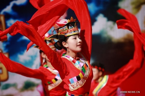
Monpa dance?
Budo, a deputy secretary of Tsona County Communist Party Committee, told the media: “Since the 12th Five-Year Plan was carried out, the economy and culture undertakings of Tsona County have grown by leaps and bounds. The total output value and annual per capita income of four Monpa ethnic townships have increased by 95% and 63% respectively. By the end of 2012, the per capita income of farmers and herdsmen in Legpo had reached 6,424 yuan ( 1,050 dollars), higher than the regional average level.”
To raise the revenue further, Tsona County “is committed to inheriting and promoting the traditional Monpa culture and Tsangyang Gyatso ballads.”
I am not sure what ‘committed in inheriting’ means, but the Communist authorities has stated that they would like the Tsangyang Gyatso Ballad Cultural Tourism Festival to gradually develop “into a grand local gathering integrating art performances, tourism promotion and business negotiation”.
The 1st Tsangyang Gyatso Ballad Cultural Tourism Festival was held in May 2012. The marketing propaganda for the 2nd Festival explains that the area is “centered around magical valley and poetic countryside, beautiful township of Monpa flavor and a holy land of love. It has been widely hailed for offering tourists the simplest folk customs and purest ecological environment.”
Besides the ‘political’ aspect of the festival, the organizers look for tourism promotion, business negotiation and commodity exhibition (sic). Cultural performances with popular ballads and songs are organized as well as “intangible cultural heritage items such as Monpa Akyi Lhamo and Dringking song of Sarma”. The visitors get a bonus by practicing ‘shooting arrows and hitting ox horns’, and sightseeing tours take the vacationers to various scenic spots: “With the clement climate and fertile land, Legpo is celebrated for its snow mountains, sea of clouds, dense forest and magnificent waterfall.”

Monpa costumes
The Chinese authorities also announced that the National Intangible Cultural Heritage ‘Mepa Akyi Lhamo’ and Tibet regional Intangible Cultural Heritage ‘Sarma oenopoetic ballad’ (one of the oldest historical singing performances handed down from ancient times, according to Chinese media, though etymologically it looks as a reference to wine drinking or making or both) performed on the festival. It was reported that the total number of ‘Mepa Akyi Lhamo’ inheritors has reached 16, while ‘Sarma oenopoetic ballad’ only has one inheritor who is an old man in his seventies. This festival is expected to rescue and protect these intangible cultural heritages, according to the Chinese media which explains to the visitors: “In 1683, Tsangyang Gyatso was born in a traditional Monpa family in Tsona. Monpa people are renowned for their singing and dancing down the ages.”
During the festival, the organizers also arrange the visit Tsangyang Gyatso's former residence (after he had left Urgyeling) “while discovering how he grew up, tourists could also learn Monpa people's folk culture, such as daily life, dress as well as vernacular architecture”.
What is happening on the other side of the border, in the Indian district of Tawang?
Despite the Tawang Festival being organized in October, the poor state of the roads and the irregular helicopter’s schedule hamper the Indian and foreign visitors to see the true birth place of Tsangyang Gyatso.
What a pity?

Sunday, October 21, 2012

Ten truths about the 1962 War

Here are some truths about the 1962 China's War which are not often mentioned in history books or Reports from the Government.
Of course, this list is not exhaustive.

1- The precise location of the border
In the Army HQ in Delhi as well as locally in the NEFA, nobody was really sure where exactly the border (the famous McMahon Line) was. It is the reason why the famous Henderson-Brooks report has been kept out of the eyes of the Indian public for fifty years. Till the fateful day of October 20, 1962, the Army bosses in Delhi were unable to tell the local commanders where the border in Tawang sector precisely was? I have earlier dealt with the issue.

2- There was no map
Lt. Gen. Niranjan Prasad, GOC 4 Infantry Division wrote in his memoirs (The Fall of Towang):  “It is hard to understand how any purposeful negotiation could have been conducted with Communist China [in 1960] when even such elementary details as accurate maps were not produced; or, if they were in existence, they were certainly not made available to the Army, who had been given the responsibility for ensuring the security of the border.”
The Army had no map.
There is the story of Capt. H.S. Talwar of the elite 17 Parachute Field Regiment who was asked to reinforce Tsangle, an advance post, north of the Namkha chu on October 16. Without map, he and his men roamed around for 2 days in the snow; they finally landed a few kilometers east at a 2 Rajputs camp (and were eventually taken PoWs to Tibet with Brig. John Dalvi on October 21).

3-  Some troops fought extremely well
Take the example of the 2 Rajputs under the command of Lt. Col. Maha Singh Rikh who moved to the banks of the Namka chu river by October 10 as a part of 7 Infantry Brigade. The brigade was stretched out along nearly 20 kilometers front beside the river. It was a five-day march to walk from an end to the other (the confluence with the Namjiang chu). Not a single man from the Rajputs was awarded any gallantry medal, because there was no one left to write the citations; all the officers or JCOs who were not killed or seriously wounded were taken POWs. Out of 513 all ranks on the banks of the river, the 2 Rajput lost 282 men, 81 were wounded and captured, while 90 others were taken prisoners. Only 60 other ranks, mostly from the administrative elements got back.
Major B.K. Pant of 2 Rajput displayed exemplary heroism while wounded in the stomach and legs. Though his Company suffered heavy casualties, he continued to lead and inspire his men, exhorting them to fight till the last man. When the Chinese finally managed to kill him, his last words were "Men of the Rajput Regiment, you were born to die for your country. God has selected this small river for which you must die. Stand up and fight like true Rajputs.” Ditto for 4 Rajputs under Lt. Col. B. Avasthi in the Sela-Bomdila sector
The Indian troops fought pitches battles in the Walong sector of the NEFA and Chushul in Ladakh where the Chinese were inflicted heavy losses.

4-  A complete intelligence failure
A flamboyant new Corps Commander, Lt. Gen. B.M. Kaul planned Operation Leghorn to ‘evict’ the Chinese by October 10. Kaul took over Corps IV, a Corps especially created ‘to throw the Chinese out’. On his arrival in Tezpur, Kaul addressed the senior officers: “The Prime Minister himself had ordered these posts [near the Thagla ridge] to be set up and he had based his decision on the highest Intelligence advice.” The ‘highest intelligence’ inputs from Mullik turned out to be a sad joke on the 7 Infantry Brigade.
Till the last fateful minute, the arrogant IB Chief, B.N. Mullick said the Chinese would not attack, they don’t have the capacity. Such a blunder!
The Prime Minister himself, at Palam airport on his way to Colombo told the waiting journalists that he had ordered the Indian Army “to throw the Chinese out”. He generously left the time to the discretion of the Army. This was on October 12, 1962, just 8 days before the fateful day. He had received intelligence inputs from Mullik.

5- Chinese spies
Just as today Beijing can hack into any computer system, in Mao’s days, the Chinese intelligence knew everything about Kaul’s and his acolytes’ plans.
The Chinese had infiltrated the area using different methods. In his memoirs, Prasad recalled: “From our own Signals channels I had received reports of a pirate radio operating somewhere in our area, but when we referred this to higher authorities the matter was dismissed: we were curtly told that there was no pirate radio transmitter on our side of the border. Subsequently it was confirmed that the Chinese had indeed sneaked in a pirate transmitter to Chacko (on the road to Bomdila) in the Tibetan labour camp. The aerial of their transmitter was concealed as a tall prayer-flagstaff so common in the Buddhist belt of the Himalayas.”
This is probably how Mao was aware of Operation Op Leghorn.
Some war veterans recall that on the way to Bomdila, there was a dhaba manned by two beautiful ‘local’ girls. All officers and jawans would stop there, have a chai and chat with the girls. It turned out later that they were from the other side.
An informant tells me that when Lt. Gen. Kaul was evacuated from the Namkha chu on October 8, having fallen sick due to the altitude, he was carried pick-a-back by ‘local’ porters. It was later discovered that one of them was a Chinese interpreter in a PoW camp in Tibet. The secrets were out!

6-  Gallantry Awards
The entire operation theater was plunged in deep chaos due to contradictory orders from the Army HQ (Lt. Gen. B.M Kaul, the Corps Commander was directing the Operation from his sick-bed in Delhi). Adhocism was the rule before, during and after the Operations.
To give an example, the GOC, 4 Division was not informed that Subedar Joginder Singh was awarded the Param Vir Chakra for some actions in Bumla (he later died of a gangrenous foot in a PoW camp in Tibet). The awards were decided by Delhi without consulting the local commanders.
An officer who had run away was given the Maha Vir Chakra, the second highest gallantry award. The Government had distributed these lollipops to each regiment to show that everyone fought well.

7- The Role of some Monpas
A senior war veteran, Maj. Gen. Tewari who spent nearly 7 months as a PoW in Tibet wrote: “In Kameng Frontier Division (Tawang) itself, they had many local people on their pay roll. They had detailed maps and knowledge of the area, how otherwise can you explain that they were able to build 30 km of road between Bumla and Tawang in less than 2 weeks?”
According to local Monpas only a few villages sided with  the Chinese under duress (after all they were ‘chinky’ like us, said the Chinese). Tewari recalled: “I was in for a still bigger shock when it was discovered that almost all the secondary batteries had arrived without any acid. I presume that what had happened is that the porters must have found it lighter without liquid and they probably decided to lighten their loads by emptying out the acid from all the batteries.”
It was an indirect collaboration with China, though the majority of the Monpas were rather patriotic.

8- Pensions and Pay
About 500 Indian jawans and officers were taken prisoner in the Tawang sector alone. As Brig. A.J.S. Behl says in his interview: “My family got two telegrams: ‘2nd Lt Behl missing, believed dead’.”
Till the Chinese authorities sent the names of the prisoners to the Indian Red Cross, all those killed and taken prisoners were considered as ‘missing-in-action’ and their salaries were cut.  For no fault of theirs, their wives and families had to manage on their own.

9- Mao’s return to power
In early 1962, Mao was out of power due to the utter failure of his Great Leap Forward. Some 45 million Chinese had died after a 3-year man-made famine. Mao Zedong managed to come back on the political scene in September 1962. If he had not managed to return at that time, the war with India would have probably not taken place. Of course, with ‘if’ many sections of world history could be rewritten, but it is a fact that once Mao’s ideological hard-line prevailed in Beijing, it was difficult to avoid a clash.

10-  The dirty American Role
Averell Harriman, the US Assistant Secretary of State and Duncan Sandys, the British Secretary for Commonwealth Relations visited India on November 22, 1962. This was the day China declared a unilateral ceasefire in the war with India. The visit was supposedly to assess India’s needs to resist Communist China; but both envoys “made clear their governments' willingness to provide military assistance to India but pointed out the related need for negotiations to resolve the Kashmir dispute.”
A clear signal was given to India who had hardly recovered from the blackest month of her history: she had to compromise on Kashmir.
Consequently six rounds of talks between India and Pakistan were held to find a solution for the vexed issue, but to no avail. However, Ayub Khan, the Pakistani President, must have taken the Western intervention as an encouragement for his claim.
The Kennedy and later the Johnson Administrations thought of ‘re-balancing’ the assistance to Pakistan, with the condition that India should accept to ‘settle’ the Kashmir issue.