Showing posts with label Aksai Chin road. Show all posts

Thursday, March 12, 2020

Krishna Menon’s Aksai Chin error

Chinese Memorial to those who died during the construction of the road
My article Krishna Menon’s Aksai Chin error appeared in The Mail Today and DailyO


Here is the link...

Menon was one of the strangest characters to have appeared on the political scene after independence.

During a recent visit to the national capital, as I was approaching the Central Secretariat in Lutyens’ Delhi, I passed a majestic statue of perhaps the most controversial Indian politician since independence. I could not help but wonder why India still honours someone who brought so much disrepute to the nation, particularly as defence minister between 1957 and 1962.

Legacy of a debacle
Though a well-researched book on Krishna Menon was published recently, the author did not elaborate on the implications of having the wrong person, at the wrong place in the years preceding the India-China border war.
Menon was one of the strangest characters to have appeared on the political scene after independence. PK Banerjee, the Indian chargé d’affaires in Beijing in 1962, who often encountered the arrogant politician, wrote in his memoir: “Krishna Menon’s appearance in the Indian political arena was as sudden as it was unexpected... He was enrolled as a barrister. He hardly had any legal practice …[but] became a protégé of Palme Dutt, a lawyer and founder member of the British Communist Party.”
A friend of India’s then Prime Minister, Menon soon became Indian High Commissioner in the UK and, in April 1957, he was appointed the defence minister: “In addition, for all practical purposes, he functioned as foreign minister de facto,” noted Banerjee. Menon was certainly brilliant in many ways, but 63 years later, India still suffers because of Jawaharlal Nehru’s mistaken choice. One of the many blunders that he committed was to post his favourites in positions where they should never have been; this eventually led to the resignation of the then Chief of Army Staff, General KS Thimayya. He also messed up the Aksai Chin issue.
Let us go back to the early 1950s. After the People’s Liberation Army entered Lhasa, the Chinese made plans to improve communications and built new roads on a war-footing. The only way to consolidate and ‘unify’ the Middle Kingdom was to construct a large network of roads. One of these roads was the Tibet-Xinjiang Highway (today infamously known as the Aksai Chin road). The first surveys were done at the end of 1951-52 and construction began in 1953. The official report of the 1962 China War prepared by ministry of defence gave a few examples showing that the construction of the road cutting across Indian soil on the Aksai Chin plateau of Ladakh was known to the Indian ministries of defence and external affairs, and this long before it was made public.

A daring mission
In early 1957, the Army selected an officer to go with a patrol and physically confirm the reports that China was building a road in the Aksai Chin area; the officer was Lt Col RS Basera of 1 Kumaon Rifles. Later, in a note Basera’s son wrote: “His mission was to be tough, exciting and most unique, as he had to proceed under cover to the vast plateau of Aksai Chin and confirm reports that the Chinese were constructing a motorable road from Kashgar to Lhasa.” Disguised as a yak herder, Basera was accompanied by Havildar Diwan Singh from the Corps of Engineers. They were to move with three genuine Ladakhi yak herders. During a briefing at the Headquarters in Leh, Basera was told that it was crucial to maintain utmost secrecy about the mission.

The Military Intelligence (MI) instructed them not to carry any documents that could disclose their identities, no notes should be taken. They were asked to memorise the map and the route: “They had to move in the easterly direction from Leh for about 250-300 km, till they reached the expected location of the new Chinese built road, in Aksai Chin. Initially, they would pass over difficult, undulating terrain, till they crossed the Karakoram Mountain Range and Shyok River,” wrote Basera’s son. Their mission was of national importance, said their handlers in the MI. After a long and adventurous journey, they finally entered Aksai Chin. On the third day, one of the herders suddenly pulled Basera's shoulder and showed him a dark line on the horizon; it was the road. The next morning, they walked in the direction of the road: “The otherwise sluggish yaks too moved forward with renewed energy, matching the sudden spring in the step of their handlers!”

Spanner in the works
At noon, they were now near the raised road, they mentally noted every detail of the road that was not yet tarred. They immediately decided to return and inform the authorities of their discovery. They were asked to report in Delhi. “At the end of the day they were told by a Lt Col from MI, that their report would be sent to defence minister Krishna Menon, who would then discuss it with the PM.”
According to the report written by Basera’s son, “the defence minister surprisingly supported the Chinese side, and even called it a friendly neighbour. He asked the MI director, if the area through which the road passed had been confirmed on a map.
The DMI told him the patrol had not carried a map for security reasons.” But that was not all, the Prime Minister and the defence minister, “more or less rebuked the DMI for sending the patrol. The PM told the defence minister that no more such patrols were to be sent to Aksai Chin till the matter had been thoroughly investigated,” as such patrols could easily vitiate the good relations between friendly neighbours.
When he was given the report, Lt Col Basera felt utterly disgusted: “The long and difficult patrol they had undertaken, now appeared to have been a futile, month-long exercise.” The greatest tragedy is that there must be hundreds of such files, but they are still buried in the almirahs of South Block. Does it help India to hide its own history?

Thursday, May 17, 2018

Why India needs to keep a tab on the new silk road

My article Why India needs to keep a tab on the new silk road appeared in Mail Today/DailyO

Linking Xinjiang to south Asia seems to be a new dream for the leadership in Beijing.

Here is the link...

After focusing for years on Lhasa and southern Tibet, Beijing has decided to invest in the development of western Tibet, known as the Ngari Prefecture of the Tibetan Autonomous Region (TAR). Despite the 2015 Nepal earthquake which delayed the building of infrastructure in the area, particularly the railway line Lhasa-Kyirong at the Nepal border, the work has now started at an accelerated pace.

Economic angle
One project which could have serious strategic implications for India is the extension of the National Highway G216 from Xinjiang to Kyirong landport; linking Xinjiang to south Asia seems to be a new dream for the leadership in Beijing. Though technically it is a formidable challenge to cross the Kunlun range, the Chinese engineers are determined to implement the scheme.
This could also have immense economic consequences as it may become the main conduit of a new Silk Road from Central Asia to Nepal and South Asia. Has India been taken into the loop when Prime Minister Narendra Modi "informally" met the Chinese president recently? It is doubtful.
Meanwhile, western Tibet develops fast. In January, VTIBET.com reported that the Ngari prefecture received over 6,60,000 visitors in 2017. The statistics released by the Ngari Tourism Bureau website said that it was a 20 per cent growth compared to the previous year. Even the revenue increased.
“The tourism revenue totalled about 750 million yuan, up by 10 per cent over the same period last year.” The website cites the prefecture’s marvels: the Kailash Manasarovar area, the ruins of the former Guge Kingdom and the Tholing Clay Forest — all located in Ngari Prefecture.
Last month, Radio Free Asia (RFA) announced that the Chinese authorities have seized farmland in Lhatse to build a new airport, “displacing Tibetan villagers and offering far less in compensation than the land is worth”. RFA argued that the land belonged to Yushang village in Shigatse prefecture’s Lhatse county.
Apart from the deprivation of the land, the news item shows that in the years to come, Western Tibet could become the new economic and touristic hub and, of course, an important strategic centre for the defence of China’s borders. The opening of a new airport should be seen in this perspective, though the rapidly increasing trade with Nepal shouldn’t be ignored.
According to Tibet Business Daily, the total value of Tibet’s foreign trade exceeded 5.8 billion yuan (nearly Rs 6,700 crore) in 2017. “The domestic economy has been steadily improving, and the demand for international market has generally recovered,” noted the daily.
Nepal is the main recipient of Tibet’s exports. In April, Nepal’s foreign minister, Pradeep Gyawali, visited Beijing. After meeting vice-president Wang Qishan and his Chinese counterpart Wang Yi, he spoke of “expediting past agreements, developing trans-Himalayan multidimensional transport network and building a China-Nepal-India economic corridor.”
Gyawali noted that China is Nepal’s genuine friend and a trusted ally. “We should build on the excellent roots of civilisational, geographical and cultural affinities to further connect our countries and societies.” This new civilisational bond between China and Nepal explains the need of a new airport in Lhatse.

Difficult terrain

China Tibet News Network mentioned another megaproject, the "extension" of the G216 Highway which, according to the article, will end in Kyirong. What does the extension of G216 mean?
In 2016, a "Public Announcement for the Environmental Impact Assessment (EIA) of G216 (Tibet Area)" was made. The original 857-km-long highway starts from Altay City in northern Xinjiang and ends in Baluntai (in Hejing County). It will now be extended via Minfeng and Keryia in southern Xinjiang to western Tibet and Nepal.
Needless to mention the immense technical challenge to cross the Kunlun range between Keryia and Rutok where the road will join the G219 or Aksai Chin road. To give an idea, Keryia is located at 1,459m sea level, while Lake Lighten on the plateau is at 5080m (a 3,500m climb in less than 200km). It is perhaps the most difficult terrain in the world.

Crazy dream

The last section of the "extended" G216 (towards Nepal) will have a length of about 94km; the geological conditions are complex, said a Chinese website: “After experiencing the May 12, 2015 earthquake in Nepal, the geological conditions are even more unpredictable. The original roads at the Kyirong Port have been seriously damaged, and the subgrade has subsided in some sections.”
The main bridge in this section is said to have collapsed “and the road surface was broken and cracked.” Kyirong is located 24km away from the Nepal border; it is now the main channel for land trade between China and the former kingdom.
Due to the earthquake, the railway line between Shigatse and Kyirong has been delayed by at least three years. After the earthquake, one section of the G216 slipped and is no longer accessible. The road from Kyirong to the border with Nepal is only a dirt road. “When the rainy season arrives, disasters such as landslides and mudslides are frequent.”
The point remains that if the terminal section of G216 towards Kyirong is difficult, it is nothing compared to the section which will try to cross the Kunlun range, north of Lake Lighten. One more crazy dream of the rulers in Beijing?
Or a visionary project in view of the importance of having a second Xinjiang-Tibet highway (after the Aksai Chin road built in the early 1950s)? Could it be a true New Silk Road linking Central Asia to South Asia via Nepal? It is difficult to say today. The engineers have to cross the Kunlun first. India should watch the developments.

Monday, June 19, 2017

The Tibet Recipe, a New Airport in Xinjiang

Xinhua announced yesterday the construction of a new regional airport in Xinjiang.
It will be built in Yutian, a remote County of Hotan/Khotan Prefecture in Xinjiang Uygur Autonomous Region (XUAR). Yutian is also known as Keryia.


Already in 1953
On July 15, 1953, a CIA note dealing with “Chinese Communist Troops, West Tibet” and “Road Construction, Sinkiang to Tibet and Ladakh” mentioned that late 1952, the 2 Cavalry Regiment, commanded by one Han Tse-min, had set up his headquarters at Gartok (the main trade centre in Western Tibet).
It announced that the regiment had 800 camels and 150 men garrisoned at Rutok, in the vicinity of the Panggong lake.
At that time, the 2 Cavalry’s commandant spoke of the Chinese intention to built three new roads in the area.
  • A road from Rutok to Keriya, south of the Taklamakan desert (the construction is ‘contemplated’ says the report); on the eastern edge of the Aksai Chin.
  • A motorable road from Khotan to Suget Karaul ending at Vanjilga (at the western end of the Aksai Chin).
    It later became the Aksai Chin road (now National Highway 219), though the alignment may have been slightly different from the present one as it was then probably impracticable for heavy vehicles (only 4 years later, heavy trucks were able to ply on the road).
  • A road from Khotan (or Hotan) to Rutok to be completed in June or July 1953. 
Though the road between Rutok and Keriya was never completed, the Chinese engineers never dropped the project.The main difficulty is to cross the Kunlun range, south of Keriya
In December 2016, I mentioned on this blog the construction of a new road linking Xinjiang and Tibet. National Highway 216 (G216) runs in the XUAR in the southern direction from Altay City to Baluntai in Hejing County, where it joins China National Highway 218. It is 857 kilometres in length.
The starting point of this project is the Jieze Lake near the G 219 highway (north of Rutok). The road will be built “in accordance with the two-lane highway construction,” asserted then a Chinese report.

New airport planned in Keriya
In this context, and in view of the proximity of the Indian border, it makes sense for China to have a new ‘civil’ airport at Keriya (Yutian is the Chinese name), considering that there is no such thing as a 'civil' airport in China, especially so close to the Indian border (Aksai Chin).
Keriya airport is designed to annually handle 180,000 passengers and 400 tonnes of cargo; it will cost 104 million US dollars and witness more than 2100 annual take-offs and landings every year.
The airport will have a 3,200-meter runway, a 3,000-square-meter terminal building, four aprons, and facilities for air traffic control and power, water, heat and fuel supplies, says Xinhua.
The project has been cleared by the National Development and Reform Commission (NDRC) and the Civil Aviation Administration of China and announced by the regional NDRC.
The Yutian/Keriya County, located south of the Taklimakan Desert, and north of the Kunlun range, covers 39,500 square kilometers and has 277,400 permanent residents.
It is a major stop over on the ancient Silk Road (OBOR), according to the Chinese news agency. The nearest airport, in Khotan/Hotan City, some 200 km away and north of the disputed Aksai Chin.
Interestingly, Yutian airport is one of 10 new airports to be built in Xinjiang by 2020.
Six older airports will also be soon renovated and expanded.

The Tibet recipe

At the end of August 2016, Wu Yingjie took over as Party Secretary of the Tibetan Autonomous Region (TAR) from Chen Quanguo who was sent to ‘pacify’ Xinjiang. The decision had been taken during the annual closed-door meeting at Beidahe.
An official statement released had then announced that Zhang Chunxian would be replaced by Chen Quanguo as secretary of the XUAR’s Committee of the Communist Party of China (CPC).
This was indeed a promotion for Chen, given the fact that Xinjiang's Party Secretaries often serve in the Politburo (though Chen will have to wait until the 19th Party Congress later this year to find out if he has made it).
His selection was linked to the Tibet recipe, the way Chen managed to ‘pacify’ Central Tibet.
There is no doubt that Chen will apply the same formula in Xinjiang: bring millions of tourists and ‘dilute’ the Uyghur characteristics.
The 10 new airports, particularly the new one in Keriya/Yutian have to be seen in this perspective.

Tuesday, February 28, 2017

The closure of the Indian Consulate in Kashgar

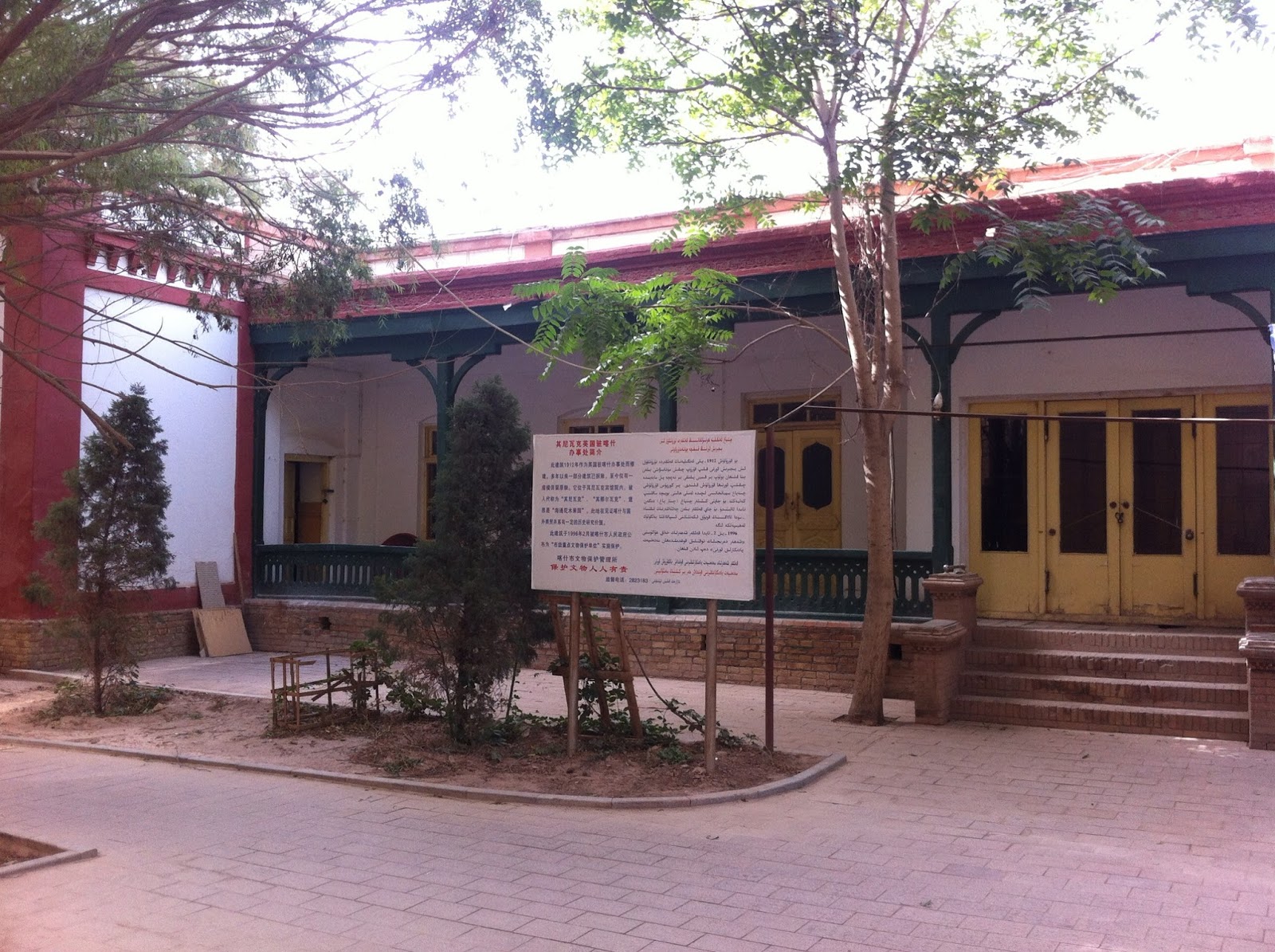
Indian Consulate in Kashgar (now a restaurant)
Historians rarely mention an event which had the most serious strategic consequences for India; it is the 1953 closure of the Indian Consulate in Kashgar in Xinjiang, formerly Eastern Turkestan.
The Indian government was then not ready to read beyond the Chinese rhetoric and Zhou En Lai’s assurance of ‘eternal’ friendship; the closure of the trade with Xinjiang should have been seen as an ominous sign. It was not to be.
As in several other cases, Nehru tried to justify the Chinese diktats, without taking any retaliatory measures or even protesting. India’s interests were lost to the ‘revolutionary changes’ happening in China.
In December 1953, Nehru declared in the Parliament: “Some major changes have taken place there [Kashgar]. …But when these changes, revolutionary changes took place there [we had to close our Consulate], it is perfectly true that the Chinese Government, when they came to Tibet, told us that they intended to treat Sinkiang [Xinjiang] as a closed area.”
India agreed to close its Consulate without even a discussion.
India had been trading with Central Asia and more particularly Kashgar, Yarkand or Khotan for millennia. Just because ‘revolutionary changes’ had occurred in China, Delhi accepted the closure of the trade with Xinjiang as a fait accompli. At that time, the Karakoram Pass was still witnessing a large numbers of caravans, trading between Kashmir and Central Asia.
A few months later (April 1954), instead of using the opportunity of the negotiations for the Panchsheel Agreement to clarify the contentious border issue and the closure of the trade, the Chinese were allowed to walk away with making a vague statement. It was indeed a great victory for Beijing.
The main reason for wanting India to close the Kashgar Consulate was that China was building a road across the Aksai Chin area on Indian territory.
The Communists did not want any witness. The Government of India never acknowledged it, but it had information about the Aksai Chin road as early as 1954-55. So did the Central Intelligence Agency (CIA) which recently released several lakhs of historical documents.

A CIA note
A couple of Information Reports dating from 1953 bring some light on the issue. On July 15, 1953, a note deals with “Chinese Communist Troops, West Tibet” and “Road Construction, Sinkiang to Tibet and Ladakh”. It says that late 1952 the 2 Cavalry Regiment, commanded by one Han Tse-min, had set up his headquarters at Gartok (the main trade centre in Western Tibet). It mentions that the regiment had 800 camels and 150 men garrisoned at Rutok, in the vicinity of the Panggong lake, shared with Ladakh.
The same report affirms that another PLA’s regiment is stationed on the Tibetan side of the Tibet-Ladakh border, opposite Koyul in the Indus Valley in Ladakh. According to the US document, the 2 Cavalry’s commandant announced the Chinese intention to built new roads in the area.
  • A road from Rutok to Keriya, south of the Taklamakan desert in Xinjiang (the construction is ‘contemplated’ says the report); on the eastern edge of the Aksai Chin.
  • A motorable road from Khotan to Suget Karaul ending at Vanjilga (at the western end of the Aksai Chin)
  • A road from Khotan (or Hotan) to Rutok to be completed in June or July 1953.
The second road is clearly the Aksai Chin road (now National Highway 219), though the alignment may have been slightly different from the present one and it was then probably impracticable for heavy vehicles (only 4 years later, heavy trucks were able to ply on the road).
The Hindi-Chini bhai-bhai wave (or was it a tsunami?) was most likely too strong and Nehru’s collaborators (BN Mullick, the IB Chief in particular) had ‘more important’ subjects to deal with than a road!
The local Chinese commander Han Tse-min asserted that “when these roads were completed, the Chinese Communists would close the Tibet Ladakh border to trade.” It is what they did soon after the signature of the infamous Panchsheel Agreement. Worse, the CIA document says that Han declared that “the Chinese Communists in Sinkiang [Xinjiang] were telling the people that Ladakh belongs to Sinkiang.”
Ten days later, another CIA note detailed the trade between Ladakh and Xinjiang, giving the coordinates for each place: “The Tibetan traders who visit Leh, are from the Chang Tang area, an arid plateau region in northern Tibet [plain between Xinjiang and Tibet] …These traders follow the Chushul [in Ladakh] route from Tibet to Leh. Border check posts on this route are at Chushul and Koyul.”
This shows how flourishing the trade was in 1953 …for a few months more. All this ended once the Aksai Chin road became fully operational.
The CIA remarks: “The only Chinese in northwestern Tibet are the Chinese Communist troops, seven or eight hundred of whom are stationed along the Tibet-Ladakh border. They first appeared in northwestern Tibet in 1951, having come from the Khotan.”
The CIA papers tend to prove that the Indian Government knew about the Aksai Chin road much earlier that thought, but it only became official on October 6, 1957, when a Chinese newspaper, Kuangming Jihpao reported: “The Sinkiang-Tibet – the highest highway in the world – has been completed. During the past few days, a number of trucks running on the highway on a trial basis have arrived in Gartok in Tibet from Yecheng in Xinjiang [near Yarkand]. The Xinjiang-Tibet Highway… is 1179 km long, of which 915 km are more than 4,000 meters above sea level; 130 km of it over 5,000 meters above sea level, with the highest point being 5,500 meters.” The reporter spoke of: “thirty heavy-duty trucks, fully loaded with road builders, maintenance equipment and fuels, running on the highway on a trial basis” heading towards Tibet. The Aksai Chin road was officially opened.
It should have been obvious  for everyone, even for the blindfolded Intelligence Bureau Director, B.N. Mullick, that India’s Kashgar Consulate had been forced to close to hide the fact that the Communists were building a road on Indian soil; still, the government took nearly two more years to make the news public in India.
In recent weeks, one question has often been raised by Indian think tanks: should India participate in the new trade routes initiated by China?
Apart from the fact that nobody dares to question the viability of such a project, after all it is part of President Xi Jinping’s Dream of a ‘Revitalized China’ for which he has envisioned a mega “One Belt, One Road” (OBOR) project to connect Asia (read China) with Europe and Africa via the ancient trading centres of Central Asia and Eastern Europe, a modern Silk Road.
However, at the same time, all the ancient trade routes between India and Central Asia remain closed.
The time has perhaps come for India to ask China to reopen the Consulates in Kashgar and Lhasa, then India could sincerely participate in the Belt and Road project.