My article Tibet Infrastructure: new panacea for the Middle Kingdom? appeared in The Indian Defence Review.July 1, 2006 witnessed a tsunami of change on the Tibetan high plateau, the first train arrived in Lhasa.
It was perhaps the most radical transformation since the People’s Liberation Army (PLA) crossed the upper reaches of the Yangtze river and entered eastern Tibet on October 7, 1950.
On October 31, 2018, China Daily reported that the Qinghai-Tibet Railway had been a driving force of Tibet's growth. The Communist Party’s mouthpiece explained: “Since its opening in 2006, the Qinghai-Tibet Railway has been serving as an important driving force for the economic development of Tibet. Linking Xining and Lhasa, capital cities of northwestern Qinghai province and southwestern Tibet autonomous region, the railway, 1,956 kilometers long, is the region's first railway in history.”
According to the Qinghai-Tibet Railway Company, during the last 12 years, the railway has transported 182 million passengers and 552 million tons of goods.
China Daily run by the Publicity Department of the Communist Party of China affirmed: “The railway is known as a ‘sky road’, because it is built at the highest altitude and is the longest railway sited on a high plateau. As a result, the geographic conditions brought many challenges, including the high altitude and lack of oxygen, to the operation of the railway.
As a result of the opening of the rail line, the TAR's GDP rose from 24.88 billion yuan ($38 billion) in 2005 to 131.06 billion yuan in 2017. This growth is generally attributed to the railway. It brought a tremendous change in strategic terms too.
Dual Use of InfrastructureTo understand the importance of the infrastructure on the plateau, one has to look at the civil-military integration or dual-use of infrastructure. In 2015, Xinhua first mentioned that the joint civil-military development of airports would “strengthen aviation safety and combat support capabilities."
A joint statement from the People Liberation Army Air Force (PLAAF) and General Administration of Civil Aviation (CAAC) explained that the integration would include joint maintenance of airport support facilities, joint flight safety support and joint airport management.
Interestingly, the Lhasa Gongkar Airport in Tibet and Sunan Shuofang International Airport in Wuxi in Jiangsu province were the first two pilot airports to implement the 'integration' in China.
It was done during the second half of 2015. The PLAAF/CAAC circular further affirms that "All the civil-military airports will conduct strengthened integration next year."
Work Forum and StabilityDuring the 6th Tibet Work Forum in 2015, the top Chinese leaders discussed economic and social development in Tibet, and how to ensure the autonomous region achieve prolonged stability." The statement of the Politburo of the Central Committee of the Communist Party of China (CPC) further noted: "Safeguarding national unity and strengthening ethnic unity should be highlighted in work involving Tibet."
It added that: "Efforts should be made to unswervingly carry out the anti-separatism battle, promote the region's economic and social development, safeguard and improve people's welfare, and enhance exchanges and integration of different ethnic groups."
The Politburo (or probably an extended Politburo) agreed that "strengthening Tibetan infrastructure, helping it foster competitive industries while ensuring environmental protection are the means to achieve marked improvement in living conditions and more social cohesion," these were the priorities for the restive region.
The PLA/Civil integration pertains not only to the airports, but the entire infrastructure setup in Tibet should be seen in the perspective of consolidating China’s presence on the plateau; in other words, 'to stabilize the borders'.
New Railway on the PlateauIn September 18, 2018, an article in Xinhua dealt at great length about the ‘LaLin’ section of the Sichuan-Tibet Railway. ‘Lalin’ is a short form for Lhasa-Linzhi railway .
The news agency reported that China Railway’s 11th Bureau had successfully laid the first group of ballasts for the Gonggao station, a new station in the railway line: “thus created the traffic conditions for the passage of the Lalin Railway.”
Liu Jun, the Secretary of the Lhasa-Nyingchi Project told the agency that the Sichuan-Tibet Railway was a key project of the National 13th Five-Year Plan: “Upon completion, it will become another railway artery connecting the plateau with the mainland.”
The ‘Lalin’ section is an important section of the Sichuan-Tibet Railway; this part is relatively easier to build than the eastern part (Nyingchi-Chengdu).
It will have a total length of 435 kilometers with 34 new stations, out of which 17 already exist. It will start in Lhasa and the terminus wil be at Nyingchi City and follow the Yarlung Tsangbo River .
The construction of this section started at the end of 2014; it will take some seven years to complete the entire project and the speed of the train will be 160 kms/hour; it will be the first electrified railway in Tibet.
The Railway line will cross the Yarlung Tsangpo 16 times. The railway bridges use large-span bridge structures: “The mountains are high in water depth, the rivers are rushing, the technology is special, and the construction is extremely difficult. There are 14 high-risk tunnels out of 47 tunnels, of which 7 are extremely high-risk tunnels,” explained China Railway's 11th Bureau.
Shen Yubin, a project manager for the China Railways Lhasa-Nyingchi Railway Second Division affirmed: “The total length of bridges and tunnels on the Lhasa-Nyingchi Railway is 331 km, 75% of the total distance of the line. Of these, there are 120 bridges totaling 84 km, which accounts for 21 % of the length of the line. As a single-track railway, there have been difficulties in construction and logistics transportation while building the Lhasa-Nyingchi Railway.”
To show the difficulty of the project, Shen added: “We have also encountered unique geographical, climatic, and environmental situations, which have brought unique challenges to the beam-laying process."
V
isit of Premier Li KeqiangAt the end of July 2018, Li Keqiang, the Chinese Premier visited a construction site of the Lhasa-Nyingchi railway.
Li stressed the importance of the project for Tibet’s development: "The railway project is beneficial for Tibet to cultivate new growth drivers, and it is the right thing that must be done. Full construction work should be accelerated," Li said.
He added that "at present, infrastructure development in the country's central and western regions is relatively weak, and promoting effective investments to improve weak links will not only narrow the gap in regional development but also be helpful for the country to cope with economic downturn.” He further observed: "China should avoid strong stimulus and take targeted measures that are beneficial in both short and long terms."
Many more railway lines are planned on the plateau.
A map of future railway linesInterestingly, on a map found on a Pakistani website accompanying one of these articles, not only the ‘Lalin’ railway line is prominently displayed, but several new lines are shown reaching the plateau. They are worth noting:
• The Lhasa-Shigatse-Kyirong section which should be completed in a couple of years (it was delayed due to the 2015 Nepal Earthquake)
• The Lhasa-Yatung section reaching the Chumbi Valley and the Indian border in Sikkim. It has serious strategic implications for India, especially after the Doklam episode. Though it is rarely mentioned in the Chinese press, it is clearly on the cards (it is not in dotted lines)
• The projected Yunnan-Tibet railway line which has special strategic implications for India too, particularly for the border in Arunachal Pradesh (in a dotted line). It will join the Sichuan-Nyingchi line somewhere near Chamdo.
• Korla-Golmud is already under construction. It will be the second major railway line linking Qinghai province to Western Xinjiang.
• The Shigatse-Rutok-Kashgar line (in dotted line). It may follow the G219 Highway (known as the Aksai Chin road). Will India protest if China starts building a railway on its territory?
• A new Qiemo-Korla line across the Taklamatan desert. An extension of G216 Highway is under construction. It should be following the highway.
• The Khotan-Quiemo line in Xinjiang. It will link up with the Khotan-Kashar line. It is probably important for the totally unstable Muslim province, in order to ‘stabilize’ southern Xinjiang and build new model villages/town along the line.
• The Khotan-Tashkurgan line, leading to the border with Afghanistan.
Tashkurgan has historically been part of the Silk Road. “Major caravan routes converged leading to Kashgar in the north, Yecheng to the east, Badakhshan and Wakhan to the west, and Chitral and Hunza to the southwest” says Wikipedia.
• A never seen-before project to link Chengdu in Sichuan to Golmud in Qinghai. It will close the loop linking the two provinces on the West and North of the Tibetan plateau and link up Xinjiang through the above-mentioned Golmud-Korla line.
But the plans are not restricted to the railway.
New RoadsIn October 2017, the Lhasa-Nyingchi High Grade Highway was opened for trial operations. Quoting from the TAR’s transportation department, Kangba TV reported: “except Songduo Tunnel and Milashan Tunnel , Lhasa-Nyingchi High Grade Highway has been well prepared and begins trial operation from October 1.” The four-lane Lhasa-Nyingchi High Grade Highway is 398 km long; it is designed for a 80 km/h speed.
According to the Chinese media: “The operation of Lhasa-Nyingchi High Grade Highway shortens the travel time between Lhasa and Nyingchi from 10 hours to four hours, which can greatly improve the traffic condition of the golden tour line as well as boost local economy development.”
The train on the same route should follow in some years from now.
Also part of the Lhasa-Nyingchi Highway, China has built a Lhasa-Lhoka (Shannan) Express Line (Highway).
On March 6, 2017, China Tibet News published some pictures of workers on the Lhasa-Lhoka Express Line driving an engineering vehicle. The news agency commented: “At present, the Lhasa-Shannan Express Line project goes well. This project started on August 26, 2016. The whole line is 48 kilometers with bidirectional four roadways. [It is] designed speed is 80 kilometers per hour. The project can not only bring the benefits of development to both Lhasa and Shannan, but also has a positive significance to improving people’s livelihood and driving the accelerated development of the whole region’s economy industry chain.”
The highway will serve the Indian border, particularly north of the Tawang sector; it will run in parallel to the railway line and have dual use.
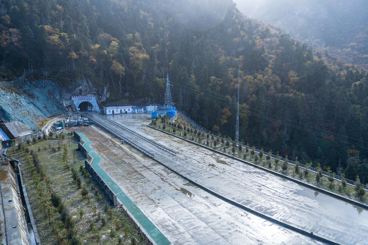
The Rongme Ngatra tunnelAnother tunnel project, termed as the world's highest highway tunnel, was opened to traffic in 2017; this time in Sichuan province on the Nyingchi-Chengdu section. The China Daily wrote: “The Que'ershan Tunnel, stretching 13 kilometers on National Highway No. 317, at Ganzi in Sichuan province, opened to traffic on September 26, 2017. It is said to be the world's highest tunnel on a highway. The tunnel, whose highest point is 4,378 meters above sea level, was completed 15 years after the launch of the project.”
According to the press release: “With the opening of the tunnel, it takes only 10 minutes to pass through the perilous and steep Que'ershan Mountain that stands 6,168 meters above the sea level. The project is projected to become a new impetus to help drive the economic and social development of the remote Tibetan region.”
Each of the tunnels represents a remarkable technological feat.
The Tibet-Nepal RoadOn August 29, 2017, the Kyirong-Nepal border post was reopened for foreign travelers. Located in the Kyirong County, Shigatse City , Kyirong border post is a vital landport between Tibet and Nepal. Kyirong border is located 85 km away from Nepal's capital Kathmandu; from China-Nepal highway section, Kyirong docking distance is only about 30 km.
According to the article, the National Highway No. 216 will end in the Kyirong county, near the Nepal border.
Incidentally, the G318 ends up in Zhangmu, the other landport between Nepal and Tibet which runs from Shanghai to Zhangmu. It is China’s longest National Highway at 5,476 kilometres before reaching Tibet; a 115 km long Araniko Highway then connects Zhangmu to Kathmandu.
The Mythic G216 HighwayWill the extended G216 be a reality one day?
The G216 would start in Northern Xinjiang, from Altay City to Baluntai (in Hejing County); the 857 kms highway would be extended to Southern Xinjiang (Keryia) and later Western Tibet; needless to speak of the immense technical challenge to cross the Kunlun range between Keryia and Rutok (joining the G219 or Aksai Chin road). Keryia in South Xinjiang is located at 1459 m above sea level (asl), while Lake Lighten on the plateau is at 5080 m asl (a 3,500 m climb in some 200 kms!).
The last section of the ‘extended’ G216 (towards Kyirong) would have a length of about 94 kilometers; the geological conditions are complex, said the website: “After experiencing the ‘May 12 2015’ earthquake in Nepal, the geological conditions are even more inestimable. The original roads at the Kyirong Port have been seriously damaged, and the subgrade has subsided in some sections.”
The main bridge in this section is said to have collapsed “and the road surface was broken and cracked.”
The town of Kyirong is only about 24 kilometers away from the Nepal border; it is today the main channel for land trade between China and Nepal.
The point remains that if the terminal section of G216 towards Kyirong is ‘difficult’, it is nothing compared to the section which will try to cross the Kunlun range, north of Lake Lighten. Is it another mad dream of the Emperor in Beijing? Is Beijing dreaming of a New Silk Road linking Central to South Asia via Nepal? Difficult to say today ...the engineers have to cross the Kunlun first.
Gongkar Airport in LhasaWe should not omit the airports.
This year, the Tibetan capital city received a record 4 million passengers according to the Civil Aviation Administration of China’s Tibet office; the passenger volume at Gongkar Airport, the largest airport in the TAR, exceeded 2 million in 2013, and 3 million in 2016.
Tibet’s civil aviation industry has witnessed a quick development thanks to the application of new technologies since the country's reform and opening-up four decades ago, noted the Chinese media.
Tibet now has 10 airlines operating a total of 81 routes, enabling convenient connections between Tibet and most of the major cities in China, according to CAAC. It is estimated that the airport will see 4.3 million passengers by the end of 2018.
New terminal opens at Nyingchi airportIn March 2017, Xinhua announced the second-largest airport terminal in Tibet has started its operations in Nyingchi: “The new terminal, the sixth to open in Tibet, is located at Nyingchi Mainling Airport. It covers an area of 10,300 square meters and will be able to handle 750,000 passengers and 3,000 tons of cargo annually by 2020.”
Nyingchi is located at an average elevation of 2,950 meters above sea level.
Xinhua says: “The city has attracted more visitors in recent years thanks to tourist attractions such as its peach blossom festival.” More than three millions according to Chinese statistics.
Incidentally, the Bayi Township, owned by the PLA and located nearly, is served by the same airport. The Indian border will be well-serviced …in case!
Three New Airports in TibetOn June 9, 2018, the CAAC and the TAR government announced that Tibet would soon have three new airports. The announcement came during a Conference held in Lhasa on June 8. A communique stated: “Construction of the three airports, all above the altitude of 3,900 meters, should begin in 2019.” Xinhua gave the official rationale: “Tourist travel will be more convenient, and economic development in Tibet's agricultural and pastoral areas will also be assisted.”
The Chinese-language press provided more information about the location of the three airports; one will be located in Lhuntse in Lhoka (called Shannan by the Chinese) area, north of the Upper Subansiri and Tawang districts of Arunachal Pradesh, the second will be between Tingri and Lhatse counties of Shigatse City, north of Zangmu, the border post with Nepal, and the last in Purang, near the trijunction Nepal-Tibet-India, north of Pittoragarh district of Uttarakhand (on the yatris’ route to Mt Kailash).
While Tingri airport is near the Nepali border, the two other (Lhuntse and Purang) are at a short distance from the Indian border.
The airports should be completed in 2021; by then, there will be eight airports in the TAR (plus three close to the Indian border in Xinjiang, i.e. Kashgar, Hotan and Yarkand).
The news agency added: “At present, the preparatory work for the three airports is underway. The preferred sites have been determined, and the construction of temporary weather stations at each site is completed.”
The three airports will be high altitude airports; they will be operated by companies including Air China, China Eastern Airlines or Sichuan Airlines already involved in Tibet.
One has to understand Xi’s plans for Tibet. The ‘core’ leader had declared: “Govern the nation by governing the borders; govern the borders by first stabilizing Tibet; ensure social harmony and stability in Tibet and strengthen the development of border regions.”
Over last few years, the authorities in Tibet have started implementing the emperor’s theory, while the Party’s propaganda is doing its best to entice the local Tibetan population to side with the Communist Party. This is a serious development, unfortunately largely ignored in India.
The protectors of the sacred homeland and the builders of happy homesIt is necessary to say a few words about a related development on the border: The Xiaogang model villages.
This new development is often mentioned in the speech of the TAR’s local satraps; it is said that the inhabitants of China’s borders (with India) will be “the protectors of the sacred homeland and the builders of happy homes.”
It has taken a concrete shape with the mushrooming of new ‘model’ villages and towns on the Tibetan side of the Indian border, mainly north of Arunachal Pradesh; officially, the scheme is linked with ‘poverty alleviation’, but also ‘defence of the borders’. These model villages are called Xiaogang, moderately well-off.
It has another connotation. The 40th anniversary of “China's reform and opening up” celebrated across China in 2018 put a great emphasis on an event which took place in 1978, when 18 farmers in Xiaogang village, in Anhui Province, signed a secret agreement to divide collectively-owned farmland into individual pieces and drop the collectivization of the Great Leap Forward (GLF), which between 1958 and 1960 resulted in some 40 million casualties; in Xiaogang itself, 67 villagers out of 120 had died of starvation between 1958 and 1960.
Forty years later, the name Xiaogang is been used for a different project, which should worry India: the building of a large number of ‘model’ villages along the border.
On October 19, China Tibet News reported that since the beginning of 2018, Tsona County, north of Arunachal Pradesh’s Tawang District, has been “vigorously promoting the construction of border ‘Xiaogang’ villages”.
Several senior Communist leaders have visited the new villages, either north of Kibithu in the Lohit valley; in Metok, north of Upper Siang district; in Yume , north of Takshing in Upper Subansari or in Lepo, Marmang and Tsona, north of Khenzimane and Tawang. As mentioned earlier, the Lhuntse airport will serve the Tsona and Yume areas.
The new project was given publicity soon after the conclusion of the 19th Congress, when Xi Jinping sent a reply to two young Tibetan herders who had written to him introducing their village, Yume. According to Xinhua, Xi “encouraged a herding family in Lhuntse County to set down roots in the border area, safeguard the Chinese territory and develop their hometown.” Xi acknowledged “the family’s efforts to safeguard China’s territory, and thanked them for the loyalty and contributions they have made in the border area. Without the peace in the territory, there will be no peaceful lives for the millions of families,” he wrote.
The two Tibetan girls, Choekar and Yangzom had told the CCP’s Secretary General about their “experiences in safeguarding the border area and the development of their township over the years.”
The girls’ village, Yume is located in Lhuntse county, not far from the remote Indian village of Takshing, which incidentally has recently been linked by a motorable road. Xi further hoped that the girls’ family could “motivate more herders to set down roots in the border area like kalsang flowers,” blooming in hard conditions.
China is to invest 110 million yuan in the Yume Well-Off Rural Construction Project; to start with, 56 sets of light-steel prefabricated residential houses are being built, linked by two new municipal roads, a central park and six squares. Electricity and water have already reached the border village. And this is not the only example.
Implications for IndiaAll this is worrisome for India, though Beijing is presently facing a serious problem: can it afford all these new infrastructure projects?
Who will finance these mega-developments, especially if the US President turns the screw on the Chinese economy and if Xi continues to ‘invest’ in Africa, Pakistan or elsewhere, outside the Walls of the Middle Kingdom?
It is a serious question, though difficult to answer.
Further, the US ‘squeezing’ of China is bound to create ‘differences’ within the Communist leadership about the investment ‘priorities’ and …when the Emperor and his courtiers start fighting among themselves, the ‘stability’ of Kingdom is jeopardized.