 |
| New Village inside India's Territory |
It has been reported by NDTV that China has constructed a new village consisting of about 101 homes, inside Arunachal Pradesh.
The TV channel acquired satellite imagery dated November 1, 2020 and the images “were analyzed by several experts approached by NDTV, who confirmed that the construction, approximately 4.5 kms within Indian territory of the de facto border.”
It is of huge concern to India, added the channel: “Though this area is Indian territory, according to official government maps, it has been in effective Chinese control since 1959. However, earlier only a Chinese military post existed, but this time a full-fledged village that can house thousands has been built. The village, located on the banks of the River Tsari Chu, lies in the Upper Subansiri district, an area which has been long disputed by India and China and has been marked by armed conflict.”
NDTV quoted me; here is the link to the article.
 |
| New Village near Longju |
Here is India's complaint:
Note given to the Foreign Office of China by the Indian Ambassador, 28 August 1959
The Government of India have recently brought to the notice of the Chinese Government a number of instances in which Chinese troops have violated the international frontier and trespassed into Indian territory.
On the 11th August the Chinese Government were informed of a violation of the border at Khinzemane [Tawang sector] and on 13th August detailed information was provided about Chinese intrusion in the Spanggur region [Ladakh sector]. No replies have been received so far to these notes.
Another serious instance of violation of the Indian border and unlawful trespass into Indian territory by Chinese forces has just been brought to the notice of the Government of India. On the 25th August a strong Chinese detachment crossed into Indian territory south of Migyitun on the NEFA border and fired without notice on an Indian forward picket. They arrested the entire picket which was twelve strong but eight Indian personnel somehow managed to escape. Thereafter the Chinese detachment outflanked the Indian outpost at Longju and opened fire on it from a distance of about 800 yards.Their object clearly was to overpower our outpost which was well within our territory about two miles south of the international border. There could be no doubt about the international frontier in this area and this is a case of deliberate aggression on Indian territory. The Government of India take very serious notice of this latest incident which as we have said above, is one of a number [during] recent weeks.
My old 2016 post
The Tibetan calendar is based on a sixty-year cycle using a combination of the twelve animal signs (Mouse, Ox, Tiger, Rabbit, Dragon, Snake, Horse, Sheep, Monkey, Bird, Dog and Pig) with the five elements (Wood, Fire, Earth, Metal, Water).
We have just entered into the Monkey-Fire Year.
Monkey and Fire have often produced special years.
Take the last Monkey-Fire Year was 1956.
The Dalai Lama and the Panchen Lama honoured India with their visit on the occasion of the 2500th anniversary of the birthday of the Buddha in that year.
But Year 1956 witnessed another significant event: the last Tsari Pilgrimage.
In the Tibetan psyche, Tsari has always been synonymous of ‘sacred place’. With the Mount Kailash and the Amye Machen in eastern Tibet, the pilgrimage around the Dakpa Sheri, the ‘Pure Crystal Mountain’ has, since centuries, been one of the holiest of the Roof of the World.
The ‘Pure Crystal Mountain’ lies at 5,735 meters above the sea in the Tsari district of southern Tibet.
Toni Huber, one of the foremost scholars on the subject, wrote a great deal about the site of the pilgrimage, located between Tsari and the Upper Subansiri district of Arunachal Pradesh: “The large-scale, 12-yearly circumambulation of Tibetan Buddhist pilgrims around the mountain known as the Rongkor Chenmo, had the character of a state ritual for the Ganden Phodrang [Tibetan Government]. Pilgrims in this huge procession crossed the McMahon Line below the frontier village of Migyitün in Tsari district,” wrote Huber.
After crossing the McMahon line, the procession would proceed southwards along the Tsari Chu (‘river’) and then suddenly turned westwards to follow the Subansiri, to finally cross back into Tibet to reach the first frontier village in Chame county.
The southern leg of the Rongkor procession crosses the tribal areas of Upper Subansiri. This was the territory of the Mara clan of the Tagin tribe who lives downstream the Tsari Chu valley and around its confluence with the Subansiri at Gelensiniak.
According to Huber, there was an elaborate system of ‘compensations’ or ‘taxes’ depending from which side one experienced the holy pilgrimage.
Payments in kind were regularly made to both the Mara and Na tribes by the Tibetan Government to allow the passage of tens of thousands of pilgrims via the tribal areas. The ‘assistance’ to the local population was compulsory for the sacred journey to proceed smoothly, south of the McMahon Line.
During the 1914 Simla Conference between Tibet and British India, Capt Frederick Bailey, an intelligence officer who had mapped the area with his colleague Capt Henry Morshead, informed Sir Henry McMahon about the sensitivity of the issue and it is probably on their recommendation that a condition was inserted in the border agreement to reassure the Tibetans and persuade them to agree to the Red Line.
The condition for the Tibetan acceptance was that the Government of India would allow the smooth continuation of the Tsari pilgrimage on the Indian side of the Tibet-India border.
Bailey and Morshead had visited the place in 1913 during their journey ‘beyond the snowline’. The young captain later recalled: “The great pilgrimage took place every twelve years, in the Monkey Year. 100,000 [perhaps less] pilgrims usually made the pilgrimage, many of them coming from Pome [in Kongpo province]. The Pobas [Tibetans] sent a hundred soldiers; fifty were sent from Trasum in Kongpo and thirty from the frontier village of Tron on the Chayul river. These were to protect the pilgrims from attack by the tribals, through whose territory the pilgrims had to travel when making the Great Pilgrimage.”
The pilgrims used to embark on their circumambulation from Migyitün which was the acknowledged border-post; the McMahon Line, drawn a few months later only reiterated this fact. Then, there was a several-day journey into Indian territory before returning to Tibet.
There is a clear racial distinction between the Tibetans and the Indian tribes, known as Lopas by the Tibetans; as Bailey put it: “The Lopas were not allowed to travel up the Tsari valley beyond the frontier village of Migyitün because the Tibetans feared they would damage their shrines. They were induced to give the pilgrims unmolested [sic] passage through their own country with the Tibetan government lavishing on them presents of woolen cloth, tsampa (barley flour) and swords.”
A few months later, the findings of Bailey and Morshead would be used by Sir Henry during the Simla Conference to draw the famous line.
When they scouted this most inaccessible area in 1913, the two Britishers probably heard about the clash which occurred during the previous Rongkor, in 1906, between some border tribes and the Tibetans. Indian tribals were enticed to abandon their traditional trade with the village of Tron located not far from the Cristal Mountain, in Chayul Dzong. Highly disturbed by this loss of trading revenues, the villagers of Tron killed more than a hundred tribals in a cold-blooded revenge. The Tibetan government had to send five hundred troops to punish the tribal attackers, thereafter the Tibet-tribal relations would never be the same.
To come back to the pilgrimage, Alex McKay, in a review of Huber’s work explained: “In terms of logistics, the event resembled a military exercise. Around 20,000 pilgrims from all parts of the Tibetan cultural world took part in this circuit with direct support from the central Government, whose agents negotiated safe passage from the various tribal groups through whose territory the pilgrims passed.”
In some ways, it was a clash of civilization. The tribes of the NEFA did not belong to the Tibetan world, but it was for them an occasion to interact and eventually extract their dues for the passage of the pilgrims on their territory.
With the recurrence of these clashes, the Tibetan government in Lhasa decided to take control the entire religious exercise. In 1920, Tibet’s strong man, Tsarong was sent to Tsari to overlook the preparations for that year’s Rongkor. The religious pilgrimage thus became a State affair, with all the implications for the future relations between India and Tibet …and today China.
The last Rongkor was performed in 1956; the Chinese had then begun occupying most of the strategic axis in Tibet and had reached north of the Indian border, i.e. the McMahon Line.
By that time, the Tibetans were also aware that the Government of India meant business, especially after Major Bob Khathing took over the Tawang area in February 1951. Elsewhere in NEFA, the Indian State was also fast pushing its administration towards the Red Line.
The 1956 Rongkor passed off peacefully with only a few noticeable incidents; according to Huber: “the Lhasa government had given a satisfactory tribute payment, made them all swear the oath successfully, and performed the appropriate rituals,” he adds: “However, it is almost certainly the fact that a vigorous decade of Indian administrative contacts had already either broken the spirit of the upper Subansiri tribes or made conditions too inconclusive for them to attempt any aggravation of their northern neighbors and risk a political incident during this increasingly critical period of Tibetan, Indian, and Chinese relations.”
For the first time during the 1956 Rongkor procession, a foreign presence was seen; the Chinese PLA camped in the Mandala Plain of Tsari from where the Pilgrimage assembles; the Chinese however kept their participation rather discreet, merely providing medicines for the pilgrims.
Huber however saw their presence differently: “These apparently innocent medical teams are now seen by Tibetans as an important reconnaissance leading up to the Chinese occupation and border claims of 1959, a view not without substance.”
Only three years after the last Pilgrimage, hostilities started on what was now the Sino-Indian border. New actors had occupied the border areas: it was no longer the Tibetans vs. the local tribals of the Upper Subansiri, but the Indian State vs the Chinese State.
The fact remains that till August 1959, the border was not really disputed in this area; it corresponded to the customary border. This however did not prevent the first serious clash between India and China.
It occurred in a small village called Longju, a few hundred meters south of Migyitün, the first Tibetan village north of the McMahon Line. This clash took place a few months after the escape of the Dalai Lama to India following the aborted Tibetan uprising in Lhasa. After India granted asylum to the Tibetan leader, the relations between Beijing and Delhi became tenser by the day. The Longju incident led to an uproar in the Indian parliament and for the first time, Nehru was questioned about his frontier policy. Ever since, the Longju area has become a bone of contention between India and China.
One should remember that traditionally the Himalayan range was never an ‘impenetrable’ barrier; on the contrary, it was a realm of exchange between people who were socially, ethnically and culturally different. Due to the geography, the contacts between the Tibetans and the tribals had not always been smooth, but the Rongkor pilgrimage institutionalized regular and business-like contacts.
With the invasion of Tibet by the Chinese People’s Liberation Army, the situation changed dramatically. Though previously, every 12 years the Upper Subansiri area was a point of contact between the Tibetan world and the subcontinent, it is no longer the case.
Sixty years after the last Rongkor, the area remains one of the most impenetrable and inaccessible parts of the entire Himalaya.
Will we have to wait another Fire-Monkey Year, i.e. 60 years, to see this stunningly luxuriant area become again a bridge between two words?
Today, no solution is in view to solve the border dispute between China and India. The reopening of the Rongkor pilgrimage could be a great Confidence Building Measure between India, China …and the Tibetans.
Unfortunately, Arunachal is today busy with politics, with crores of rupees flying above the Himalayan ranges, spoiling the democratic process.
Who thinks of reviving the Great Pilgrimage?
In the meantime, China still claims the entire Arunachal as hers!
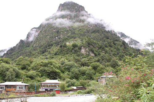
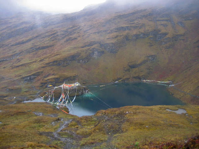
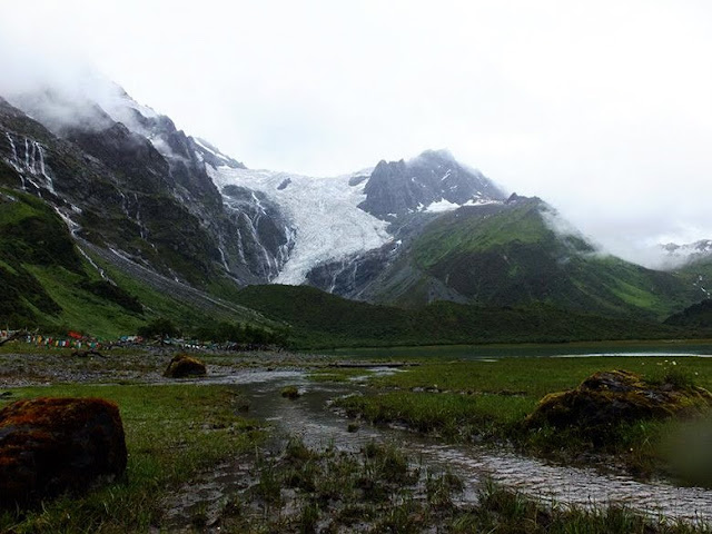
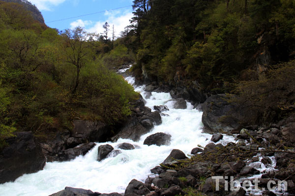
(Here are some of the rare pictures of Tsari and its surroundings found on the Internet)
 |
| Tsari today |


